Country:
Region:
City:
Latitude and Longitude:
Time Zone:
Postal Code:
IP information under different IP Channel
ip-api
Country
Region
City
ASN
Time Zone
ISP
Blacklist
Proxy
Latitude
Longitude
Postal
Route
Luminati
Country
ASN
Time Zone
Europe/Madrid
ISP
Adamo Telecom Iberia S.A.
Latitude
Longitude
Postal
IPinfo
Country
Region
City
ASN
Time Zone
ISP
Blacklist
Proxy
Latitude
Longitude
Postal
Route
db-ip
Country
Region
City
ASN
Time Zone
ISP
Blacklist
Proxy
Latitude
Longitude
Postal
Route
ipdata
Country
Region
City
ASN
Time Zone
ISP
Blacklist
Proxy
Latitude
Longitude
Postal
Route
Popular places and events near this IP address

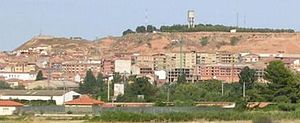
Cadreita
Town and municipality in Navarre, Spain
Distance: Approx. 4 meters
Latitude and longitude: 42.21666667,-1.68333333
Cadreita is a town and municipality located in the province and autonomous community of Navarre, northern Spain.
Igantzi
Distance: Approx. 1636 meters
Latitude and longitude: 42.22555556,-1.69916667
Igantzi is a town and municipality located in the province and autonomous community of Navarre, northern Spain.

Milagro, Navarre
Distance: Approx. 7805 meters
Latitude and longitude: 42.25,-1.76666667
Milagro is a town and municipality located in the province and autonomous community of Navarre, northern Spain.

Valtierra
Town and municipality in Navarre, Spain
Distance: Approx. 4522 meters
Latitude and longitude: 42.2,-1.63333333
Valtierra is a town and municipality located in the province and autonomous community of Navarre, northern Spain. (Bazterra in euskera) In 918, Ordoño II of Asturias and Sancho I of Pamplona attacked the fortress of Valtierra and burned its mosque and surrounding territory but failed to take the town.
Villafranca, Navarre
Municipality in Navarre, Spain
Distance: Approx. 9206 meters
Latitude and longitude: 42.28305556,-1.75
Villafranca (Basque: Alesbes) is a town and municipality located in the province and the autonomous community (Comunidad Foral) of Navarre, northern Spain.

Arguedas, Navarre
Distance: Approx. 8290 meters
Latitude and longitude: 42.17694444,-1.59833333
Arguedas is a town and municipality located in the province and autonomous community of Navarre, northern Spain. Birthplace of the artist Antonio Loperena.

Monte Alto photovoltaic power plant
Photovoltaic power stations in Spain
Distance: Approx. 8833 meters
Latitude and longitude: 42.259,-1.774
The Monte Alto photovoltaic power plant in Spain has a generating capacity of 9.55 megawatts peak (MWp) and will generate 14 million kilowatt-hours of electricity per annum. It cost 65 million euros [US$87 million]. The installation covers an area of 51 hectares on agricultural land near the locality of Milagro (Navarre) and contains 889 solar structures, of which 864 are equipped with automated solar tracking.
Alfaro, La Rioja
Municipality in La Rioja, Spain
Distance: Approx. 6908 meters
Latitude and longitude: 42.17833333,-1.74916667
Alfaro is a town and municipality in La Rioja, northern Spain. Its population in January 2009 was 9,883 inhabitants, and its area is 194.23 km2. It is known for the annual return and nesting of the 'Storks of Alfaro.' During ancient Roman times, Alfaro was a municipium known as Graccuris; named after Tiberius Sempronius Gracchus.
Arnedo Solar Plant
Solar photovoltaic power plant
Distance: Approx. 5924 meters
Latitude and longitude: 42.2694,-1.6933
The Arnedo Solar Plant is a solar photovoltaic power plant located in Arnedo, La Rioja, Spain. The power system installations are supplied and the solar plant is operated by T-Solar. The plant was built by Isolux Corsán in 2008.
Alhama (river)
Distance: Approx. 4643 meters
Latitude and longitude: 42.1839,-1.7181
The Alhama is a tributary of the Ebro. Its source is Suellacabras, in Soria, and it flows for 78 kilometres (48 mi) until it reaches the Ebro at Alfaro (La Rioja).
Weather in this IP's area
few clouds
10 Celsius
9 Celsius
10 Celsius
10 Celsius
1022 hPa
76 %
1022 hPa
988 hPa
10000 meters
1.39 m/s
1.42 m/s
96 degree
23 %
07:57:38
17:45:23


