Country:
Region:
City:
Latitude and Longitude:
Time Zone:
Postal Code:
IP information under different IP Channel
ip-api
Country
Region
City
ASN
Time Zone
ISP
Blacklist
Proxy
Latitude
Longitude
Postal
Route
Luminati
Country
ASN
Time Zone
Europe/Madrid
ISP
Adamo Telecom Iberia S.A.
Latitude
Longitude
Postal
IPinfo
Country
Region
City
ASN
Time Zone
ISP
Blacklist
Proxy
Latitude
Longitude
Postal
Route
db-ip
Country
Region
City
ASN
Time Zone
ISP
Blacklist
Proxy
Latitude
Longitude
Postal
Route
ipdata
Country
Region
City
ASN
Time Zone
ISP
Blacklist
Proxy
Latitude
Longitude
Postal
Route
Popular places and events near this IP address
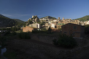
Pratdip
Municipality in Catalonia, Spain
Distance: Approx. 446 meters
Latitude and longitude: 41.05,0.86666667
Pratdip (Catalan pronunciation: [ˌpɾadˈdip]) is a municipality in the comarca of Baix Camp, in the province of Tarragona, Catalonia, Spain. Most of the people of Pratdip work in agriculture in the pastures, fields, and forests around the village. Prominent local agricultural products are hazelnuts and almonds.

Costa Daurada
Area on the coast of Catalonia, Spain
Distance: Approx. 6776 meters
Latitude and longitude: 41.01194444,0.93222222
The Costa Daurada (Catalan: [ˈkɔstə ðəwˈɾaðə]; Spanish: Costa Dorada [ˈkosta ðoˈɾaða]; meaning in English "Golden Coast") is an area on the coast of Catalonia, Spain, between Cunit and Alcanar on the Mediterranean Sea. Its traditional banks are the deltas of the Foix and Ebro rivers, although it mainly refers to the entire province of Tarragona. To the north it borders the Garraf Massif and it borders the Costa del Azahar to the south.

Miami Platja
Distance: Approx. 8583 meters
Latitude and longitude: 41.089,0.961
Miami Platja (Catalan pronunciation: [miˈami ˈpladʒə]; literally "Miami Beach") is a coastal resort about 30 km south of Tarragona, in southern Catalonia, Spain. It forms part of the municipality of Mont-roig del Camp, some 20 kilometres (12 mi) away, although it is contiguous with the municipality of Vandellòs i l'Hospitalet de l'Infant, just the other side of the river Llastres. It consists mainly of holiday apartments and villas, with a few hotels.
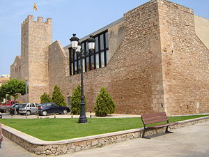
Vandellòs i l'Hospitalet de l'Infant
Municipality in Catalonia, Spain
Distance: Approx. 4908 meters
Latitude and longitude: 41.02,0.831
Vandellòs i l'Hospitalet de l'Infant (Catalan pronunciation: [bandeˈʎɔz i luspitəˈlɛd də limˈfan]) is a municipality in the comarca of the Baix Camp in Catalonia, Spain. It is situated in the south-west of the comarca, between the Serra de Llaberia range and the coast. The town of Vandellòs is some 15 km inland, connected with the AP-7 autopista and the N-340 road (which run near to the coast) by the C-44 road.

L'Hospitalet de l'Infant
Distance: Approx. 7944 meters
Latitude and longitude: 40.99178611,0.92231389
L'Hospitalet de l'Infant, Catalonia, Spain is coastal suburb of Tarragona, inside the municipality of Vandellòs i l'Hospitalet de l'Infant and southwest of Baix Camp. The town center is on a rocky promontory flanked by an extensive beach ("L'Arenal") and crossed by the Llastres River. Tourism is one of the main economic activities of the town and the area represented by the regional brand Costa Daurada.

La Miranda
Distance: Approx. 4564 meters
Latitude and longitude: 41.0924,0.8629
La Miranda is a mountain of the Catalan Pre-Coastal Range in the autonomous community of Catalonia in Spain. It has an elevation of 918 metres above sea level. It is the second-highest summit of the Serra de Llaberia range.
Fatges
Distance: Approx. 6686 meters
Latitude and longitude: 41.03222222,0.79611111
Fatges or Fatxes is a ghost town located in the Baix Camp comarca, Catalonia, Spain. It is located 4,5 km to the northeast of Vandellòs town, surrounded by the Tivissa-Vandellós Mountains, within the Vandellòs i l'Hospitalet de l'Infant municipality limits.

Mont-roig del Camp
Municipality in Catalonia, Spain
Distance: Approx. 8559 meters
Latitude and longitude: 41.08916667,0.96055556
Mont-roig del Camp (Catalan pronunciation: [munˈrɔdʒ ðəl ˈkam]) is a town and municipality in the comarca of Baix Camp in Catalonia. It is in the middle of its comarca, between the Serra de Colldejou and the Mediterranean Sea. It includes two populated places: the historic town of Mont-roig del Camp in the interior, whose economy revolves round the cultivation of nuts and olives, and the beach resort of Miami Platja on the coast, the Costa Daurada.
Montalt
Mountain in Catalonia, Spain
Distance: Approx. 5927 meters
Latitude and longitude: 41.06361111,0.80246667
Montalt is a mountain that is part of the Serra de Montalt, Serra de Llaberia in Catalonia, Spain. It has an elevation of 749 metres (2,457 ft) above sea level. There is a triangulation station (256141001) at the summit.
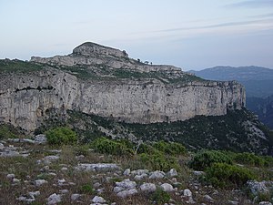
Serra de Llaberia
Distance: Approx. 4244 meters
Latitude and longitude: 41.08972222,0.865
Serra de Llaberia is a mountain chain in Catalonia, Spain located between the Prades and the Tivissa-Vandellòs Mountains. It is part of the Catalan Pre-Coastal Range. The main peaks are Mola de Llaberia (918.3 m), La Miranda (918 m) and Mont-redon (864 m).
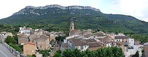
Mola de Colldejou
Distance: Approx. 6350 meters
Latitude and longitude: 41.10891111,0.87400833
Mola de Colldejou is a mountain chain in Catalonia, Spain located north of the Serra de Llaberia in the Catalan Pre-Coastal Range. The highest point is 921.8 m above sea level. This mountain range is named after Colldejou village, located east of the range.

La Torre de Fontaubella
Municipality in Catalonia, Spain
Distance: Approx. 8275 meters
Latitude and longitude: 41.12611111,0.86555556
La Torre de Fontaubella (Catalan pronunciation: [la ˈtore ðe ˌfɔntawˈβeʎa]) is a municipality in the comarca of the Priorat in Catalonia, Spain. It is situated at the southeastern end of the comarca.
Weather in this IP's area
overcast clouds
13 Celsius
13 Celsius
12 Celsius
14 Celsius
1023 hPa
73 %
1023 hPa
995 hPa
10000 meters
2.53 m/s
2.81 m/s
110 degree
89 %
07:44:34
17:38:00
