91.126.239.163 - IP Lookup: Free IP Address Lookup, Postal Code Lookup, IP Location Lookup, IP ASN, Public IP
Country:
Region:
City:
Location:
Time Zone:
Postal Code:
ISP:
ASN:
language:
User-Agent:
Proxy IP:
Blacklist:
IP information under different IP Channel
ip-api
Country
Region
City
ASN
Time Zone
ISP
Blacklist
Proxy
Latitude
Longitude
Postal
Route
db-ip
Country
Region
City
ASN
Time Zone
ISP
Blacklist
Proxy
Latitude
Longitude
Postal
Route
IPinfo
Country
Region
City
ASN
Time Zone
ISP
Blacklist
Proxy
Latitude
Longitude
Postal
Route
IP2Location
91.126.239.163Country
Region
la rioja
City
san vicente de la sonsierra
Time Zone
Europe/Madrid
ISP
Language
User-Agent
Latitude
Longitude
Postal
ipdata
Country
Region
City
ASN
Time Zone
ISP
Blacklist
Proxy
Latitude
Longitude
Postal
Route
Popular places and events near this IP address

Labastida
Municipality in Basque Country, Spain
Distance: Approx. 4169 meters
Latitude and longitude: 42.59027778,-2.79583333
Labastida in Spanish or Bastida in Basque is a town and municipality of the Rioja Alavesa, in the province of Álava in the Basque Country, northern Spain. It is located between the River Ebro and the Sierra de Toloño mountain range, 4 km east of the city of Haro and 30 km south of the Basque capital Vitoria-Gasteiz.
Escucha Formation
Geological formation in Spain
Distance: Approx. 6445 meters
Latitude and longitude: 42.6,-2.7
The Escucha Formation is a geological formation in La Rioja and Teruel provinces of northeastern Spain whose strata date back to the late Aptian to middle Albian stages of the Early Cretaceous. Dinosaur remains are among the fossils that have been recovered from the formation. The approximately 70 m (230 ft) thick formation underlies the Utrillas Formation and overlies Castrillo de la Reina, Benassal & Oliete Formations.
Battle of Monte Laturce
Distance: Approx. 5456 meters
Latitude and longitude: 42.5833,-2.7
The Battle of Monte Laturce, also known as the second Battle of Albelda, was a victory for the forces of Ordoño I of Asturias and his ally García Íñiguez of Pamplona. They defeated the latter's uncle and former ally, the Banu Qasi lord of Borja, Zaragoza, Terrer, and Tudela, Navarre, Musa ibn Musa al-Qasawi, a marcher baron so powerful and independent that he was called by an Andalusi chronicler "The Third King of the Spains" (Spaniae). The battle took place during the Asturian siege of a new fortress under construction by Musa at Albelda de Iregua.

Briones, La Rioja
Municipality in La Rioja, Spain
Distance: Approx. 2909 meters
Latitude and longitude: 42.54416667,-2.785
Briones is a village in the province and autonomous community of La Rioja, Spain. The municipality covers an area of 37.72 square kilometres (14.56 sq mi) and as of 2011 had a population of 873 people.

Gimileo
Municipality in La Rioja, Spain
Distance: Approx. 5303 meters
Latitude and longitude: 42.54916667,-2.8225
Gimileo (Spanish pronunciation: [ximiˈleo]) is a village in the province and autonomous community of La Rioja, Spain. The municipality covers an area of 4 square kilometres (1.5 sq mi) and in 2011 had a population of 171.

Ollauri
Municipality in La Rioja, Spain
Distance: Approx. 6388 meters
Latitude and longitude: 42.54194444,-2.83305556
Ollauri is a village in the northwest province and autonomous community of La Rioja, Spain. The municipality covers an area of 2.6 square kilometres (1.0 sq mi) and as of 2011 had a population of 311 people.

San Vicente de la Sonsierra
Municipality in La Rioja, Spain
Distance: Approx. 166 meters
Latitude and longitude: 42.56222222,-2.75916667
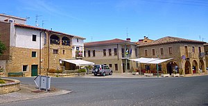
San Vicente de la Sonsierra is a village in the province and autonomous community of La Rioja, Spain. The municipality covers an area of 48.56 square kilometres (18.75 sq mi) and as of 2011 had a population of 1132 people.

Church of Nuestra Señora de la Asunción, Labastida
Church in Labastida, Spain
Distance: Approx. 3994 meters
Latitude and longitude: 42.59038,-2.7925
The Church of Nuestra Señora de la Asunción (Spanish: Iglesia de Nuestra Señora de la Asunción, Basque: Andre Mariaren Jasokundearen eliza) is a church located in Labastida, Basque Country, Spain. It was declared Bien de Interés Cultural in 1984.
Ábalos, La Rioja
Municipality in La Rioja, Spain
Distance: Approx. 4240 meters
Latitude and longitude: 42.57166667,-2.71027778
Ábalos (Spanish pronunciation: [ˈaβalos]) is a municipality in the autonomous region of La Rioja, Spain. Located in Rioja Alta, on the left bank of the river Ebro, near Haro. It is bounded on the north by the Toloño mountains, on the south by San Asensio and Baños de Ebro, on the east by Samaniego and Villabuena de Álava, and to the west by San Vicente de la Sonsierra.
Church of San Esteban (Ábalos)
Historic site in La Rioja, Spain
Distance: Approx. 4252 meters
Latitude and longitude: 42.5736,-2.7108
The Church of San Esteban (Spanish: Iglesia Parroquial de San Esteban) is a church located in Ábalos, La Rioja, Spain. It was declared Bien de Interés Cultural in 1973.
Hermitage of Santa María de La Piscina
Historic site in San Vicente de la Sonsierra, Spain
Distance: Approx. 3295 meters
Latitude and longitude: 42.578053,-2.725931
The Hermitage of Santa María de La Piscina (Spanish: Ermita de Santa María de La Piscina) is a medieval church located in San Vicente de la Sonsierra, La Rioja, Spain. It was consecrated in 1137. It was apparently founded by Ramiro Sánchez to house relics from the Holy Land, notably a supposed fragment of the True Cross.

Rivas de Tereso
Populated place in La Rioja, Spain
Distance: Approx. 4518 meters
Latitude and longitude: 42.60305556,-2.75027778
Rivas de Tereso is a village in the municipality of San Vicente de la Sonsierra, in the province and autonomous community of La Rioja, Spain. As of 2018 had a population of 21 people.
Weather in this IP's area
clear sky
-0 Celsius
-3 Celsius
-0 Celsius
-0 Celsius
1034 hPa
69 %
1034 hPa
967 hPa
10000 meters
1.7 m/s
1.92 m/s
294 degree


