Country:
Region:
City:
Latitude and Longitude:
Time Zone:
Postal Code:
IP information under different IP Channel
ip-api
Country
Region
City
ASN
Time Zone
ISP
Blacklist
Proxy
Latitude
Longitude
Postal
Route
Luminati
Country
Region
ct
City
cardedeu
ASN
Time Zone
Europe/Madrid
ISP
Adamo Telecom Iberia S.A.
Latitude
Longitude
Postal
IPinfo
Country
Region
City
ASN
Time Zone
ISP
Blacklist
Proxy
Latitude
Longitude
Postal
Route
db-ip
Country
Region
City
ASN
Time Zone
ISP
Blacklist
Proxy
Latitude
Longitude
Postal
Route
ipdata
Country
Region
City
ASN
Time Zone
ISP
Blacklist
Proxy
Latitude
Longitude
Postal
Route
Popular places and events near this IP address

Vallès Oriental
Comarca in Catalonia, Spain
Distance: Approx. 4250 meters
Latitude and longitude: 41.64638889,2.30777778
Vallès Oriental (Catalan pronunciation: [bəˈʎɛz uɾiənˈtal]) is a comarca (county) in the Barcelona region in Catalonia (Spain). Its capital is Granollers. Along with Vallès Occidental it forms the historical Vallès region.

Les Franqueses del Vallès
Municipality in Catalonia, Spain
Distance: Approx. 5057 meters
Latitude and longitude: 41.633,2.298
Les Franqueses del Vallès (Catalan pronunciation: [ləs fɾəŋˈkɛzəz ðəl βəˈʎɛs]; Spanish: Las Franquesas del Vallés [las fɾaŋˈkesas ðel βaˈʎes]) is a municipality in the comarca of the Vallès Oriental in Catalonia, Spain. It lies to the north of Granollers, the capital and largest city in the comarca. The municipality covers an area of 29.1 km2, and has about 20,000 inhabitants.
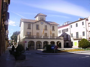
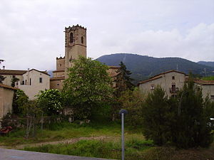
Cardedeu
Municipality in Catalonia, Spain
Distance: Approx. 140 meters
Latitude and longitude: 41.64055556,2.35944444
Cardedeu (Catalan pronunciation: [ˌkaɾðəˈðɛw]) is a small town in the comarca of Vallès Oriental in the province of Barcelona and autonomous community of Catalonia, Spain. It is near Granollers, the capital of Vallès Oriental, and it is placed between Serralada Litoral and Montseny. Cardedeu is a small town of medieval origin, with the first written reference known dated in the year 941.
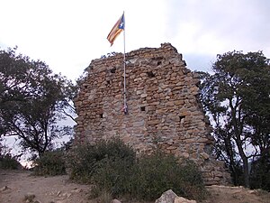
Dosrius Castle
Distance: Approx. 6034 meters
Latitude and longitude: 41.59765,2.40368889
The Dosrius Castle is a castle situated atop a hill, some 246 m above sea level, to the north of Dosrius, in Maresme. Now only ruins, it was first documented in 1114, and is a contemporary of other castles in the area, notably Burriac Castle. Until the beginning of the 15th century it belonged to the Priory of Saint Peter of Casseres.

Bombing of Granollers
Distance: Approx. 5477 meters
Latitude and longitude: 41.61666667,2.3
The bombing of Granollers took place during the Spanish Civil War in 1938. On 31 May 1938, the Italian Aviazione Legionaria bombed the town of Granollers. There were between 100 and 224 civilian deaths.
Cànoves i Samalús
Municipality in Catalonia, Spain
Distance: Approx. 5654 meters
Latitude and longitude: 41.69055556,2.35555556
Cànoves i Samalús (Catalan pronunciation: [ˈkanuβəz i səməˈlus]) is a village in the comarca of Vallès Oriental in the province of Barcelona and autonomous community of Catalonia, Spain. The municipality covers an area of 28.48 square kilometres (11.00 sq mi) and the population in 2014 was 2,863.

Llinars del Vallès
Municipality in Catalonia, Spain
Distance: Approx. 3672 meters
Latitude and longitude: 41.64055556,2.40222222
Llinars del Vallès (Catalan pronunciation: [ʎiˈnaz ðəl βəˈʎɛs]) is a village and a municipality in the comarca of Vallès Oriental, in the province of Barcelona and autonomous community of Catalonia, Spain. That village forms part of the county of Baix Montseny. Its municipal term goes by the mountain of the Massís del Montseny to the Serralada Litoral.
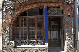
Sant Antoni de Vilamajor
Municipality in Catalonia, Spain
Distance: Approx. 5314 meters
Latitude and longitude: 41.67472222,2.40166667
Sant Antoni de Vilamajor (Catalan pronunciation: [ˈsant ənˈtɔni ðə βiləməˈʒo]) is a village in the comarca of Vallès Oriental in the province of Barcelona and autonomous community of Catalonia, Spain. The municipality covers an area of 13.7 square kilometres (5.3 sq mi) and the population in 2014 was 5,708.

Sant Pere de Vilamajor
Municipality in Catalonia, Spain
Distance: Approx. 5743 meters
Latitude and longitude: 41.68555556,2.39
Sant Pere de Vilamajor (Catalan pronunciation: [ˈsam ˈpeɾə ðə ˌβiləməˈʒo]) is a village in the province of Barcelona and autonomous community of Catalonia, Spain. The municipality covers an area of 13.8 square kilometres (5.3 sq mi) and the population in 2014 was 4,248.
Cardadeu Tomàs Balvey Museum-Archive
Museum of Pharmacy in Barcelona
Distance: Approx. 332 meters
Latitude and longitude: 41.63799722,2.35491389
The Cardadeu Tomàs Balvey Museum-Archive (Catalan: Museu-Arxiu Tomàs Balvey), in Cardedeu, Vallès Oriental, is organised around the legacy of Tomàs Balvey i Bas (1865–1954), the last of a line of apothecaries in Cardedeu. The theme of the museum is based on the pharmacy and its pharmacist, focusing on the world of illness, remedies and health. The Museum-Archive is part of the Barcelona Provincial Council Local Museum Network and of the Catalan Pharmacy Museum Network.

High Speed Railway Bridge over AP7, Llinars del Valles
Bridge in Catalonia, Spain
Distance: Approx. 4586 meters
Latitude and longitude: 41.6385,2.4132
The Llinars Bridge this bridge is the first steel structure in the high-speed railway (HSR) joining Barcelona and the French Border. The 1,883-foot-long (574 m) Llinars HSR bridge comprises two parts: a 1,008-foot-long (307 m) composite steel–concrete structure crossing Autopista AP-7, and a continuous prestressed concrete bridge crossing the Mogent River with a maximum span of 157 feet (48 m). After analyzing many possible color combinations for the Llinars bridge, the designers selected blue for the members above the deck level and gray for the bottom of the longitudinal beams.
Coll de Can Bordoi
Mountain pass in Barcelona, Catalonia, Spain
Distance: Approx. 4190 meters
Latitude and longitude: 41.624237,2.403957
The Coll de Can Bordoi is a mountain pass on the B-510 road across the Catalan Coastal Range from Dosrius to Llinars del Vallès. The pass lies in the municipality of Llinars del Vallès, comarca of Vallès Oriental, province of Barcelona, Catalonia, Spain. The pass reaches a height of 318.1 metres (1,044 ft) above sea level and is in the Parc del Montnegre i el Corredor.
Weather in this IP's area
clear sky
13 Celsius
12 Celsius
10 Celsius
14 Celsius
1023 hPa
72 %
1023 hPa
999 hPa
10000 meters
1.34 m/s
2.24 m/s
350 degree
07:40:02
17:30:38
