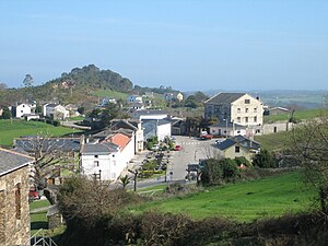
Country:
Region:
City:
Latitude and Longitude:
Time Zone:
Postal Code:
IP information under different IP Channel
ip-api
Country
Region
City
ASN
Time Zone
ISP
Blacklist
Proxy
Latitude
Longitude
Postal
Route
Luminati
Country
ASN
Time Zone
Europe/Madrid
ISP
Adamo Telecom Iberia S.A.
Latitude
Longitude
Postal
IPinfo
Country
Region
City
ASN
Time Zone
ISP
Blacklist
Proxy
Latitude
Longitude
Postal
Route
db-ip
Country
Region
City
ASN
Time Zone
ISP
Blacklist
Proxy
Latitude
Longitude
Postal
Route
ipdata
Country
Region
City
ASN
Time Zone
ISP
Blacklist
Proxy
Latitude
Longitude
Postal
Route
Popular places and events near this IP address

El Franco
Municipality in Asturias, Spain
Distance: Approx. 6618 meters
Latitude and longitude: 43.55,-6.86666667
El Franco is a municipality in the autonomous community of the Principality of Asturias. It is bordered on the north by the Cantabrian Sea, to the west by Tapia, to the south by Castropol and Boal, and to the east by Cuaña. El Franco is part of the comarca of Eo-Navia.
Tapia de Casariego
Municipality in Asturias, Spain
Distance: Approx. 634 meters
Latitude and longitude: 43.56666667,-6.95
Tapia (Spanish: Tapia de Casariego) is a municipality in the Autonomous Community of the Principality of Asturias, Spain. It is bordered on the north by the Cantabrian Sea, on the east by El Franco, on the south and west by Castropol. Tapia is also the name of one of the parishes inside the municipality.
Eo (river)
River in Spain
Distance: Approx. 7374 meters
Latitude and longitude: 43.5505,-7.0311
The Eo is a river, 91 kilometres (57 mi) long, in northwestern Spain. Its estuary forms the boundary between the regions of Galicia and Asturias. The river is known for its salmon fishing.
Barres (Castropol)
Parish in Asturias, Spain
Distance: Approx. 6114 meters
Latitude and longitude: 43.533333,-7
Barres is one of nine parishes (administrative divisions) in Castropol, a municipality within the province and autonomous community of Asturias, in northern Spain. The population is 652 (INE 2005).
As Figueiras
Parish in Asturias, Spain
Distance: Approx. 7168 meters
Latitude and longitude: 43.533333,-7.016667
As Figueiras is one of nine parishes (administrative divisions) in the Castropol municipality, within the province and autonomous community of Asturias, in northern Spain. The population is 714 (INE 2006).
Piñeira
Parish in Asturias, Spain
Distance: Approx. 6758 meters
Latitude and longitude: 43.516667,-6.983333
Piñeira is one of nine parishes (administrative divisions) in the Castropol municipality, within the province and autonomous community of Asturias, in northern Spain. The population is 445 (INE 2005).
Tol (Castropol)
Parish in Asturias, Spain
Distance: Approx. 4190 meters
Latitude and longitude: 43.533333,-6.933333
Tol is one of nine parishes (administrative divisions) in the Castropol municipality, within the province and autonomous community of Asturias, in northern Spain. The population is 340 (INE 2005).
San Xuan de Prendonés
Parish in Asturias, Spain
Distance: Approx. 6537 meters
Latitude and longitude: 43.54388889,-6.87138889
San Xuan de Prendones is a parish (administrative division) in the municipality of El Franco, within the province and autonomous community of Asturias, in northern Spain. The population is 293 (INE 2007).
Valdepares
Parish in Asturias, Spain
Distance: Approx. 7568 meters
Latitude and longitude: 43.57,-6.85
Valdepares is one of eight parishes (administrative divisions) in the El Franco municipality, within the province and autonomous community of Asturias, in northern Spain. The population is 695 (INE 2007).
Serantes (Tapia de Casariego)
Parishes in Tapia de Casariego, Asturias, Spain
Distance: Approx. 4134 meters
Latitude and longitude: 43.533333,-6.95
Serantes is one of four parishes (administrative divisions) in Tapia de Casariego, a municipality within the province and autonomous community of Asturias, in northern Spain. It has a population of 700.
Campos y Salave
Distance: Approx. 5373 meters
Latitude and longitude: 43.55,-6.883333
Campos y Salave is one of four parishes (administrative divisions) in Tapia de Casariego, a municipality within the province and autonomous community of Asturias, in northern Spain.

A Roda (Tapia de Casariego)
Distance: Approx. 6377 meters
Latitude and longitude: 43.533333,-6.883333
A Roda is one of four parishes (administrative divisions) in Tapia de Casariego, a municipality within the province and autonomous community of Asturias, in northern Spain. As of 2018, the population was 187, with 90 males & 97 females living in the parish.
Weather in this IP's area
overcast clouds
10 Celsius
10 Celsius
10 Celsius
10 Celsius
1019 hPa
91 %
1019 hPa
1017 hPa
10000 meters
3.2 m/s
3.9 m/s
118 degree
86 %
08:22:08
18:02:58

