Country:
Region:
City:
Latitude and Longitude:
Time Zone:
Postal Code:
IP information under different IP Channel
ip-api
Country
Region
City
ASN
Time Zone
ISP
Blacklist
Proxy
Latitude
Longitude
Postal
Route
Luminati
Country
Region
ct
City
barcelona
ASN
Time Zone
Europe/Madrid
ISP
Adamo Telecom Iberia S.A.
Latitude
Longitude
Postal
IPinfo
Country
Region
City
ASN
Time Zone
ISP
Blacklist
Proxy
Latitude
Longitude
Postal
Route
db-ip
Country
Region
City
ASN
Time Zone
ISP
Blacklist
Proxy
Latitude
Longitude
Postal
Route
ipdata
Country
Region
City
ASN
Time Zone
ISP
Blacklist
Proxy
Latitude
Longitude
Postal
Route
Popular places and events near this IP address

Sants Estació (Barcelona Metro)
Metro station in Barcelona, Spain
Distance: Approx. 356 meters
Latitude and longitude: 41.380586,2.140598
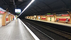
Sants Estació is a station in the Barcelona Metro network in the Sants-Montjuïc district of Barcelona. It serves the Barcelona Sants railway station, Barcelona's principal main line railway station, and is named Sants Estació to distinguish it from the nearby Plaça de Sants station also named after the Sants neighbourhood. It is served by line L3 and line L5.

Plaça de Sants (Barcelona Metro)
Metro station in Barcelona, Spain
Distance: Approx. 452 meters
Latitude and longitude: 41.37527778,2.13638889
Plaça de Sants is a Barcelona Metro station, named after the nearby Plaça de Sants, in the Sants-Montjuïc district of the city of Barcelona. The station is served by lines L1 and L5. The line L1 platforms are located below the Carrer de Sants between the Carrer d'Alcolea and the Carrer de Guadiana, and comprise two 88-metre (289 ft) long side platforms.

Barcelona Sants railway station
Railway station in Spain
Distance: Approx. 186 meters
Latitude and longitude: 41.37888889,2.14
Barcelona Sants is the main railway station in Barcelona, owned by Adif, the railway infrastructure agency of Spain. It has become the most important transport hub of the city - being the centre of Rodalies de Catalunya including Barcelona suburban railway services and regional services, as well as the main inter-city station for national and international destinations. The station is named after Sants, the neighbourhood of Barcelona in which it is located.
Tarragona metro station
Metro station in Barcelona, Spain
Distance: Approx. 350 meters
Latitude and longitude: 41.37833333,2.145
Tarragona is a station in the Barcelona Metro network in the Sants-Montjuïc district of Barcelona. It is served by line L3 (green line). The station is located under Carrer de Tarragona between Carrer de València and Carrer d'Aragó, not far from Barcelona Sants railway station.

Hostafrancs station
Metro station in Barcelona, Spain
Distance: Approx. 322 meters
Latitude and longitude: 41.37527778,2.14361111
Hostafrancs (Catalan pronunciation: [ustəˈfɾaŋs]) is a Barcelona Metro station, named after the Hostafrancs neighbourhood, in the Sants-Montjuïc district of the city of Barcelona. The station is served by line L1. The station's name is still occasionally written as Hostafranchs, following the old Catalan spelling, chiefly in Spanish-language contexts.

Carrer de Tarragona, Barcelona
Street in Barcelona, Catalonia, Spain
Distance: Approx. 392 meters
Latitude and longitude: 41.3784,2.1455
Carrer de Tarragona is a street in Barcelona. A long street lined with high-rises, it serves as the border between Hostafrancs, in the district of Sants-Montjuïc, and Eixample. This street runs from Plaça d'Espanya towards Plaça dels Països Catalans, the location of the Barcelona Sants railway station.
Hostafrancs
Distance: Approx. 262 meters
Latitude and longitude: 41.37571111,2.14319167
Hostafrancs is a neighbourhood in the Sants-Montjuïc district of Barcelona, Catalonia, Spain. Originally the land of the neighbourhood belonged to the former municipality of Santa Maria de Sants, the current district. In 1839 the Provincial Council was to disassociate the sector was the Pont d'en Rabassa Cross to cover for him in Barcelona.

Pavelló de l'Espanya Industrial
Barcelona Game House for Weight Lifting
Distance: Approx. 111 meters
Latitude and longitude: 41.37736667,2.14233333
The Pavelló de l'Espanya Industrial (English: Industrial Spain Pavilion), currently named Centre Esportiu Municipal l'Espanya Industrial is a building located in Barcelona. Completed in 1991, it hosted the weightlifting competitions for the 1992 Summer Olympics.

Nobu Hotel Barcelona
Skyscraper in Spain
Distance: Approx. 285 meters
Latitude and longitude: 41.3797,2.1425
The Nobu Hotel Barcelona, formerly the Gran Hotel Torre Catalunya, is a skyscraper and hotel in Barcelona, Catalonia, Spain. Completed in 1970, has 25 floors and rises 100 metres (including mast) and 80 metres without mast. It is located near Barcelona Sants Railway Station, Plaça d'Espanya and three other high-rises: Edificio Allianz, Edificio Tarragona, Torre Núñez y Navarro.

Edificio Tarragona
Office in Catalonia, Spain
Distance: Approx. 319 meters
Latitude and longitude: 41.3787,2.1444
Edifici Tarragona is a high-rise building in Barcelona, Catalonia, Spain. Completed in 1998, has 22 floors and rises 78 metres. Lies on Carrer de Tarragona street 159, near Plaça d'Espanya and three other high-rises: Edificio Allianz, Hotel Torre Catalunya, Torre Núñez y Navarro.

Plaça dels Països Catalans, Barcelona
Distance: Approx. 228 meters
Latitude and longitude: 41.37944444,2.14083333
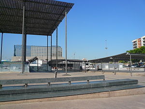
Plaça dels Països Catalans is a square in Barcelona (the capital of Catalonia, Spain) on one side of the city's central railway station, Estació de Sants, in the district of Sants-Montjuïc. It borders carrer de Tarragona, carrer de Numància and Avinguda Roma. It was so named in 1989 after the Catalan Countries.

La España Industrial
Spanish cotton factory (1847–1981)
Distance: Approx. 128 meters
Latitude and longitude: 41.37756389,2.13948889
La España Industrial, (Catalan: L'Espanya Industrial), was a cotton textile company founded 1847, and which built its primary factory (known as Vapor nou) in the village of Santa María de Sans (modern day Sants). It was not only the first joint-stock company (Spanish: sociedad anónima) created in Spain for cotton manufacturing, but it was also the first company to undertake all aspects (carding, spinning, weaving and finishing) under one roof. It was for many years, the largest and most innovative cotton manufacturer in Spain.
Weather in this IP's area
broken clouds
13 Celsius
13 Celsius
12 Celsius
15 Celsius
1023 hPa
73 %
1023 hPa
1018 hPa
10000 meters
2.06 m/s
320 degree
75 %
07:40:16
17:32:08
