Country:
Region:
City:
Latitude and Longitude:
Time Zone:
Postal Code:
IP information under different IP Channel
ip-api
Country
Region
City
ASN
Time Zone
ISP
Blacklist
Proxy
Latitude
Longitude
Postal
Route
Luminati
Country
Region
an
City
diezma
ASN
Time Zone
Europe/Madrid
ISP
Adamo Telecom Iberia S.A.
Latitude
Longitude
Postal
IPinfo
Country
Region
City
ASN
Time Zone
ISP
Blacklist
Proxy
Latitude
Longitude
Postal
Route
db-ip
Country
Region
City
ASN
Time Zone
ISP
Blacklist
Proxy
Latitude
Longitude
Postal
Route
ipdata
Country
Region
City
ASN
Time Zone
ISP
Blacklist
Proxy
Latitude
Longitude
Postal
Route
Popular places and events near this IP address
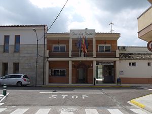
Palma de Gandia
Municipality in Valencian Community, Spain
Distance: Approx. 757 meters
Latitude and longitude: 38.925,-0.2225
Palma de Gandia (Valencian pronunciation: [ˈpalma ðe ɣanˈdi.a]; Spanish: Palma de Gandía) is a municipality in the comarca of Safor in the Valencian Community, Spain. The municipality of Palma de Gandia limited to the following locations: Ador, Alfauir, Beniarjó, Beniflà, Gandia, Potries, Real de Gandia and Ròtova, all in the province of Valencia.
Potríes
Municipality in Valencian Community, Spain
Distance: Approx. 1595 meters
Latitude and longitude: 38.91527778,-0.20444444
Potries (Valencian pronunciation: [poˈtɾi.es]) is a municipality in the comarca of Safor in the Valencian Community, Spain.
El Real de Gandia
Municipality in Valencian Community, Spain
Distance: Approx. 4251 meters
Latitude and longitude: 38.94722222,-0.19055556
El Real de Gandia (Valencian pronunciation: [el reˈal de ɣanˈdi.a], Spanish: Real de Gandía) is a municipality in the comarca of Safor in the Valencian Community, Spain.
Ròtova
Municipality in Valencian Community, Spain
Distance: Approx. 3554 meters
Latitude and longitude: 38.93333333,-0.25861111
Ròtova (Valencian pronunciation: [ˈrɔtova]; Spanish: Rótova [ˈrotoβa]) is a municipality in the comarca of Safor in the Valencian Community, Spain.
Ador, Spain
Municipality in Valencian Community, Spain
Distance: Approx. 244 meters
Latitude and longitude: 38.91805556,-0.22527778
Ador (Valencian pronunciation: [aˈðoɾ]) is a municipality in the comarca of Safor in the Valencian Community, Spain.
Alfauir
Municipality in Valencian Community, Spain
Distance: Approx. 2811 meters
Latitude and longitude: 38.92777778,-0.2525
Alfauir (Valencian: [alfaˈwiɾ]; Spanish: Alfahuir [alfaˈwiɾ]) is a municipality in the comarca of Safor in the Valencian Community, Spain.
Almoines
Municipality in Valencian Community, Spain
Distance: Approx. 4469 meters
Latitude and longitude: 38.94333333,-0.18222222
Almoines (Valencian: [alˈmɔjnes]; Spanish: [alˈmojnes]) is a municipality in the comarca of Safor in the Valencian Community, Spain.
Beniarjó
Municipality in Valencian Community, Spain
Distance: Approx. 3415 meters
Latitude and longitude: 38.93277778,-0.18777778
Beniarjó (Valencian: [beniaɾˈdʒo]; Spanish: [beniaɾˈxo]) is a municipality in the comarca of Safor in the Valencian Community, Spain.

Beniflá
Municipality in Valencia, Valencia
Distance: Approx. 3120 meters
Latitude and longitude: 38.92888889,-0.18916667
Beniflà (Valencian pronunciation: [beniˈfla], Spanish: Beniflá) is a municipality in the region of Safor in the Valencian Country, Spain. As the crow flies, it is approximately 63km (39 miles) away from Valencia.

Castellonet de la Conquesta
Municipality in Valencian Community, Spain
Distance: Approx. 3643 meters
Latitude and longitude: 38.91388889,-0.26416667
Castellonet de la Conquesta (Valencian pronunciation: [kasteʎoˈned de la koŋˈkesta]) (Spanish: Castellonet) is a municipality in the comarca of Safor in the Valencian Community, Spain.
Villalonga / Vilallonga
Municipality in Valencian Community, Spain
Distance: Approx. 3915 meters
Latitude and longitude: 38.88472222,-0.20861111
Villalonga (Spanish: [biʎaˈloŋɡa]) or Vilallonga (Valencian: [ˌvilaˈʎoŋɡa]), officially Villalonga / Vilallonga, is a municipality in the comarca of Safor in the Valencian Community, Spain.
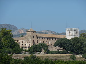
Monastery of Sant Jeroni de Cotalba
Distance: Approx. 3245 meters
Latitude and longitude: 38.94075278,-0.24620556
The Monastery of Sant Jeroni de Cotalba (Valencian pronunciation: [ˈsaɲ dʒeˈɾɔni ðe koˈtalba]; Spanish: San Jerónimo de Cotalba, "Saint Jerome of Cotalba") is a monastic building of Valencian Gothic, Mudéjar, Renaissance, Baroque and Neoclassical styles constructed between the 14th and 18th centuries, located in the municipal area of Alfauir, (Valencia), Spain, about 8 km. from the well-known city of Gandia.
Weather in this IP's area
overcast clouds
15 Celsius
15 Celsius
15 Celsius
18 Celsius
1021 hPa
87 %
1021 hPa
1012 hPa
10000 meters
8.05 m/s
11.18 m/s
49 degree
100 %
07:44:02
17:47:17


