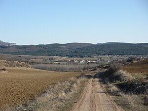
Country:
Region:
City:
Latitude and Longitude:
Time Zone:
Postal Code:
IP information under different IP Channel
ip-api
Country
Region
City
ASN
Time Zone
ISP
Blacklist
Proxy
Latitude
Longitude
Postal
Route
Luminati
Country
Region
ct
ASN
Time Zone
Europe/Madrid
ISP
Adamo Telecom Iberia S.A.
Latitude
Longitude
Postal
IPinfo
Country
Region
City
ASN
Time Zone
ISP
Blacklist
Proxy
Latitude
Longitude
Postal
Route
db-ip
Country
Region
City
ASN
Time Zone
ISP
Blacklist
Proxy
Latitude
Longitude
Postal
Route
ipdata
Country
Region
City
ASN
Time Zone
ISP
Blacklist
Proxy
Latitude
Longitude
Postal
Route
Popular places and events near this IP address
Pomar de Valdivia
Municipality in Castile and León, Spain
Distance: Approx. 8149 meters
Latitude and longitude: 42.76666667,-4.16666667
Pomar de Valdivia is a municipality located in the province of Palencia, Castile and León, Spain. According to the 2004 census (INE), the municipality has a population of 531 inhabitants.

Tariego de Cerrato
Municipality in Castile and León, Spain
Distance: Approx. 251 meters
Latitude and longitude: 42.79666667,-4.25805556
Tariego de Cerrato is a municipality located in the province of Palencia, Castile and León, Spain. According to the 2018 census (INE), the municipality has a population of 490 inhabitants.

Monastery of Santa María la Real (Palencia)
Distance: Approx. 1113 meters
Latitude and longitude: 42.79527778,-4.2725
Santa María la Real is a monastery in Aguilar de Campoo, province of Palencia, Spain. Santa María la Real is a common name for monasteries in Spain, and indicates a royal connection, in this case to King Alfonso VIII of Castile. From the 12th century the monastery was the home of a Premonstratensian community.

Camesa
River in northern Spain
Distance: Approx. 3825 meters
Latitude and longitude: 42.76036,-4.25366
The Camesa is a river located in the north of Spain, a tributary of the Pisuerga. It rises in the province of Palencia in the municipio of Brañosera. It runs briefly through the region of Cantabria, where gives its name to a Site of Community Importance.
Battle of Vellica
A battle of the Cantabrian Wars with the right location unknown.
Distance: Approx. 6104 meters
Latitude and longitude: 42.7436,-4.2867
The Battle of Vellica was a battle of the Cantabrian Wars fought in the year 25 BC by the emperor Augustus and his Roman legions against the Cantabri forces who resided in the area. The most generally accepted location for the battle is the area around Monte Cildá, Olleros de Pisuerga, Palencia.

Rubagón
Watercourse of the Ibereian Peninsula, a tributary of the Camesa River
Distance: Approx. 5549 meters
Latitude and longitude: 42.8225,-4.2027
The Rubagón is a river that runs entirely through the province of Palencia, in the eastern part of the Montaña Palentina, in Spain.
Weather in this IP's area
broken clouds
7 Celsius
7 Celsius
7 Celsius
7 Celsius
1021 hPa
76 %
1021 hPa
916 hPa
10000 meters
0.53 m/s
1.2 m/s
328 degree
75 %
08:09:23
17:54:13

