Country:
Region:
City:
Latitude and Longitude:
Time Zone:
Postal Code:
IP information under different IP Channel
ip-api
Country
Region
City
ASN
Time Zone
ISP
Blacklist
Proxy
Latitude
Longitude
Postal
Route
Luminati
Country
Region
ct
ASN
Time Zone
Europe/Madrid
ISP
Adamo Telecom Iberia S.A.
Latitude
Longitude
Postal
IPinfo
Country
Region
City
ASN
Time Zone
ISP
Blacklist
Proxy
Latitude
Longitude
Postal
Route
db-ip
Country
Region
City
ASN
Time Zone
ISP
Blacklist
Proxy
Latitude
Longitude
Postal
Route
ipdata
Country
Region
City
ASN
Time Zone
ISP
Blacklist
Proxy
Latitude
Longitude
Postal
Route
Popular places and events near this IP address

Cabezón de Pisuerga
Place in Castile and León, Spain
Distance: Approx. 7476 meters
Latitude and longitude: 41.7333,-4.6464
Cabezón de Pisuerga is a municipality located in the province of Valladolid, Castile and León, Spain. According to the 2004 census (INE), the municipality had a population of 2,344 inhabitants.

Castronuevo de Esgueva
Place in Castile and León, Spain
Distance: Approx. 475 meters
Latitude and longitude: 41.68333333,-4.58333333
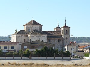
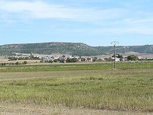
Castronuevo de Esgueva is a municipality located in the province of Valladolid, Castile and León, Spain. According to the 2004 census (INE), the municipality has a population of 337 inhabitants.

Olmos de Esgueva
Place in Castile and León, Spain
Distance: Approx. 5988 meters
Latitude and longitude: 41.68333333,-4.51666667
Olmos de Esgueva is a municipality located in the province of Valladolid, Castile and León, Spain. According to the 2004 census (INE), the municipality has a population of 212 inhabitants.

Pedrosa del Rey
Place in Castile and León, Spain
Distance: Approx. 9046 meters
Latitude and longitude: 41.70222222,-4.48333333
Pedrosa del Rey is a municipality located in the province of Valladolid, Castile and León, Spain. According to the 2004 census (INE), the municipality has a population of 216 inhabitants.

Renedo de Esgueva
Place in Castile and León, Spain
Distance: Approx. 4237 meters
Latitude and longitude: 41.65,-4.61666667
Renedo de Esgueva is a municipality located in the province of Valladolid, Castile and León, Spain. According to the 2011 census (INE), the municipality has a population of 3,113 inhabitants.

San Martín de Valvení
Place in Castile and León, Spain
Distance: Approx. 7809 meters
Latitude and longitude: 41.75,-4.56666667
San Martín de Valvení is a municipality located in the province of Valladolid, Castile and León, Spain. According to the 2004 census (INE), the municipality has a population of 105 inhabitants.

Santovenia de Pisuerga
Place in Castile and León, Spain
Distance: Approx. 8127 meters
Latitude and longitude: 41.7,-4.68333333
Santovenia de Pisuerga is a municipality located in the province of Valladolid, Castile and León, Spain. It has a population of 4,480 inhabitants.
Villabáñez
Place in Castile and León, Spain
Distance: Approx. 7932 meters
Latitude and longitude: 41.6297,-4.5236
Villabáñez is a municipality located in the province of Valladolid, Castile and León, Spain. According to the 2004 census (INE), the municipality has a population of 480 inhabitants.

Villarmentero de Esgueva
Place in Castile and León, Spain
Distance: Approx. 4603 meters
Latitude and longitude: 41.68333333,-4.53333333
Villarmentero de Esgueva is a municipality located in the province of Valladolid, Castile and León, Spain. According to the 2004 census (INE), the municipality had a population of 123 inhabitants.

Canal de Castilla
Canal in Castile and León, Spain
Distance: Approx. 8949 meters
Latitude and longitude: 41.7494,-4.64694
The Canal of Castile (Canal de Castilla in Spanish) is a canal in the north of Spain. Constructed between the last half of the 18th century and the first half of the 19th century, it was conceived to facilitate the transportation of wheat from Castille to the ports in the Bay of Biscay for export. The canal runs 207 km through the provinces of Burgos, Palencia and Valladolid, in the Autonomous Community of Castile and León.

Estadio Pepe Rojo
Distance: Approx. 7436 meters
Latitude and longitude: 41.65972222,-4.67305556
Estadio Pepe Rojo is a sports stadium located in the city of Valladolid, Spain. It is the home ground of CR El Salvador and Valladolid RAC leading clubs of the División de Honor, the top-level of Spanish rugby. The stadium is named after José Rojo Giralda, the president of the Valladolid Rugby Federation in the 1960s.
Weather in this IP's area
overcast clouds
10 Celsius
8 Celsius
8 Celsius
10 Celsius
1019 hPa
88 %
1019 hPa
931 hPa
10000 meters
2.68 m/s
3.62 m/s
92 degree
100 %
08:07:57
17:58:18