Country:
Region:
City:
Latitude and Longitude:
Time Zone:
Postal Code:
IP information under different IP Channel
ip-api
Country
Region
City
ASN
Time Zone
ISP
Blacklist
Proxy
Latitude
Longitude
Postal
Route
Luminati
Country
Region
ct
ASN
Time Zone
Europe/Madrid
ISP
Adamo Telecom Iberia S.A.
Latitude
Longitude
Postal
IPinfo
Country
Region
City
ASN
Time Zone
ISP
Blacklist
Proxy
Latitude
Longitude
Postal
Route
db-ip
Country
Region
City
ASN
Time Zone
ISP
Blacklist
Proxy
Latitude
Longitude
Postal
Route
ipdata
Country
Region
City
ASN
Time Zone
ISP
Blacklist
Proxy
Latitude
Longitude
Postal
Route
Popular places and events near this IP address
Alovera
Place in Castile-La Mancha, Spain
Distance: Approx. 2495 meters
Latitude and longitude: 40.59666667,-3.24805556
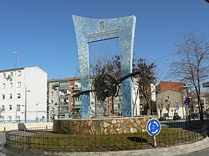
Alovera is a municipality located in the province of Guadalajara, Castile-La Mancha, Spain. According to the 2015 census (INE), the municipality has a population of 12,247 inhabitants.

Azuqueca de Henares
Place in Castile-La Mancha, Spain
Distance: Approx. 4558 meters
Latitude and longitude: 40.56472222,-3.26805556
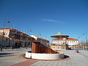
Azuqueca de Henares is a municipality located in the province of Guadalajara, Castile-La Mancha, Spain. According to the 2013 census (INE), the municipality had a population of 34,685 inhabitants. The mayor of Azuqueca is José Luis Blanco.

Cabanillas del Campo
Municipality in Castilla–La Mancha, Spain
Distance: Approx. 4996 meters
Latitude and longitude: 40.638333,-3.235278
Cabanillas del Campo is a municipality of Spain located in the province of Guadalajara, Castilla–La Mancha. As of 2017, it has registered population of 9,947. The municipality includes 2 supermarkets, three primary schools, one secondary (high) school and many plazas.
Quer, Guadalajara
Place in Castile-La Mancha, Spain
Distance: Approx. 299 meters
Latitude and longitude: 40.60777778,-3.27666667
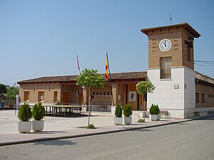
Quer is a municipality located in the province of Guadalajara, Castile-La Mancha, Spain. According to the 2004 census (INE), the municipality has a population of 449 inhabitants.

Torrejón del Rey
Place in Castile-La Mancha, Spain
Distance: Approx. 6803 meters
Latitude and longitude: 40.64583333,-3.33555556
Torrejón del Rey is a municipality located in the province of Guadalajara, Castile-La Mancha, Spain. According to the 2004 census (INE), the municipality has a population of 2,341 inhabitants.

Valdeaveruelo
Place in Castile-La Mancha, Spain
Distance: Approx. 4986 meters
Latitude and longitude: 40.63805556,-3.31555556
Valdeaveruelo is a municipality located in the province of Guadalajara, Castile-La Mancha, Spain. According to the 2004 census (INE), the municipality has a population of 530 inhabitants.
Villanueva de la Torre
Place in Castile-La Mancha, Spain
Distance: Approx. 3103 meters
Latitude and longitude: 40.58527778,-3.30083333
Villanueva de la Torre is a municipality located in the province of Guadalajara, Castile-La Mancha, Spain. The village has a surface of 11,21 km ² with a population of 6603 inhabitants according to the municipal census of the year 2023 and a density of 590 inhabitants/km ².
Meco, Spain
Municipality in Madrid, Spain
Distance: Approx. 7156 meters
Latitude and longitude: 40.55388889,-3.32611111
Meco (Spanish: [ˈmeko] ) is a municipality in the eastern part of the Autonomous Community of Madrid, (Spain). In 2006, Meco had a population of 11,094 (Spanish National Statistics Institute). The town is located to the north of the River Henares, in the comarca of La Campiña del Henares, and also in one of the two natural sub-comarcas that make up the Comarca de Alcalá, La Campiña del Henares, characterized by vast grain fields and gentle hills.

Guadalajara railway station
Railway station in Guadalajara, Spain
Distance: Approx. 8840 meters
Latitude and longitude: 40.64277778,-3.18305556
Guadalajara railway station (Spanish: Estación de Guadalajara) is a Spanish railway station owned by ADIF that serves the Spanish city of Guadalajara. There is another station outside the urban limits 5 km away from the city on the Madrid–Barcelona high-speed rail line called Guadalajara–Yebes railway station. The Madrid–Guadalajara stretch was opened on 3 May 1859.

Valdeavero
Municipality in Community of Madrid, Spain
Distance: Approx. 5812 meters
Latitude and longitude: 40.63333333,-3.33333333
Valdeavero is a municipality of the Community of Madrid, Spain.

Church of Nuestra Señora de la Asunción (Meco)
Cultural property in Meco, Spain
Distance: Approx. 7333 meters
Latitude and longitude: 40.553633,-3.329094
The Church of Nuestra Señora de la Asunción (Spanish: Parroquia de Nuestra Señora de la Asunción) is a church and parish in Meco, Spain. The church was added to the Bien de Interés Cultural registry in 1982.

Academy of Military Engineering of Guadalajara
Military academy in Spain
Distance: Approx. 9558 meters
Latitude and longitude: 40.63666667,-3.17
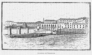
The Academy of Military Engineering of Guadalajara (Spanish: Academia de Ingenieros de Guadalajara) was a military academy in Guadalajara, Spain. It operated in Guadalajara from 1833 until its move to Segovia in 1932 as part of its merger with the Artillery Academy (Academia de Artilleros). The Academy was located in the Montesclaros Palace, in the west of the city, until a 1924 fire destroyed part of the premises and an important collection of models, documents, books, and artworks.
Weather in this IP's area
broken clouds
13 Celsius
12 Celsius
12 Celsius
13 Celsius
1020 hPa
81 %
1020 hPa
939 hPa
10000 meters
1.54 m/s
50 degree
75 %
08:00:07
17:55:38


