Country:
Region:
City:
Latitude and Longitude:
Time Zone:
Postal Code:
IP information under different IP Channel
ip-api
Country
Region
City
ASN
Time Zone
ISP
Blacklist
Proxy
Latitude
Longitude
Postal
Route
Luminati
Country
Region
ct
ASN
Time Zone
Europe/Madrid
ISP
Adamo Telecom Iberia S.A.
Latitude
Longitude
Postal
IPinfo
Country
Region
City
ASN
Time Zone
ISP
Blacklist
Proxy
Latitude
Longitude
Postal
Route
db-ip
Country
Region
City
ASN
Time Zone
ISP
Blacklist
Proxy
Latitude
Longitude
Postal
Route
ipdata
Country
Region
City
ASN
Time Zone
ISP
Blacklist
Proxy
Latitude
Longitude
Postal
Route
Popular places and events near this IP address

El Poblenou
Neighbourhood of Barcelona in Catalonia, Spain
Distance: Approx. 175 meters
Latitude and longitude: 41.39916667,2.20388889
El Poblenou (Catalan for 'new village'; Catalan pronunciation: [əl ˌpɔbːləˈnɔw]) is an extensive neighborhood of Barcelona’s Sant Martí district that borders the Mediterranean Sea to the south, Sant Adrià del Besòs to the east, Parc de la Ciutadella in Ciutat Vella to the west, and Sant Andreu to the north. Considered one of the best areas of the city, the neighborhood was once its own town, entirely separate from Barcelona proper.

Llacuna station
Metro station in Barcelona, Spain
Distance: Approx. 383 meters
Latitude and longitude: 41.39888889,2.19722222
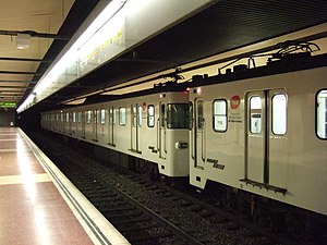
Llacuna is a Barcelona Metro station in the Poblenou neighbourhood of Barcelona, in the Sant Martí district, located under Carrer de Pujades between Carrer Ciutat de Granada and Carrer de Roc Boronat. It's served by L4 (yellow line). The station was inaugurated in 1977 (1977).

Poblenou (Barcelona Metro)
Metro station in Barcelona, Spain
Distance: Approx. 437 meters
Latitude and longitude: 41.40305556,2.20277778
Poblenou is a Barcelona Metro station in Poblenou, a formerly industrial area of Barcelona's Sant Martí district. The location of the station is in the intersections of Carrer de Pujades with carrer de Bilbao and carrer de Lope de Vega. It's served by L4 (yellow line).

La Vila Olímpica del Poblenou
Neighbourhood of Barcelona in Catalonia, Spain
Distance: Approx. 957 meters
Latitude and longitude: 41.39083333,2.19916667
La Vila Olímpica del Poblenou or La Villa Olímpica (The Olympic Village of Poblenou) is a neighborhood in the Sant Martí district of Barcelona, Catalonia (Spain). It was constructed in the late 1980s and early 1990s for the 1992 Summer Olympic Games which took place in Barcelona. Its construction was devised by Oriol Bohigas, David Mackay, and Albert Puigdomènec as a residential area in the otherwise industrial and working-class district of Poblenou, which underwent regeneration but involved massive expropriation, as well as the destruction of a sizeable portion of the district, including Industrial Revolution factories of architectural value such as Fàbrica Foret.

El Parc i la Llacuna del Poblenou
Neighbourhood of Barcelona in Catalonia, Spain
Distance: Approx. 915 meters
Latitude and longitude: 41.39916667,2.19083333
El Parc i Llacuna del Poblenou is a neighborhood in the Sant Martí district of Barcelona, Catalonia (Spain). The cores from this area were established around several parks (Parc de l'Estació del Nord, Parc de la Ciutadella), and the road that connected with el Clot, el Poblenou and la Llacuna. Previously, the nearest park was known as Fort Pius (some entities of the region retain this reference), which extended also to some islands that are in the neighborhood of la Vila Olímpica del Poblenou.
Pavelló de la Mar Bella
Distance: Approx. 848 meters
Latitude and longitude: 41.4,2.21188611
The Pavelló de la Mar Bella is an indoor arena located in Barcelona, Catalonia. Seating 4000, it hosted the badminton events for 1992 Summer Olympics. This venue was completed in time for the 1992 Games.

22@
Business center in Barcelona, Spain
Distance: Approx. 699 meters
Latitude and longitude: 41.40055556,2.19361111
22@ (read in Catalan: vint-i-dos arrova [ˌbintiˌðozəˈrɔβə]), also known as 22@Barcelona and Districte de la innovació (Innovation District) is the corporative name given to an urban renewal area in Barcelona's formerly industrial area of Poblenou, in the district of Sant Martí, nicknamed "the Catalan Manchester" in the 19th century. Its aim is to convert Poblenou into the city's technological and innovation district, as well as to increase leisure and residential spaces. Centered on Plaça de les Glòries Catalanes, it is part of one of Europe's biggest urban regeneration schemes, begun during the 2000s and still ongoing, spanning 115 blocks (198.26 hectares (489.9 acres)).

Poblenou Cemetery
Cemetery in Barcelona, Spain
Distance: Approx. 360 meters
Latitude and longitude: 41.39611111,2.20305556
Poblenou Cemetery (Cementerio de Pueblo Nuevo in Spanish, Cementiri de Poblenou in Catalan) is located in the neighbourhood of the same name in Barcelona. It is also called East Cemetery (Cementiri de l'Est) or General Cemetery (Cementiri General). It is located in calle de Taulat, with the main entrance at Avenida Icària.

Hotel Melia Barcelona Sky
Skyscraper in Barcelona
Distance: Approx. 781 meters
Latitude and longitude: 41.40617778,2.20079444
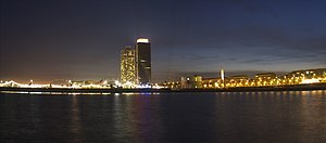
The Hotel Meliá Barcelona Sky is a skyscraper designed by Dominique Perrault located in Barcelona, Catalonia, Spain. The building is 116 metres (381 ft) tall and has 31 floors and 258 rooms. It is the fourth-tallest building in Barcelona after Torre Mapfre, Hotel Arts, and Torre Agbar.
Dos Cielos
Distance: Approx. 797 meters
Latitude and longitude: 41.4063,2.2006
Dos Cielos is a Michelin starred restaurant in Barcelona, Catalonia, Spain.
Can Framis Museum
Contemporary art museum in Barcelona, Spain
Distance: Approx. 711 meters
Latitude and longitude: 41.40305556,2.195
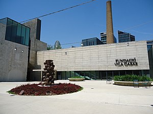
Can Framis is the latest Fundació Vila Casas museum, an art center in Barcelona devoted to the promotion of contemporary Catalan painting. Located in the old Can Framis factory complex, the museum displays more than 250 paintings from the sixties to the present made by artists born or currently living in Catalonia. In addition to the permanent collection which is divided in three floors, Can Framis Museum has an area dedicated to temporary exhibitions named Espai Aø.
Razzmatazz (club)
Nightclub and concert hall in Barcelona, Spain
Distance: Approx. 919 meters
Latitude and longitude: 41.39722,2.19111
Razzmatazz (also known as Razz) is a nightclub and concert hall in the Poblenou neighbourhood in Barcelona, Catalonia, Spain. It is one of the city's biggest with a capacity of over 2,000 people in its main hall. The club is formed of five halls where different genres of music are played even though the most played are indie pop, alternative rock and electronic music.
Weather in this IP's area
broken clouds
14 Celsius
13 Celsius
13 Celsius
15 Celsius
1023 hPa
72 %
1023 hPa
1022 hPa
10000 meters
2.06 m/s
320 degree
75 %
07:40:05
17:31:51


