91.126.123.89 - IP Lookup: Free IP Address Lookup, Postal Code Lookup, IP Location Lookup, IP ASN, Public IP
Country:
Region:
City:
Location:
Time Zone:
Postal Code:
ISP:
ASN:
language:
User-Agent:
Proxy IP:
Blacklist:
IP information under different IP Channel
ip-api
Country
Region
City
ASN
Time Zone
ISP
Blacklist
Proxy
Latitude
Longitude
Postal
Route
db-ip
Country
Region
City
ASN
Time Zone
ISP
Blacklist
Proxy
Latitude
Longitude
Postal
Route
IPinfo
Country
Region
City
ASN
Time Zone
ISP
Blacklist
Proxy
Latitude
Longitude
Postal
Route
IP2Location
91.126.123.89Country
Region
catalunya
City
breda
Time Zone
Europe/Madrid
ISP
Language
User-Agent
Latitude
Longitude
Postal
ipdata
Country
Region
City
ASN
Time Zone
ISP
Blacklist
Proxy
Latitude
Longitude
Postal
Route
Popular places and events near this IP address

Massanes, Catalonia
Municipality in Catalonia, Spain
Distance: Approx. 8013 meters
Latitude and longitude: 41.767778,2.6525
Massanes (Catalan pronunciation: [məˈsanəs]), also called Maçanes ("apple grove", lit. 'apples'), is a municipality of the province of Girona, in the comarca of the Selva in Catalonia, Spain. It is situated on the left bank of the Tordera river. Local roads link the town with the A-7 autopista, the C-251 road and the RENFE railway station shared with Maçanet de la Selva.

Turó de Morou
Mountain in Spain
Distance: Approx. 7085 meters
Latitude and longitude: 41.77277778,2.48083333
Turó de Morou is a mountain of Catalonia, Spain. It has an elevation of 1,303 metres above sea level.

Catalan Coastal Range
System of mountain ranges in Spain
Distance: Approx. 7549 meters
Latitude and longitude: 41.68055556,2.55555556
The Catalan Coastal Range (Catalan: Serralada Litoral Catalana, IPA: [sərəˈlaðə lituˈɾal kətəˈlanə]) is a system of mountain ranges running parallel to the Mediterranean Sea coast in Catalonia, Spain. It is part of the Catalan Mediterranean System. Its main axis runs between the Foix River and the Roses Gulf and the average altitude is around 500 m.

Catalan Mediterranean System
Ggeographical region in Catalonia
Distance: Approx. 6735 meters
Latitude and longitude: 41.68932222,2.57766667
The Catalan Mediterranean System, also known as Mediterranean System, Transversal Ibero-Pyrenaean System, and Catalanid System, is a wide coastal geographical region in Catalonia. It is made up of a double system of coastal mountain chains: The Catalan Coastal Range and the Catalan Pre-Coastal Range, as well as the Catalan Coastal Depression and other coastal and pre-coastal plains located among those mountain ranges.

Breda, Spain
Municipality in Catalonia, Spain
Distance: Approx. 192 meters
Latitude and longitude: 41.75,2.56
Breda (Catalan pronunciation: [ˈbɾɛðə]) is a village in the province of Girona and autonomous community of Catalonia, Spain. The municipality covers an area of 5.09 square kilometres (1.97 sq mi) and the population in 2014 was 3,751.

Hostalric
Municipality in Catalonia, Spain
Distance: Approx. 6127 meters
Latitude and longitude: 41.75,2.63333333
Hostalric (Catalan pronunciation: [ustəlˈrik]) is a village in the province of Girona and autonomous community of Catalonia, Spain. The municipality covers an area of 3.39 square kilometres (1.31 sq mi) and the population in 2014 was 4,010.
Riells i Viabrea
Municipality in Catalonia, Spain
Distance: Approx. 4948 meters
Latitude and longitude: 41.776,2.513
Riells i Viabrea (Catalan pronunciation: [riˈeʎz i βiəˈβɾeə]) is a municipality in the province of Girona and autonomous community of Catalonia, Spain. The municipality covers an area of 27 square kilometres (10 sq mi) and the population in 2014 was 4,000.

Sant Feliu de Buixalleu
Municipality in Catalonia, Spain
Distance: Approx. 5494 meters
Latitude and longitude: 41.79305556,2.5875
Sant Feliu de Buixalleu (Catalan pronunciation: [ˈsaɱ fəˈliw ðə βuʃəˈʎew]) is a village in the province of Girona and autonomous community of Catalonia, Spain. The village is situated in the southeast of the ancient Catalan comarca of Selva. The municipality covers an area of 61.94 square kilometres (23.92 sq mi) and the population in 2014 was 776.
Santa Fe Reservoir
Dam in Fogars de Montclús, Catalonia
Distance: Approx. 7723 meters
Latitude and longitude: 41.76833333,2.47055556
The Santa Fe Reservoir (Catalan: Pantà de Santa Fe) is a reservoir on the Riera de Gualba, a tributary of the Tordera River. It is located within the Fogars de Montclús municipal term, Catalonia, Spain. The area is a popular destination for excursions and picnics and is easily accessible on foot from the nearest road.

Campins, Spain
Municipality in Catalonia, Spain
Distance: Approx. 8485 meters
Latitude and longitude: 41.71666667,2.46666667
Campins (Catalan pronunciation: [kəmˈpins]) is a municipality in the Vallès Oriental comarca, in Catalonia (North east of Spain). It is part of the subregion of Lower Montseny.
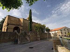
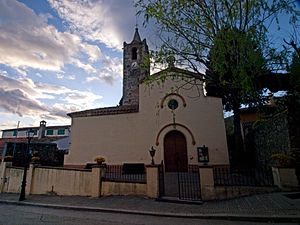
Sant Salvador, Breda
Church
Distance: Approx. 208 meters
Latitude and longitude: 41.748453,2.5571
Sant Salvador de Breda is a parish church and former Benedictine monastery in Breda, Province of Girona, Catalonia, Spain.
Gualba
Municipality in Catalonia, Spain
Distance: Approx. 4897 meters
Latitude and longitude: 41.73222222,2.50472222
Gualba (Catalan pronunciation: [ˈgwalβə]) is a municipality in Catalonia, Spain. It is in Barcelona Province in the comarca of Vallès Oriental. As of 2014, the population was 1,429.
Weather in this IP's area
clear sky
11 Celsius
10 Celsius
10 Celsius
12 Celsius
1010 hPa
59 %
1010 hPa
964 hPa
10000 meters
6.06 m/s
12.87 m/s
275 degree


