91.126.111.203 - IP Lookup: Free IP Address Lookup, Postal Code Lookup, IP Location Lookup, IP ASN, Public IP
Country:
Region:
City:
Location:
Time Zone:
Postal Code:
ISP:
ASN:
language:
User-Agent:
Proxy IP:
Blacklist:
IP information under different IP Channel
ip-api
Country
Region
City
ASN
Time Zone
ISP
Blacklist
Proxy
Latitude
Longitude
Postal
Route
db-ip
Country
Region
City
ASN
Time Zone
ISP
Blacklist
Proxy
Latitude
Longitude
Postal
Route
IPinfo
Country
Region
City
ASN
Time Zone
ISP
Blacklist
Proxy
Latitude
Longitude
Postal
Route
IP2Location
91.126.111.203Country
Region
cantabria
City
san vicente de la barquera
Time Zone
Europe/Madrid
ISP
Language
User-Agent
Latitude
Longitude
Postal
ipdata
Country
Region
City
ASN
Time Zone
ISP
Blacklist
Proxy
Latitude
Longitude
Postal
Route
Popular places and events near this IP address

Comillas
Municipality in Cantabria, Spain
Distance: Approx. 8898 meters
Latitude and longitude: 43.38694444,-4.28944444
Comillas is a small township and municipality in the northern reaches of Spain, in the autonomous community of Cantabria. The Marquessate of Comillas, a fiefdom of Spanish nobility, holds ceremonial office in the seat of power at a small castle which overlooks the town. The Comillas Pontifical University was housed here before it moved to Madrid, and the old university buildings are among the finest examples of architecture in the town.

San Vicente de la Barquera
Municipality in Cantabria, Spain
Distance: Approx. 68 meters
Latitude and longitude: 43.385,-4.39861111
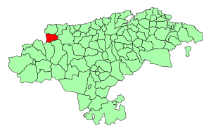
San Vicente de la Barquera is a municipality of Cantabria in northern Spain. It had a population of 4,412 in 2002. Tourism is its main activity due to the area's natural environment and heritage.

Western coast of Cantabria
Comarca in Cantabria, Spain
Distance: Approx. 9206 meters
Latitude and longitude: 43.37138889,-4.28722222
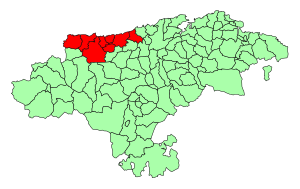
The Western Coast of Cantabria is a comarca of said Spanish autonomous community which comprises the municipalities of Val de San Vicente, San Vicente de la Barquera, Valdáliga, Comillas, Udías, Ruiloba, Alfoz de Lloredo and Santillana del Mar. As its own name indicates, this comarca extends over the western coast of the autonomous community, from its border with Asturias by the mouth of the Deva River, to the Saja-Besaya mouth in Suances, although this limits may vary depending on the source, since this comarca, as the rest of Cantabria's, is not regulated, but there are common characteristic elements in the municipalities that belong to it. This zone has great tourism assets like beaches, nature, gastronomy and culture.

Herrerías
Municipality in Cantabria, Spain
Distance: Approx. 9384 meters
Latitude and longitude: 43.31555556,-4.46472222
Herrerías (Spanish pronunciation: [e.re.ˈɾi.as]) is a municipality located in the autonomous community of Cantabria, Spain. According to the 2007 census, the city has a population of 715 inhabitants.

Cabra (river)
River in Asturias, Spain
Distance: Approx. 9129 meters
Latitude and longitude: 43.38666667,-4.51222222
The Cabra is a river in northern Spain flowing through the Autonomous Community of Asturias. Beginning: Pico Arenas, on the border between the municipalities of Llanes and Ribadedeva. River mouth: Bay of Biscay, in the Playa de la Franca.

Cave of El Soplao
Cave in Cantabria, Spain
Distance: Approx. 9924 meters
Latitude and longitude: 43.29638889,-4.41
El Soplao (Cantabrian: El Sopláu) is a cave located in the municipalities of Rionansa, Valdáliga and Herrerías in Cantabria, Spain. It is considered unique for the quality and quantity of geological formations (speleothems) in its 17 miles length, 6 of which are open to the public. In it are formations such as helictites (eccentric stalactites defying gravity) and curtains (draperies, or sheets of calcite, sometimes translucent, hanging from the ceiling).

Seminario Pontificio
Distance: Approx. 8312 meters
Latitude and longitude: 43.3875,-4.2967
Seminario Pontificio (Spanish for Pontifical Seminary) is a hamlet located in the Spanish municipality of Comillas, in the province of Cantabria. As of 2008, it had no inhabitants.

Val de San Vicente
Place in Cantabria, Spain
Distance: Approx. 6867 meters
Latitude and longitude: 43.3775,-4.48361111
Val de San Vicente is a municipality located in the autonomous community of Cantabria, Spain.

Valdáliga
Place in Cantabria, Spain
Distance: Approx. 7446 meters
Latitude and longitude: 43.32916667,-4.34916667
Valdáliga is a municipality in Cantabria, Spain.

El Capricho
Building in Comillas , Spain
Distance: Approx. 8634 meters
Latitude and longitude: 43.3837,-4.2927
El Capricho is a villa in Comillas (Cantabria), Spain, designed by Antoni Gaudí. It was built in 1883–1885 for the summer use of a wealthy client, Máximo Díaz de Quijano, who died a year before the house was completed. Gaudí, who designed only a small number of buildings outside Catalonia, was involved with other projects at Comillas.
Weather in this IP's area
scattered clouds
5 Celsius
3 Celsius
5 Celsius
5 Celsius
1034 hPa
72 %
1034 hPa
1010 hPa
10000 meters
2.52 m/s
2.02 m/s
157 degree
33 %