91.126.105.28 - IP Lookup: Free IP Address Lookup, Postal Code Lookup, IP Location Lookup, IP ASN, Public IP
Country:
Region:
City:
Location:
Time Zone:
Postal Code:
ISP:
ASN:
language:
User-Agent:
Proxy IP:
Blacklist:
IP information under different IP Channel
ip-api
Country
Region
City
ASN
Time Zone
ISP
Blacklist
Proxy
Latitude
Longitude
Postal
Route
db-ip
Country
Region
City
ASN
Time Zone
ISP
Blacklist
Proxy
Latitude
Longitude
Postal
Route
IPinfo
Country
Region
City
ASN
Time Zone
ISP
Blacklist
Proxy
Latitude
Longitude
Postal
Route
IP2Location
91.126.105.28Country
Region
cantabria
City
bareyo
Time Zone
ISP
Language
User-Agent
Latitude
Longitude
Postal
ipdata
Country
Region
City
ASN
Time Zone
ISP
Blacklist
Proxy
Latitude
Longitude
Postal
Route
Popular places and events near this IP address

Arnuero
Municipality in Cantabria, Spain
Distance: Approx. 3125 meters
Latitude and longitude: 43.47305556,-3.56305556
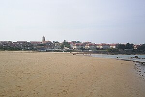
Arnuero is a municipality in the province and autonomous community of Cantabria, northern Spain. The municipality is located in the northeastern portion of the province, and includes three small villages : Arnuero, Soano and Isla. Isla has two seaside districts, popular tourism destinations, Quejo (Cape Quejo) and Playa la Arena.

Trasmiera
Comarca in Cantabria, Spain
Distance: Approx. 6247 meters
Latitude and longitude: 43.41111111,-3.60916667
Trasmiera (Spanish: Trasmiera; Cantabrian and historically: Tresmiera) is a historic comarca of Cantabria (Spain), located to the east of the Miera River (tras Miera, meaning behind Miera, from the point of view of Asturias de Santillana), reaching the western side of the Asón. It extends between the bays of Santander and Santoña, occupying most of the Eastern seaboard of Cantabria. This piece of coast is known for its cliffs and fine beaches, such as those of Langre, Loredo, Isla, Noja and Berria.

Bareyo
Municipality in Cantabria, Spain
Distance: Approx. 1888 meters
Latitude and longitude: 43.48222222,-3.61083333
Bareyo is a municipality located in the autonomous community of Cantabria, Spain. According to the 2007 census, the city has a population of 1.702 inhabitants. Its capital is Ajo.

Hazas de Cesto
Municipality in Cantabria, Spain
Distance: Approx. 7839 meters
Latitude and longitude: 43.39694444,-3.58972222
Hazas de Cesto is a municipality located in the autonomous community of Cantabria, Spain. According to the 2007 census, the city has a population of 1,285 inhabitants. Its capital is Beranga.

Isla (Cantabria)
Village in Cantabria, Spain
Distance: Approx. 3897 meters
Latitude and longitude: 43.49333333,-3.56916667
Isla is a small village in the municipality of Arnuero in Cantabria, Spain together with other settlements, such as Soane, Castillo Siete Villas and Arnuero. It is in the region of Trasmiera.

Noja
Municipality in Cantabria, Spain
Distance: Approx. 6833 meters
Latitude and longitude: 43.48138889,-3.51861111
Noja is a municipality located in the autonomous community of Cantabria, Spain. It has 2 beaches, "Trengandin" and "Ris".
CF Ribamontán al Mar
Association football club in Spain
Distance: Approx. 6523 meters
Latitude and longitude: 43.462461,-3.681301
Club de Fútbol Ribamontán al Mar is a football team based in Galizano, Ribamontán al Mar in the autonomous community of Cantabria. Founded in 1971, the team plays in Tercera División – Group 3. The club's home ground is Baceñuela, which has a capacity of 3,000 spectators.
AD Siete Villas
Spanish football team
Distance: Approx. 3675 meters
Latitude and longitude: 43.459653,-3.556429
Asociación Deportiva Siete Villas is a football team based in Castillo, Arnuero in the autonomous community of Cantabria. Founded in 1969 as Club Deportivo Siete Villas, the team plays in Tercera Federación – Group 3. The club's home ground is San Pedro, which has a capacity of 500 spectators.

Santa Olaja mill
Historic site in Cantabria, Spain
Distance: Approx. 4670 meters
Latitude and longitude: 43.4861,-3.5494
The Santa Olaja mill is located in the Joyel Marshes in Soano, in the municipality of Arnuero in the autonomous community of Cantabria, Spain. It was declared a Bien de Interés Cultural in November 2013.

Meruelo, Spain
Municipality in Cantabria, Spain
Distance: Approx. 2442 meters
Latitude and longitude: 43.4569,-3.5739
Meruelo is a municipality in Cantabria, Spain.

Ribamontán al Mar
Place in Cantabria, Spain
Distance: Approx. 5731 meters
Latitude and longitude: 43.4556,-3.67
Ribamontán al Mar is a municipality in Cantabria, Spain, located on the Bay of Santander.

La Garma cave complex
Cave complex and archaeological site with prehistoric paintings in Spain
Distance: Approx. 6633 meters
Latitude and longitude: 43.43055556,-3.66583333
The La Garma cave complex is a parietal art-bearing paleoanthropological cave system in Cantabria, Spain. It is located just north of the village of Omoño, part of the municipality of Ribamontán al Monte. The cave complex is noted for one of the best preserved floors from the Paleolithic containing more than 4,000 fossils and more than 500 graphical units.
Weather in this IP's area
scattered clouds
10 Celsius
9 Celsius
10 Celsius
11 Celsius
1008 hPa
49 %
1008 hPa
997 hPa
10000 meters
5.66 m/s
230 degree
40 %