91.106.157.72 - IP Lookup: Free IP Address Lookup, Postal Code Lookup, IP Location Lookup, IP ASN, Public IP
Country:
Region:
City:
Location:
Time Zone:
Postal Code:
IP information under different IP Channel
ip-api
Country
Region
City
ASN
Time Zone
ISP
Blacklist
Proxy
Latitude
Longitude
Postal
Route
Luminati
Country
Region
sh
City
sandesneben
ASN
Time Zone
Europe/Berlin
ISP
Vereinigte Stadtwerke Media GmbH
Latitude
Longitude
Postal
IPinfo
Country
Region
City
ASN
Time Zone
ISP
Blacklist
Proxy
Latitude
Longitude
Postal
Route
IP2Location
91.106.157.72Country
Region
schleswig-holstein
City
labenz
Time Zone
Europe/Berlin
ISP
Language
User-Agent
Latitude
Longitude
Postal
db-ip
Country
Region
City
ASN
Time Zone
ISP
Blacklist
Proxy
Latitude
Longitude
Postal
Route
ipdata
Country
Region
City
ASN
Time Zone
ISP
Blacklist
Proxy
Latitude
Longitude
Postal
Route
Popular places and events near this IP address

Steinhorst, Schleswig-Holstein
Municipality in Schleswig-Holstein, Germany
Distance: Approx. 3061 meters
Latitude and longitude: 53.72083333,10.48638889
Steinhorst (which roughly translates as Stone Refuge) is a municipality in Kreis Herzogtum Lauenburg in Schleswig-Holstein. It belongs to the Amt Sandesneben-Nusse.
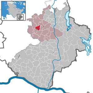
Sandesneben
Municipality in Schleswig-Holstein, Germany
Distance: Approx. 2157 meters
Latitude and longitude: 53.68333333,10.5
Sandesneben is a village in the district of Lauenburg, in Schleswig-Holstein, Germany. It is situated approximately 18 km west of Ratzeburg, and 25 km southwest of Lübeck. Sandesneben is the seat of the Amt ("collective municipality") Sandesneben-Nusse.

Lüchow, Schleswig-Holstein
Municipality in Schleswig-Holstein, Germany
Distance: Approx. 1358 meters
Latitude and longitude: 53.69057,10.52977
Lüchow is a municipality in the district of Lauenburg, in Schleswig-Holstein, Germany.
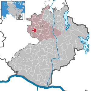
Wentorf, Sandesneben
Municipality in Schleswig-Holstein, Germany
Distance: Approx. 3784 meters
Latitude and longitude: 53.68333333,10.46666667
Wentorf (Amt Sandesneben) is a municipality in the district of Lauenburg, in Schleswig-Holstein, Germany.
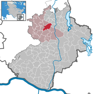
Duvensee
Municipality in Schleswig-Holstein, Germany
Distance: Approx. 3293 meters
Latitude and longitude: 53.7,10.56666667
Duvensee is a municipality in the district of Lauenburg, in Schleswig-Holstein, Germany. It is best known for its Mesolithic archaeologic sites located in the Duvensee Bog, which have helped in the discovery of diets and settlement strategies of European post-glacial hunter gatherers. The Duvensee paddle was also discovered there in 1926.
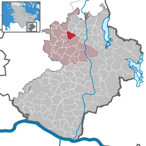
Klinkrade
Municipality in Schleswig-Holstein, Germany
Distance: Approx. 2873 meters
Latitude and longitude: 53.71666667,10.55
Klinkrade is a municipality in the district of Lauenburg, in Schleswig-Holstein, Germany.

Labenz
Municipality in Schleswig-Holstein, Germany
Distance: Approx. 2 meters
Latitude and longitude: 53.7,10.51666667
Labenz is a municipality in the district of Lauenburg, in Schleswig-Holstein, Germany.
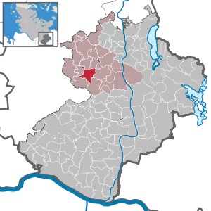
Sirksfelde
Municipality in Schleswig-Holstein, Germany
Distance: Approx. 3871 meters
Latitude and longitude: 53.66666667,10.5
Sirksfelde is a municipality in the district of Lauenburg, in Schleswig-Holstein, Germany.

Sandesneben (Amt)
Former amt in Germany
Distance: Approx. 2189 meters
Latitude and longitude: 53.683,10.5
Sandesneben was an Amt ("collective municipality") in the district of Lauenburg, in Schleswig-Holstein, Germany. Its seat was in Sandesneben. In January 2008, it was merged with the Amt Nusse to form the Amt Sandesneben-Nusse.

Sandesneben-Nusse
Amt in Germany
Distance: Approx. 2189 meters
Latitude and longitude: 53.683,10.5
Sandesneben-Nusse is an Amt ("collective municipality") in the district of Lauenburg, in Schleswig-Holstein, Germany. Its seat is in Sandesneben. It was formed on 1 January 2008 from the former Ämter Sandesneben and Nusse.

Duvensee paddle
Mesolithic paddle found in Schleswig-Holstein, Germany
Distance: Approx. 2025 meters
Latitude and longitude: 53.699171,10.54739
The Duvensee paddles is the preserved part of a Mesolithic spade paddle, which was found during archaeological excavations of a Mesolithic dwelling area at Duvensee near Klinkrade (Herzogtum Lauenburg) Schleswig-Holstein, Germany in 1926. After a paddle from Star Carr in England, the Duvensee paddle is the second oldest known paddle and is considered among the earliest evidence for the use of water transport in the Mesolithic. The find is in the permanent exhibition of the Archaeological Museum Hamburg in Harburg, Hamburg.
Duvensee archaeological sites
Series of archaeological sites in Duvensee, Germany
Distance: Approx. 2036 meters
Latitude and longitude: 53.69861111,10.5475
The Duvensee archaeological sites (German: Duvenseer Wohnplätze) are a series of early Mesolithic archaeological sites that are located within the Duvensee bog near Duvensee in Schleswig Holstein, Germany. The bog is one of the oldest and well-researched archaeological settlement areas from the early Holocene in Central Europe. The archaeological sites are renowned for their well-preserved organic remains and are of great importance in understanding the subsistence and settlement strategies of post-glacial hunter-gatherer societies.
Weather in this IP's area
broken clouds
1 Celsius
-2 Celsius
-0 Celsius
2 Celsius
1021 hPa
85 %
1021 hPa
1016 hPa
10000 meters
2.06 m/s
280 degree
75 %