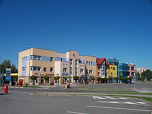
Country:
Region:
City:
Latitude and Longitude:
Time Zone:
Postal Code:
IP information under different IP Channel
ip-api
Country
Region
City
ASN
Time Zone
ISP
Blacklist
Proxy
Latitude
Longitude
Postal
Route
Luminati
Country
Region
80
City
orlova
ASN
Time Zone
Europe/Prague
ISP
Futruy s.r.o.
Latitude
Longitude
Postal
IPinfo
Country
Region
City
ASN
Time Zone
ISP
Blacklist
Proxy
Latitude
Longitude
Postal
Route
db-ip
Country
Region
City
ASN
Time Zone
ISP
Blacklist
Proxy
Latitude
Longitude
Postal
Route
ipdata
Country
Region
City
ASN
Time Zone
ISP
Blacklist
Proxy
Latitude
Longitude
Postal
Route
Popular places and events near this IP address
Dolní Lutyně
Municipality in Moravian-Silesian, Czech Republic
Distance: Approx. 3298 meters
Latitude and longitude: 49.89944444,18.42083333
Dolní Lutyně (Polish: , German: Deutsch Leuten or Nieder Leuten) is a municipality and village in Karviná District in the Moravian-Silesian Region of the Czech Republic. It has about 5,300 inhabitants.

Orlová
Town in Moravian-Silesian, Czech Republic
Distance: Approx. 2890 meters
Latitude and longitude: 49.84527778,18.43027778
Orlová (Czech pronunciation: [ˈorlovaː] ; Polish: , German: Orlau) is a town in Karviná District in the Moravian-Silesian Region of the Czech Republic. It has about 28,000 inhabitants. The town is struggling with structural problems and is infamously known as the worst town to live in in the Czech Republic according to the national Quality of Life Index.

Dětmarovice
Municipality in Moravian-Silesian, Czech Republic
Distance: Approx. 4118 meters
Latitude and longitude: 49.89416667,18.46083333
Dětmarovice (Czech: [ˈɟɛtmaroˌvɪtsɛ] ; Polish: , German: Dittmarsdorf, Dittmannsdorf) is a municipality and village in Karviná District in the Moravian-Silesian Region of the Czech Republic. It has about 4,400 inhabitants.

Rychvald
Town in Moravian-Silesian, Czech Republic
Distance: Approx. 2980 meters
Latitude and longitude: 49.86611111,18.37638889
Rychvald (Polish: , German: Reichwaldau) is a town in Karviná District in the Moravian-Silesian Region of the Czech Republic. It has about 7,800 inhabitants.

Doubrava (Karviná District)
Municipality in Moravian-Silesian, Czech Republic
Distance: Approx. 4677 meters
Latitude and longitude: 49.85861111,18.48027778
Doubrava (Polish: , German: Dombrau) is a municipality and village in Karviná District in the Moravian-Silesian Region of the Czech Republic. It has about 1,200 inhabitants.

Záblatí (Bohumín)
Distance: Approx. 3379 meters
Latitude and longitude: 49.88472222,18.37638889
(Polish: ) is a village in Karviná District, Moravian-Silesian Region, Czech Republic. It was a separate municipality but became administratively a part of Bohumín in 1974. It has a population of 2,220 (2022).

Skřečoň
Distance: Approx. 4953 meters
Latitude and longitude: 49.90666667,18.37861111
(German: Skretschon, Polish: ) is a village in Karviná District, Moravian-Silesian Region, Czech Republic. It was a separate municipality but became administratively a part of Bohumín in 1974. It has a population of 2,656 (2022).
Lazy (Orlová)
Village in the Czech Republic
Distance: Approx. 3453 meters
Latitude and longitude: 49.83888889,18.41833333
(Polish: ) is a village in Karviná District, Moravian-Silesian Region, Czech Republic. It was a separate municipality but became administratively a part of Orlová in 1946. It has a population of 274.

Poruba (Orlová)
Distance: Approx. 1618 meters
Latitude and longitude: 49.85555556,18.41388889
(Polish: ) is a village in Karviná District, Moravian-Silesian Region, Czech Republic. It was a separate municipality but became administratively a part of Orlová in 1946 and now is one of the parts of the town. It has a population of 5,604.

Monument to the fallen for Těšín Silesia
Distance: Approx. 3307 meters
Latitude and longitude: 49.84055556,18.42472222
Monument to fallen for Těšín Silesia (Czech: Pomník padlým za Těšínsko) is a monument in Orlová commemorating Czech victims of the Polish–Czechoslovak War and the following plebiscite period during the Polish–Czechoslovak dispute over Cieszyn Silesia (1919–1920). The monument was built in 1928, damaged during the Polish annexation of the territory in 1938–1939 and after the end of the World War II partially reconstructed.

Orlová monastery
Distance: Approx. 2796 meters
Latitude and longitude: 49.84611111,18.43
The Orlová monastery (Czech: benediktinský klášter v Orlové, Polish: klasztor benedyktynów w Orłowej) was a Benedictine abbey established around 1268 in what is now a town of Orlová in the Karviná District, Moravian-Silesian Region, Czech Republic.

Lutyně (Orlová)
Distance: Approx. 659 meters
Latitude and longitude: 49.87138889,18.42638889
Lutyně (Polish: Lutynia, German: Leuten) is a town part of Orlová in Karviná District, Moravian-Silesian Region, Czech Republic. It was a separate municipality, historically prior to World War II known as Polská Lutyně (Polish: Lutynia Polska, German: Polnischleuten), and later as Horní Lutyně (Polish: Lutynia Górna, German: Ober-Leuten). It became administratively a part of Orlová in 1946, as opposed to its sister settlement of Dolní Lutyně, which remained independent.
Weather in this IP's area
light rain
4 Celsius
0 Celsius
3 Celsius
4 Celsius
1012 hPa
79 %
1012 hPa
980 hPa
10000 meters
3.84 m/s
9.93 m/s
241 degree
100 %
07:04:00
15:59:25

