90.250.10.26 - IP Lookup: Free IP Address Lookup, Postal Code Lookup, IP Location Lookup, IP ASN, Public IP
Country:
Region:
City:
Location:
Time Zone:
Postal Code:
IP information under different IP Channel
ip-api
Country
Region
City
ASN
Time Zone
ISP
Blacklist
Proxy
Latitude
Longitude
Postal
Route
Luminati
Country
Region
eng
City
miltonkeynes
ASN
Time Zone
Europe/London
ISP
Vodafone Limited
Latitude
Longitude
Postal
IPinfo
Country
Region
City
ASN
Time Zone
ISP
Blacklist
Proxy
Latitude
Longitude
Postal
Route
IP2Location
90.250.10.26Country
Region
scotland
City
saint andrews
Time Zone
Europe/London
ISP
Language
User-Agent
Latitude
Longitude
Postal
db-ip
Country
Region
City
ASN
Time Zone
ISP
Blacklist
Proxy
Latitude
Longitude
Postal
Route
ipdata
Country
Region
City
ASN
Time Zone
ISP
Blacklist
Proxy
Latitude
Longitude
Postal
Route
Popular places and events near this IP address

St Andrews
Town in Fife, Scotland
Distance: Approx. 287 meters
Latitude and longitude: 56.3404,-2.7955
St Andrews (Latin: S. Andrea(s); Scots: Saunt Aundraes; Scottish Gaelic: Cill Rìmhinn, pronounced [kʰʲɪʎˈrˠiː.ɪɲ]) is a town on the east coast of Fife in Scotland, 10 miles (16 kilometres) southeast of Dundee and 30 miles (50 kilometres) northeast of Edinburgh. St Andrews had a recorded population of 16,800 as of 2011, making it Fife's fourth-largest settlement and 45th most populous settlement in Scotland. The town is home to the University of St Andrews, the third oldest university in the English-speaking world and the oldest in Scotland.

St Mary's College, St Andrews
Distance: Approx. 281 meters
Latitude and longitude: 56.3391,-2.7945
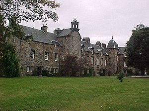
St Mary's College, founded as New College or College of the Assumption of the Blessed Virgin Mary, is the home of the Faculty and School of Divinity within the University of St Andrews, in Fife, Scotland.
University of St Andrews School of Medicine
Distance: Approx. 318 meters
Latitude and longitude: 56.338,-2.794
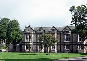
The University of St Andrews School of Medicine (formerly the Bute Medical School) is the school of medicine at the University of St Andrews in St Andrews, Fife, Scotland and the oldest medical school in Scotland. The medical school offers several programmes to students, the BSc (Hons) in Medicine program teaches medical students for the first three years of their training, with students completing this training, earning their MB ChB/MBBS at various partner medical schools in the UK in a pre-arranged fashion. From September 2025 onwards, a 5-year MB ChB will be offered with a particular focus on community healthcare.
Madras College
School in St Andrews, Fife, Scotland
Distance: Approx. 99 meters
Latitude and longitude: 56.338,-2.798
Madras College, often referred to as Madras, is a Scottish comprehensive secondary school located in St Andrews, Fife. It educates over 1,400 pupils aged between 11 and 18 and was founded in 1833 by the Rev. Dr Andrew Bell.

Hope Park Church, St Andrews
Distance: Approx. 223 meters
Latitude and longitude: 56.340663,-2.799711
Hope Park Church in St Andrews, Fife, is a congregation of the Church of Scotland.

New Picture House
Cinema in St Andrews, Scotland
Distance: Approx. 354 meters
Latitude and longitude: 56.3418,-2.7977
The New Picture House (often called the NPH) is an independent cinema in St Andrews, Scotland originally built in 1930 with a capacity of 910 seats. It was subsequently remodelled to contain three cinema screens. The largest screen has seats with electronic black recliners both on ground level and balcony.
Universal Short Title Catalogue
Bibliographic database
Distance: Approx. 319 meters
Latitude and longitude: 56.339778,-2.794211
The Universal Short Title Catalogue (USTC) brings together information on all books published in Europe between the invention of printing and the end of the sixteenth century, creating a powerful resource for the study of the book and print culture. The project has a searchable interface, which brings together data from established national bibliographical projects and new projects undertaken by the project team based at the University of St Andrews, with partners in University College Dublin. This new work builds upon the principles established by the St Andrews French Vernacular Book project, completed and published in 2007 (FB volumes 1 & 2).

Siege of St Andrews Castle
1546–47 Siege of St Andrews Castle during the Rough Wooing
Distance: Approx. 22 meters
Latitude and longitude: 56.33888889,-2.79888889
The siege of St Andrews Castle (1546–1547) followed the killing of Cardinal David Beaton by a group of Protestants at St Andrews Castle. They remained in the castle and were besieged by the Governor of Scotland, Regent Arran. However, over 18 months the Scottish besieging forces made little impact, and the Castle finally surrendered to a French naval force after artillery bombardment.

Holy Trinity Church, St Andrews
Distance: Approx. 240 meters
Latitude and longitude: 56.33969,-2.79555
Holy Trinity Church is a Church of Scotland parish church in St Andrews, Fife. It is a Category A listed building.
St Andrews (New) railway station
Disused railway station in St Andrews, Fife
Distance: Approx. 351 meters
Latitude and longitude: 56.3404,-2.8038
St Andrews railway station was the second station to be built in the town of St Andrews, Fife, Scotland. The station, which was in service from 1887 to 1969, was built by the St Andrews Railway and the Anstruther and St Andrews Railway.
University of St Andrews Library
Library in Scotland
Distance: Approx. 324 meters
Latitude and longitude: 56.3391,-2.7938
The University of St Andrews Library dates back to the early 17th century but its books have been collected over some 600 years since the university was founded in 1413. It holds one of the most extensive collections of the research libraries in the United Kingdom with more than one million volumes. In addition to 210,000 printed books in special collections, it has large manuscript and photographic collections while its archives date back to the early 15th century.

St Andrews Town Hall
Municipal building in St Andrews, Scotland
Distance: Approx. 227 meters
Latitude and longitude: 56.3391,-2.7954
St Andrews Town Hall is a municipal structure in South Street, St Andrews, Fife, Scotland. The structure, which is the meeting place of the Royal Burgh of St Andrews Community Council, is a Category B listed building.
Weather in this IP's area
clear sky
5 Celsius
1 Celsius
5 Celsius
7 Celsius
1007 hPa
67 %
1007 hPa
1002 hPa
10000 meters
6.69 m/s
290 degree

