Country:
 Czech Republic
Region:
City:
Latitude and Longitude:
Time Zone:
Postal Code:
IP information under different IP Channel
ip-api
Country
Region
City
ASN
Time Zone
ISP
Blacklist
Proxy
Latitude
Longitude
Postal
Route
IPinfo
Country
Region
City
ASN
Time Zone
ISP
Blacklist
Proxy
Latitude
Longitude
Postal
Route
MaxMind
Country
Region
City
ASN
Time Zone
ISP
Blacklist
Proxy
Latitude
Longitude
Postal
Route
Luminati
Country
CZRegion
71
City
stepanov
ASN
Time Zone
Europe/Prague
ISP
O2 Czech Republic, a.s.
Latitude
Longitude
Postal
db-ip
Country
Region
City
ASN
Time Zone
ISP
Blacklist
Proxy
Latitude
Longitude
Postal
Route
ipdata
Country
Region
City
ASN
Time Zone
ISP
Blacklist
Proxy
Latitude
Longitude
Postal
Route
Popular places and events near this IP address
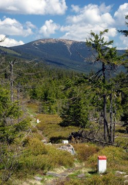
Králický Sněžník
Mountain in the Czech Republic and Poland
Distance: Approx. 7284 meters
Latitude and longitude: 50.20694444,16.84888889
Králický Sněžník (Czech pronunciation: [ˈkraːlɪtskiː ˈsɲɛʒɲiːk]) or Śnieżnik (Polish pronunciation: [ˈɕɲɛʐɲik]) is a mountain on the border between the Czech Republic and Poland. With 1,423 metres (4,669 ft), it is the highest mountain of the Králický Sněžník Mountains.

Dolní Morava
Municipality in Pardubice, Czech Republic
Distance: Approx. 9316 meters
Latitude and longitude: 50.1225,16.79944444
Dolní Morava (German: Mohrau) is a municipality and village in Ústí nad Orlicí District in the Pardubice Region of the Czech Republic. It has about 400 inhabitants.
Nowa Morawa
Village in Lower Silesian Voivodeship, Poland
Distance: Approx. 8940 meters
Latitude and longitude: 50.23833333,16.90527778
Nowa Morawa [ˈnɔva mɔˈrava] is a village in the administrative district of Gmina Stronie Śląskie, within Kłodzko County, Lower Silesian Voivodeship, in south-western Poland. It lies approximately 7 kilometres (4 mi) south of Stronie Śląskie, 29 kilometres (18 mi) south-east of Kłodzko, and 100 kilometres (62 mi) south of the regional capital Wrocław.

Hanušovice
Town in Olomouc, Czech Republic
Distance: Approx. 8771 meters
Latitude and longitude: 50.08055556,16.93638889
Hanušovice (German: Hannsdorf) is a town in Šumperk District in the Olomouc Region of the Czech Republic. It has about 2,900 inhabitants. The Holba brewery is located in the town.

Staré Město (Šumperk District)
Town in Olomouc, Czech Republic
Distance: Approx. 2706 meters
Latitude and longitude: 50.16166667,16.955
Staré Město (German: Mährisch Altstadt) is a town in Šumperk District in the Olomouc Region of the Czech Republic. It has about 1,700 inhabitants.

Jindřichov (Šumperk District)
Municipality in Olomouc, Czech Republic
Distance: Approx. 8473 meters
Latitude and longitude: 50.09583333,16.985
Jindřichov (German: Heinrichsthal) is a municipality and village in Šumperk District in the Olomouc Region of the Czech Republic. It has about 1,100 inhabitants.

Šléglov
Municipality in Olomouc, Czech Republic
Distance: Approx. 4681 meters
Latitude and longitude: 50.15305556,16.9825
Šléglov (German: Schlögelsdorf) is a municipality and village in Šumperk District in the Olomouc Region of the Czech Republic. It has about 40 inhabitants. Šléglov lies approximately 22 kilometres (14 mi) north of Šumperk, 66 km (41 mi) north of Olomouc, and 184 km (114 mi) east of Prague.

Vikantice
Municipality in Olomouc, Czech Republic
Distance: Approx. 5922 meters
Latitude and longitude: 50.13611111,16.99277778
Vikantice (German: Weigelsdorf) is a municipality and village in Šumperk District in the Olomouc Region of the Czech Republic. It has about 80 inhabitants. Vikantice lies approximately 19 kilometres (12 mi) north of Šumperk, 63 km (39 mi) north of Olomouc, and 184 km (114 mi) east of Prague.

Branná
Municipality in Olomouc, Czech Republic
Distance: Approx. 6747 meters
Latitude and longitude: 50.15333333,17.01166667
Branná (until 1949 Kolštejn; German: Goldenstein) is a municipality and village in Šumperk District in the Olomouc Region of the Czech Republic. It has about 300 inhabitants. The historic town centre is well preserved and is protected by law as an urban monument zone.
Krupá (Morava)
River in Olomouc, Czech Republic
Distance: Approx. 8433 meters
Latitude and longitude: 50.08333333,16.93333333
Krupá (German: Graupa) is a creek in Šumperk District in the Olomouc Region of the Czech Republic. It is a left tributary of the Morava. Its length is 19,2 km and its drainage basin covers 112.7 km2.

Habartice (Šumperk District)
Village in Šumperk District, Czech Republic
Distance: Approx. 6101 meters
Latitude and longitude: 50.11,16.9575
Habartice (German: Ebersdorf) is a village and administrative part of Jindřichov in Šumperk District in the Olomouc Region of the Czech Republic.

Klepáč
Peak in the Králický Sněžník Mountains range
Distance: Approx. 9027 meters
Latitude and longitude: 50.1575,16.79083333
Klepáč (Polish: Trójmorski Wierch (Polish pronunciation: [trujˈmɔrski ˈvjɛrx]), until 1946 Klepacz; German: Klappersteine) is a peak in the Králický Sněžník Mountains range. It lies on the Czech Republic–Poland border. It is a triple point of the European watershed.
Weather in this IP's area
overcast clouds
13 Celsius
13 Celsius
13 Celsius
15 Celsius
1018 hPa
84 %
1018 hPa
945 hPa
10000 meters
2.18 m/s
5.49 m/s
43 degree
99 %
06:31:32
19:02:08