89.83.100.35 - IP Lookup: Free IP Address Lookup, Postal Code Lookup, IP Location Lookup, IP ASN, Public IP
Country:
Region:
City:
Location:
Time Zone:
Postal Code:
IP information under different IP Channel
ip-api
Country
Region
City
ASN
Time Zone
ISP
Blacklist
Proxy
Latitude
Longitude
Postal
Route
Luminati
Country
Region
idf
City
levalloisperret
ASN
Time Zone
Europe/Paris
ISP
Bouygues Telecom SA
Latitude
Longitude
Postal
IPinfo
Country
Region
City
ASN
Time Zone
ISP
Blacklist
Proxy
Latitude
Longitude
Postal
Route
IP2Location
89.83.100.35Country
Region
provence-alpes-cote-d'azur
City
toulon
Time Zone
Europe/Paris
ISP
Language
User-Agent
Latitude
Longitude
Postal
db-ip
Country
Region
City
ASN
Time Zone
ISP
Blacklist
Proxy
Latitude
Longitude
Postal
Route
ipdata
Country
Region
City
ASN
Time Zone
ISP
Blacklist
Proxy
Latitude
Longitude
Postal
Route
Popular places and events near this IP address
Toulon
Prefecture of Var, Provence-Alpes-Côte d'Azur, France
Distance: Approx. 1041 meters
Latitude and longitude: 43.12583333,5.93055556
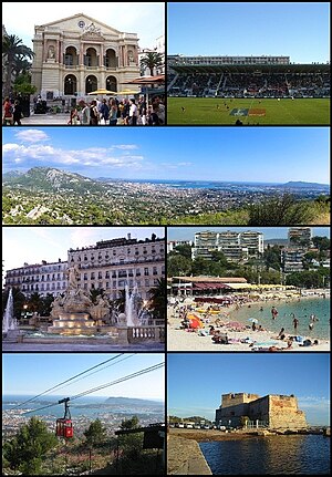
Toulon (UK: , US: , French: [tulɔ̃] ; Provençal: Tolon (classical norm), Touloun (Mistralian norm), pronounced [tuˈlun]) is a city on the French Riviera, famous for its 1793 siege, and a large port on the Mediterranean coast, with a major naval base. Located in the Provence-Alpes-Côte d'Azur region, and the Provence province, Toulon is the prefecture of the Var department. The Commune of Toulon has a population of 176,198 people (2018), making it France's 13th-largest city.

Arrondissement of Toulon
Arrondissement in Provence-Alpes-Côte d'Azur, France
Distance: Approx. 455 meters
Latitude and longitude: 43.12,5.93
The arrondissement of Toulon (French: arrondissement de Toulon) is an arrondissement of France in the Var department in the Provence-Alpes-Côte d'Azur region. It has 32 communes. Its population is 590,778 (2021), and its area is 1,233.5 km2 (476.3 sq mi).
Stade Mayol
Distance: Approx. 366 meters
Latitude and longitude: 43.11888889,5.93666667
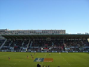
The Stade Mayol is a multi-purpose stadium in Toulon, France. It is currently used mostly for rugby union matches and is the home stadium of RC Toulonnais. The stadium is able to hold 17,500 people.

Siege of Toulon (1707)
1707 siege
Distance: Approx. 1041 meters
Latitude and longitude: 43.12583333,5.93055556
The siege of Toulon took place between 29 July to 21 August 1707 during the War of the Spanish Succession, when a combined Savoyard-Imperial army supported by a British naval force, attacked the French base at Toulon. The Allies had insufficient men to institute a formal siege, while they were outnumbered by French land forces; after losing around 13,000 men, mostly from disease, they retreated to Piedmont. The French fleet inside the harbour, including 46 ships of the line, was sunk to prevent its destruction; the fleet would not be re-floated until after the war ended, cementing British control of the western Mediterranean.

Toulon Cathedral
Distance: Approx. 557 meters
Latitude and longitude: 43.12166667,5.93416667
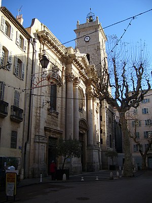
Toulon Cathedral (French: Cathédrale Notre-Dame-de-la-Seds de Toulon; Notre-Dame-de-la-Sède de Toulon), also known as Sainte-Marie-Majeure, is a Catholic church located in Toulon, in the Var department of France. The cathedral is a national monument. Construction of the church began in the 11th century and finished in the 18th century.
Roman Catholic Diocese of Toulon
Distance: Approx. 455 meters
Latitude and longitude: 43.12,5.93
The former French Roman Catholic Diocese of Toulon existed until the Concordat of 1801. Its seat was in Toulon.

Bagne of Toulon
French prison
Distance: Approx. 401 meters
Latitude and longitude: 43.118,5.9287
The Bagne of Toulon was a notorious bagne, or penal establishment in Toulon, France, made famous as the place of imprisonment of the fictional Jean Valjean, the hero of Victor Hugo's novel Les Misérables. It was opened in 1748 and closed in 1873.

Le Mourillon
Distance: Approx. 1092 meters
Latitude and longitude: 43.10694444,5.93194444
Le Mourillon is a neighbourhood to the east of the French city of Toulon, near the entrance to the Rade or roadstead. It was once a fishing village, and then became the home of many of the officers of the French fleet and to part of the naval dockyard. Mourillon has a small fishing port, next to a 16th-century fort, Fort Saint Louis, which was reconstructed by Vauban.

Battle of Toulon (1944)
Battle fought during WWII
Distance: Approx. 668 meters
Latitude and longitude: 43.1222,5.93
The Battle of Toulon was an urban battle of World War II in southern France that took place August 20–26, 1944 and led to the liberation of Toulon by Free French forces under the command of General Edgard de Larminat.
Lycée Dumont d'Urville (Maurepas, Yvelines)
Distance: Approx. 480 meters
Latitude and longitude: 43.1169,5.9392
Lycée Dumont d'Urville (French pronunciation: [lise dymɔ̃ dyʁvil]) is a senior high school/sixth form college in Maurepas, Yvelines, France in the Paris metropolitan area; it serves Maurepas and Élancourt.
Canton of Toulon-4
Distance: Approx. 923 meters
Latitude and longitude: 43.11,5.94
The canton of Toulon-4 is an administrative division of the Var department, southeastern France. Its borders were modified at the French canton reorganisation which came into effect in March 2015. Its seat is in Toulon.

Hôtel de Ville, Toulon
Town hall in Toulon, France
Distance: Approx. 406 meters
Latitude and longitude: 43.1203,5.9325
The Hôtel de Ville (French pronunciation: [otɛl də vil], City Hall) is a historic building in Toulon, Var, southern France, standing on Avenue de la République.
Weather in this IP's area
broken clouds
14 Celsius
13 Celsius
13 Celsius
15 Celsius
1010 hPa
82 %
1010 hPa
995 hPa
10000 meters
6.69 m/s
250 degree
75 %


