89.42.134.36 - IP Lookup: Free IP Address Lookup, Postal Code Lookup, IP Location Lookup, IP ASN, Public IP
Country:
Region:
City:
Location:
Time Zone:
Postal Code:
IP information under different IP Channel
ip-api
Country
Region
City
ASN
Time Zone
ISP
Blacklist
Proxy
Latitude
Longitude
Postal
Route
Luminati
Country
ASN
Time Zone
Europe/Rome
ISP
Seflow s.r.l.
Latitude
Longitude
Postal
IPinfo
Country
Region
City
ASN
Time Zone
ISP
Blacklist
Proxy
Latitude
Longitude
Postal
Route
IP2Location
89.42.134.36Country
Region
emilia-romagna
City
ravenna
Time Zone
Europe/Rome
ISP
Language
User-Agent
Latitude
Longitude
Postal
db-ip
Country
Region
City
ASN
Time Zone
ISP
Blacklist
Proxy
Latitude
Longitude
Postal
Route
ipdata
Country
Region
City
ASN
Time Zone
ISP
Blacklist
Proxy
Latitude
Longitude
Postal
Route
Popular places and events near this IP address

Ravenna
City in Emilia-Romagna, Italy
Distance: Approx. 116 meters
Latitude and longitude: 44.41611111,12.20166667
Ravenna ( rə-VEN-ə; Italian: [raˈvenna], also local pronunciation: [raˈvɛn(n)a] ; Romagnol: Ravèna, Ravêna) is the capital city of the Province of Ravenna, in the Emilia-Romagna region of Northern Italy. It was the capital city of the Western Roman Empire during the 5th century until its collapse in 476, after which it served as the capital of the Ostrogothic Kingdom and then the Byzantine Exarchate of Ravenna.Initially settled by the Umbri people, Ravenna came under Roman Republic control in 89 BC. Octavian built the military harbor of Classis at Ravenna, and the city remained an important seaport on the Adriatic until the early Middle Ages. The city prospered under imperial rule.

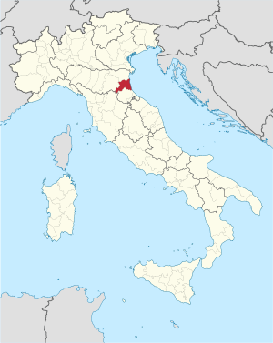
Province of Ravenna
Province of Italy
Distance: Approx. 159 meters
Latitude and longitude: 44.41777778,12.19944444
The province of Ravenna (Italian: provincia di Ravenna; Romagnol: pruvènza ed Ravèna) is a province in the Emilia-Romagna region of Italy. Its capital is the city of Ravenna. As of 2015, it has a population of 391,997 inhabitants over an area of 1,859.44 square kilometres (717.93 sq mi), giving it a population density of 210.81 inhabitants per square kilometre.

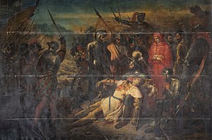
Battle of Ravenna (1512)
1512 war of the League of Cambrai event
Distance: Approx. 107 meters
Latitude and longitude: 44.41666667,12.2
The Battle of Ravenna, fought on 11 April 1512, was a major battle of the War of the League of Cambrai. It pitted forces of the Holy League against France and their Ferrarese allies. Although the French and Ferrarese eliminated the Papal–Spanish forces as a serious threat, their triumph was overshadowed by the loss of their young general Gaston of Foix.
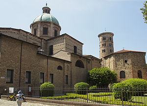
Basilica of Sant'Apollinare Nuovo
Basilica church in Ravenna, Italy, erected by king Theodoric the Great in 6th century CE
Distance: Approx. 284 meters
Latitude and longitude: 44.41666667,12.20472222
The Basilica of Sant'Apollinare Nuovo is a basilica church in Ravenna, Italy. It was erected by the Ostrogothic king Theodoric the Great as his palace chapel during the first quarter of the 6th century (as attested to in the Liber Pontificalis). This Arian church was originally dedicated in 504 AD to "Christ the Redeemer".

Arian Baptistery
UNESCO World Heritage Site in Ravenna, Italy
Distance: Approx. 197 meters
Latitude and longitude: 44.41861111,12.2025
The Arian Baptistry in Ravenna, Italy is a Christian baptismal building that was erected by the Ostrogothic King Theodoric the Great between the end of the 5th century and the beginning of the 6th century A.D., at the same time as the Basilica of Sant' Apollinare Nuovo. Theodoric the Great was an Arian Christian who spent his formative years as a hostage in Constantinople, where he received a comprehensive education that included imperial customs. As an adult Theodoric's political cunning and martial feats gained him the respect of other Goths.

Battle of Rimini (432)
432 battle between Bonifacius and Flavius Aetius
Distance: Approx. 107 meters
Latitude and longitude: 44.41666667,12.2
The Battle of Rimini was fought in 432 between the two strong men of the Western Roman Empire, the very recently deposed Magister Utriusque Militiae Flavius Aetius and the newly appointed Magister Utriusque Militiae Bonifatius (Bonifacius or Boniface). In 430, Aetius had the Magister Utriusque Militiae Flavius Constantius Felix executed by the army, as he was allegedly plotting against Aetius. According to Wijnendaele, Aetius was lured into confronting Bonifatius by being appointed Consul in 432, where he was deposed and Bonifatius appointed by Galla Placidia.

Teatro Comunale Alighieri
Distance: Approx. 15 meters
Latitude and longitude: 44.41722222,12.20111111
The Teatro Comunale Alighieri is an opera house located at 2 Via Mariani in Ravenna, Italy and designed by the Venetian architects, Tommaso Meduna and his brother, Giambattista who had designed the second La Fenice theatre after the fire of 1836 . The new Teatro Comunale Alighieri was inaugurated on 15 May 1852 with a production of Meyerbeer's Robert le diable, followed by Giovanni Pacini's Medea. It presently offers a program of up to six operas during the season which runs from November to April.

Roman Catholic Archdiocese of Ravenna-Cervia
Roman Catholic archdiocese in Italy
Distance: Approx. 105 meters
Latitude and longitude: 44.4167,12.2
The Archdiocese of Ravenna-Cervia (Latin: Archidioecesis Ravennatensis-Cerviensis) is an archdiocese of the Catholic Church. It is a metropolitan see of the Latin Church, located in the Emilia-Romagna region of Italy. The cathedral of the archdiocese is the Cathedral Basilica of the Resurrection of Our Lord in Ravenna.
Battle of Ravenna (729)
Middle Ages battle
Distance: Approx. 107 meters
Latitude and longitude: 44.41666667,12.2
The Battle of Ravenna in 729 was fought between the troops of the Eastern Roman (Byzantine) Exarchate of Ravenna and a force of Lombard Italians. This was in response to Emperor Leo III the Isaurian outlawing the veneration of holy icons, which Pope Gregory II was against. After a fierce battle, the Eastern Roman Army was overcome and thousands of Byzantines were killed.

Battle of Ravenna (476)
Germanic seizure of the Western Roman Empire's capital
Distance: Approx. 107 meters
Latitude and longitude: 44.41666667,12.2
The Battle of Ravenna, capital of the Western Roman Empire, between the Heruli under their King Odoacer and the remnants of the Western Roman army in Roman Italy occurred in early September 476, and represented a culminating event in the ongoing fall of the Western Roman Empire. The Western Roman Empire had been in relative decline since the beginning of the barbarian invasions and Rome, the symbolical heart and largest city of the Western Empire, was sacked in 410 by the Visigoths and in 455 by the Vandals. By 476 the Roman emperor was little more than a puppet, having very little de facto control of any territory outside of Italy.

Tomb of Dante
Mausoleum in Ravenna, Italy
Distance: Approx. 103 meters
Latitude and longitude: 44.41619,12.20094
The Tomb of Dante (Italian: Sepolcro di Dante) is an Italian neoclassical national monument built over the tomb of the poet Dante Alighieri (1265-1321) in 1781. It is sited next to the Basilica of San Francesco in central Ravenna. The monument is surrounded by a "zona dantesca", in which visitors have to remain silent and respectful.

Basilica of San Francesco, Ravenna
Distance: Approx. 131 meters
Latitude and longitude: 44.41592,12.20115
The Basilica of San Francesco is a major church in Ravenna. It was first built in 450 by Neo, bishop of Ravenna, and dedicated to saint Peter and Saint Paul. It was later also known as the Church of the Apostles (Chiesa degli Apostoli).
Weather in this IP's area
clear sky
2 Celsius
-2 Celsius
2 Celsius
3 Celsius
1031 hPa
67 %
1031 hPa
1030 hPa
10000 meters
4.82 m/s
7.89 m/s
4 degree
1 %
