Country:
 Netherlands
Region:
City:
Latitude and Longitude:
Time Zone:
Postal Code:
IP information under different IP Channel
ip-api
Country
Region
City
ASN
Time Zone
ISP
Blacklist
Proxy
Latitude
Longitude
Postal
Route
IPinfo
Country
Region
City
ASN
Time Zone
ISP
Blacklist
Proxy
Latitude
Longitude
Postal
Route
MaxMind
Country
Region
City
ASN
Time Zone
ISP
Blacklist
Proxy
Latitude
Longitude
Postal
Route
Luminati
Country
 RO
ROASN
Time Zone
Europe/Bucharest
Latitude
Longitude
Postal
db-ip
Country
Region
City
ASN
Time Zone
ISP
Blacklist
Proxy
Latitude
Longitude
Postal
Route
ipdata
Country
Region
City
ASN
Time Zone
ISP
Blacklist
Proxy
Latitude
Longitude
Postal
Route
Popular places and events near this IP address
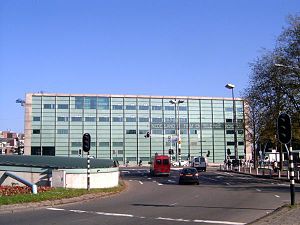
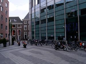
Netherlands Film Academy
Distance: Approx. 60 meters
Latitude and longitude: 52.36833333,4.90472222
The Netherlands Film Academy (Dutch: Nederlandse Filmacademie) (NFA) was founded in 1958. The academy is the only recognised institute in the Netherlands that offers training to prepare for the work in the various crew disciplines. Specialisation is possible in fiction directing, documentary directing, screenwriting, editing, producing, sounddesign, cinematography, production design, and interactive multimedia/visual effects.
Markenplein
Distance: Approx. 108 meters
Latitude and longitude: 52.3686,4.9053
Markenplein (Marken Square) is the name of a square in the centre of Amsterdam. Until 1970, it was called het oude Markenpleintje and before World War II it used to be a part of the Jewish district of Amsterdam. The name Markenplein symbolizes the bond between the new neighborhood and the old Jewish neighborhood.

Waterlooplein
Square in Amsterdam, Netherlands
Distance: Approx. 150 meters
Latitude and longitude: 52.36833333,4.90166667
Waterlooplein (Waterloo Square) is a square in the centre of Amsterdam in the Netherlands. The square near the Amstel river is named after the Battle of Waterloo in 1815. Prominent buildings on the square are the Stopera city hall and opera building and the Mozes en Aäronkerk church.

Portuguese Synagogue (Amsterdam)
Orthodox synagogue in Amsterdam, Netherlands
Distance: Approx. 130 meters
Latitude and longitude: 52.3675,4.9054
The Portuguese Synagogue, also known as the Esnoga, or Snoge, is an Orthodox Jewish congregation and synagogue, located at Mr. Visserplein 3 in Central Amsterdam, Amsterdam, in the North Holland region of The Netherlands. The synagogue was completed in 1675.

Jodenbreestraat
Street in Amsterdam
Distance: Approx. 121 meters
Latitude and longitude: 52.36916667,4.90305556
The Jodenbreestraat ("Jewish Broad Street") is a street in the centre of Amsterdam, which connects the Sint Antoniesluis sluice gates to the Mr. Visserplein traffic circle. North of the sluice gates, the street continues on to Nieuwmarkt square as the Sint Antoniesbreestraat.

Joods Historisch Museum
History museum in Amsterdam, Netherlands
Distance: Approx. 140 meters
Latitude and longitude: 52.36694444,4.90402778
The Joods Museum (Dutch pronunciation: [ˌjoːts ɦɪsˈtoːris myˈzeːjʏm]; English: Jewish Museum), part of the Jewish Cultural Quarter, is a museum in Amsterdam dedicated to Jewish history, culture and religion, in the Netherlands and worldwide. It is the only museum in the Netherlands dedicated to Jewish history.
Jodenbuurt
Neighborhood of Amsterdam in North Holland, Netherlands
Distance: Approx. 142 meters
Latitude and longitude: 52.36916667,4.9025
The Jodenbuurt (Dutch: Jewish neighbourhood) is a neighbourhood of Amsterdam, Netherlands. For centuries before World War II, it was the center of the Dutch Jews of Amsterdam — hence, its name (literally Jewish quarter). It is best known as the birthplace of Baruch Spinoza, the home of Rembrandt, and the Jewish ghetto of Nazi occupation of the Netherlands.

290 Square Meters
Retail shop in Amsterdam, Netherlands
Distance: Approx. 125 meters
Latitude and longitude: 52.36880556,4.90230556
290 Square Meters was a retail shop in Amsterdam, Netherlands. It offered men's and women's fashion as well as limited edition books, jewelry and scents. 290 Square Meters was best known for being the only retail location in the world where one could buy customized NikeID shoes for a number of years.

Mozes en Aäronkerk
Distance: Approx. 57 meters
Latitude and longitude: 52.36805556,4.90305556
The Moses and Aaron Church (Dutch: Mozes en Aäronkerk, pronounced [ˌmoːzəs ɛn aːˈʔaːrəŋkɛr(ə)k]), in the Waterlooplein neighborhood of Amsterdam, is officially the Roman Catholic Church of St. Anthony of Padua (Dutch: Sint-Anthoniuskerk). Originally a clandestine church, it was operated by Franciscan priests at a house on Jodenbreestraat ["Jewish Broad Street"], where the wall tablets of Moses and Aaron hung on the wall.

Maupoleum
Distance: Approx. 136 meters
Latitude and longitude: 52.36926111,4.90286667
The Maupoleum (1971–1994) was a building on Amsterdam's Jodenbreestraat. Built in 1971, it acquired a reputation for being unattractive before being demolished in 1994.

Leprozengracht
Canal in Amsterdam
Distance: Approx. 142 meters
Latitude and longitude: 52.36734,4.902323
The Leprozengracht was a canal in Amsterdam that defined one side of the Vlooienburg island. Leprozengracht and the connected Houtgracht canal were filled in 1882 to form the Waterlooplein.
Houtgracht
Canal in Amsterdam
Distance: Approx. 134 meters
Latitude and longitude: 52.368391,4.90191
The Houtgracht (Dutch pronunciation: [ˈɦʌutˌxrɑxt]; Wood Canal) was a canal in Amsterdam that defined one side of Vlooienburg island. Houtgracht and the connected Leprozengracht canal were filled in 1882 to form the Waterlooplein.
Weather in this IP's area
few clouds
21 Celsius
21 Celsius
20 Celsius
22 Celsius
1006 hPa
63 %
1006 hPa
1005 hPa
10000 meters
5.66 m/s
180 degree
20 %
07:03:45
20:12:33