89.34.174.176 - IP Lookup: Free IP Address Lookup, Postal Code Lookup, IP Location Lookup, IP ASN, Public IP
Country:
Region:
City:
Location:
Time Zone:
Postal Code:
IP information under different IP Channel
ip-api
Country
Region
City
ASN
Time Zone
ISP
Blacklist
Proxy
Latitude
Longitude
Postal
Route
Luminati
Country
ASN
Time Zone
Europe/Bucharest
ISP
Prime Telecom srl
Latitude
Longitude
Postal
IPinfo
Country
Region
City
ASN
Time Zone
ISP
Blacklist
Proxy
Latitude
Longitude
Postal
Route
IP2Location
89.34.174.176Country
Region
arges
City
campulung
Time Zone
Europe/Bucharest
ISP
Language
User-Agent
Latitude
Longitude
Postal
db-ip
Country
Region
City
ASN
Time Zone
ISP
Blacklist
Proxy
Latitude
Longitude
Postal
Route
ipdata
Country
Region
City
ASN
Time Zone
ISP
Blacklist
Proxy
Latitude
Longitude
Postal
Route
Popular places and events near this IP address

Câmpulung
Municipality in Argeș County, Romania
Distance: Approx. 307 meters
Latitude and longitude: 45.26777778,25.04638889
Câmpulung (also spelled Cîmpulung, Romanian pronunciation: [kɨmpuˈluŋɡ], German: Langenau, Old Romanian Dlăgopole, Длъгополе (from Middle Bulgarian), or Câmpulung Muscel) is a city in Argeș County, Muntenia, Romania. It is situated among the outlying hills of the Southern Carpathians, at the head of a long well-wooded glen traversed by the river Târgului, a tributary of the river Argeș.

Albeștii de Muscel
Commune in Argeș, Romania
Distance: Approx. 6802 meters
Latitude and longitude: 45.31666667,25
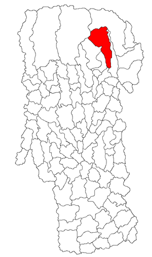
Albeștii de Muscel is a commune in Argeș County, Muntenia, Romania. It is composed of two villages, Albești (the commune centre) and Cândești. It also included Bughea de Sus village, the former commune centre, until 2004, when it was split off to form Bughea de Sus Commune.
Râușor (Bratia)
River in Argeș County, Romania
Distance: Approx. 9021 meters
Latitude and longitude: 45.2647,24.9349
The Râușor is a right tributary of the river Bratia in Romania. It flows into the Bratia in the village Gămăcești. Its length is 19 km (12 mi) and its basin size is 61 km2 (24 sq mi).

Bughea de Jos
Commune in Argeș, Romania
Distance: Approx. 4809 meters
Latitude and longitude: 45.28,24.9916
Bughea de Jos is a commune in Argeș County, Muntenia, Romania. It is composed of a single village, Bughea de Jos. The commune is situated on the banks of the river Bughea.

Godeni
Commune in Argeș, Romania
Distance: Approx. 7161 meters
Latitude and longitude: 45.22444444,24.98111111
Godeni is a commune in Argeș County, Muntenia, Romania. It is composed of five villages: Bordeieni, Capu Piscului, Cotești, Godeni, and Malu. The commune is situated in the southern foothills of the Făgăraș Mountains, at an altitude of 528 m (1,732 ft), on the banks of the river Bughea.

Lerești
Commune in Argeș, Romania
Distance: Approx. 7532 meters
Latitude and longitude: 45.33333333,25.06666667
Lerești is a commune in Argeș County, Muntenia, Romania. It is composed of three villages: Lerești, Pojorâta and Voinești.

Mioarele
Commune in Argeș, Romania
Distance: Approx. 3789 meters
Latitude and longitude: 45.23722222,25.07416667
Mioarele, formerly known as Mățău, is a commune in Argeș County, Muntenia, Romania. Located 4 kilometers southeast of Câmpulung, on the way to Târgoviște, it touches both the Argeș River valley and the banks of its Argeșel tributary. It is composed of five villages: Mățău (the commune center), with Chilii and Cocenești, as one cluster; Suslănești, the oldest surviving village, is located farther to the east, alongside Aluniș.

Stoenești, Argeș
Commune in Argeș, Romania
Distance: Approx. 9329 meters
Latitude and longitude: 45.25,25.16666667
Stoenești is a commune in Argeș County, Muntenia, Romania. It is composed of seven villages: Bădeni, Cotenești, Lunca Gârtii, Piatra, Slobozia, Stoenești, and Valea Bădenilor. The commune lies in the foothills of the Southern Carpathians, on the banks of the Dâmbovița River.

Valea Mare-Pravăț
Commune in Argeș, Romania
Distance: Approx. 3201 meters
Latitude and longitude: 45.28333333,25.08333333
Valea Mare-Pravăț is a commune in Argeș County, Muntenia, Romania. It is composed of eight villages: Bilcești, Colnic, Fântânea, Gura Pravăț, Nămăești, Pietroasa, Șelari, and Valea Mare-Pravăț. The commune is located in the northeastern part of the county, right next to the city of Câmpulung, and 58 km (36 mi) from the county seat, Pitești.

Jidava (castra)
Distance: Approx. 5900 meters
Latitude and longitude: 45.22074722,25.01248611
Jidava (or Jidova) was a fort (also called Campulung Muscel fort) in the Roman province of Dacia 4 km southwest of the town of Campulung, Romania. It was built around 190–211 AD as part of the frontier system of the Limes Transalutanus located approximately 20 km south of the Rucăr-Bran pass. It has been excavated and can be seen today.

Dinicu Golescu National College
School in Câmpulung, Argeș County, Romania
Distance: Approx. 784 meters
Latitude and longitude: 45.2645,25.04048889
Dinicu Golescu National College (Romanian: Colegiul Național Dinicu Golescu) is a high school located at 66 Negru Vodă Street, Câmpulung, Romania. When it opened in September 1894, the school was the first secondary institution in Câmpulung. From that point until 1917, it operated as a science and humanities gymnasium, producing 380 graduates over the years.
Mausoleum of Mateiaș
Monument in Romania
Distance: Approx. 7548 meters
Latitude and longitude: 45.29214,25.13932
Heroes' Mausoleum, in the commune of Valea Mare-Pravăț, Argeș County, Romania, also known as the Mausoleum of Mateiaș, is a historic monument dedicated to the heroes of the war of 1916–1918, considered by Romanians as the War for National Integration. It is located on the European Route E574 (DN 73), 11 km from Câmpulung towards Brașov, on Mateiaș Hill. The monument is listed at position no.
Weather in this IP's area
broken clouds
1 Celsius
-1 Celsius
1 Celsius
1 Celsius
1035 hPa
62 %
1035 hPa
961 hPa
10000 meters
1.71 m/s
2.03 m/s
15 degree
57 %
