Country:
Region:
City:
Latitude and Longitude:
Time Zone:
Postal Code:
IP information under different IP Channel
ip-api
Country
Region
City
ASN
Time Zone
ISP
Blacklist
Proxy
Latitude
Longitude
Postal
Route
Luminati
Country
Region
vc
City
hondondelasnieves
ASN
Time Zone
Europe/Madrid
ISP
Cable Aireworld S.A.U.
Latitude
Longitude
Postal
IPinfo
Country
Region
City
ASN
Time Zone
ISP
Blacklist
Proxy
Latitude
Longitude
Postal
Route
db-ip
Country
Region
City
ASN
Time Zone
ISP
Blacklist
Proxy
Latitude
Longitude
Postal
Route
ipdata
Country
Region
City
ASN
Time Zone
ISP
Blacklist
Proxy
Latitude
Longitude
Postal
Route
Popular places and events near this IP address
Crevillent
Municipality in Valencian Community, Spain
Distance: Approx. 7848 meters
Latitude and longitude: 38.24861111,-0.80888889
Crevillent (Valencian: [kɾeviˈʎent]; Spanish: Crevillente [kɾeβiˈʎente]) is a town and municipality located in the Alicante province, part of the Valencian Community, Spain. It is situated in the comarca of Baix Vinalopó, and lies at the foot of the hill range known locally as Serra de Crevillent. As of 2009, it has a total population of 28,609 inhabitants.
Aspe
Town in Valencian community, Spain
Distance: Approx. 9000 meters
Latitude and longitude: 38.34555556,-0.76888889
Aspe (Spanish pronunciation: [ˈaspe], Valencian: Asp) is a town and municipality located in the comarca of Vinalopó Mitjà, in the province of Alicante, Spain. The town is located in the valley of the river Vinalopó, 25 km (16 mi) from Alicante city. The economy of Aspe is based on textile and footwear industries, as well as farming of vegetables and fruits.
Don Francisco Mira Cánovas Dam
Distance: Approx. 3622 meters
Latitude and longitude: 38.28381,-0.88861
Francisco Mira Dam is a reservoir in the Valencian Community, Spain.
Serra de Crevillent
Mountain range in southern Spain
Distance: Approx. 2727 meters
Latitude and longitude: 38.28361111,-0.84972222
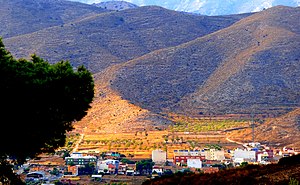
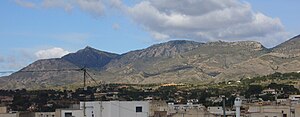
The Serra de Crevillent (Spanish: Sierra de Crevillente) is a mountain range in the Baetic System, southern Spain. It spans the region of Murcia and the province of Alicante. The highest peak is Sant Gaietà at 835 meters, near the town of Crevillent.

Hondón de los Frailes
Municipality and village in Spain
Distance: Approx. 6715 meters
Latitude and longitude: 38.26666667,-0.91666667
Hondón de los Frailes (Valencian: El Fondó dels Frares) is a municipality and village in the province of Alicante and autonomous community of Valencia, Spain. The municipality covers an area of 12.6 square kilometres (4.9 sq mi) and as of 2018 had a population of 1132 people.

Els Pontets
Aqueduct in Crevillent, Spain
Distance: Approx. 5570 meters
Latitude and longitude: 38.26468,-0.82518
Els Pontets is a Spanish aqueduct located in the municipality of Crevillent, Alicante. The aqueduct is part of the qanat that supplied water during the Al-Andalus era to the population from the Sierra de Crevillente. The infrastructure of the aqueduct dates back to the 13th century, although the stone arches only date back to the early 20th century.
Weather in this IP's area
overcast clouds
16 Celsius
15 Celsius
15 Celsius
17 Celsius
1020 hPa
79 %
1020 hPa
977 hPa
10000 meters
4.32 m/s
6.84 m/s
58 degree
100 %
07:45:13
17:51:11


