Country:
Region:
City:
Latitude and Longitude:
Time Zone:
Postal Code:
IP information under different IP Channel
ip-api
Country
Region
City
ASN
Time Zone
ISP
Blacklist
Proxy
Latitude
Longitude
Postal
Route
Luminati
Country
Region
cm
City
montealegredelcastillo
ASN
Time Zone
Europe/Madrid
ISP
Spotting Brands Technologies S.L.
Latitude
Longitude
Postal
IPinfo
Country
Region
City
ASN
Time Zone
ISP
Blacklist
Proxy
Latitude
Longitude
Postal
Route
db-ip
Country
Region
City
ASN
Time Zone
ISP
Blacklist
Proxy
Latitude
Longitude
Postal
Route
ipdata
Country
Region
City
ASN
Time Zone
ISP
Blacklist
Proxy
Latitude
Longitude
Postal
Route
Popular places and events near this IP address

Montealegre del Castillo
Distance: Approx. 1044 meters
Latitude and longitude: 38.78333333,-1.31666667
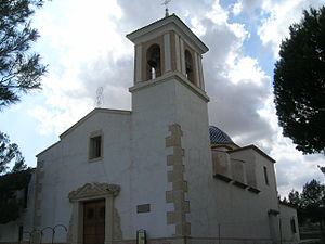
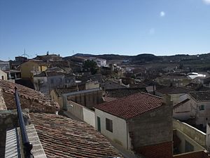
Montealegre del Castillo, (named simply Montealegre before 1916), is a municipality in Albacete, Castile-La Mancha, Spain. It has a population of 2,122 (2015).
Bonete
Municipality in Castile-La Mancha, Spain
Distance: Approx. 9229 meters
Latitude and longitude: 38.86992,-1.35377
Bonete is a municipality in Albacete, Castilla-La Mancha, Spain. It has 1057 inhabitants (2018) and is located at a distance of 54 km (34 mi) from Albacete.

Jumilla (DO)
Distance: Approx. 1044 meters
Latitude and longitude: 38.78333333,-1.31666667
Jumilla is a Spanish Denominación de Origen Protegida (DOP) for wines that extends over the north of the region of Murcia, Spain. The area includes the municipality of Jumilla, from which it takes its name, and the contiguous southeast of the Albacete province (municipalities of Montealegre del Castillo, Fuente-Álamo, Ontur, Hellin, Albatana and Tobarra) in the Castile-La Mancha region. It is one of Spain's leading wine regions.
Cerro de los Santos
Distance: Approx. 7950 meters
Latitude and longitude: 38.73334722,-1.26939444
Cerro de los Santos is an Iberian religious sanctuary built in the 4th century BCE, during the Iberian period, with evidence of continued use into the Roman period. The site lies in southeastern Spain near an ancient road. Little remains of the original structures at the site.
Weather in this IP's area
overcast clouds
12 Celsius
12 Celsius
11 Celsius
12 Celsius
1022 hPa
95 %
1022 hPa
928 hPa
466 meters
6.71 m/s
9.51 m/s
80 degree
100 %
07:48:09
17:51:59

