Country:
 Norway
Region:
City:
Latitude and Longitude:
Time Zone:
Postal Code:
IP information under different IP Channel
ip-api
Country
Region
City
ASN
Time Zone
ISP
Blacklist
Proxy
Latitude
Longitude
Postal
Route
IPinfo
Country
Region
City
ASN
Time Zone
ISP
Blacklist
Proxy
Latitude
Longitude
Postal
Route
MaxMind
Country
Region
City
ASN
Time Zone
ISP
Blacklist
Proxy
Latitude
Longitude
Postal
Route
Luminati
Country
NOASN
Time Zone
Europe/Oslo
ISP
Orange Business Digital Norway As
Latitude
Longitude
Postal
db-ip
Country
Region
City
ASN
Time Zone
ISP
Blacklist
Proxy
Latitude
Longitude
Postal
Route
ipdata
Country
Region
City
ASN
Time Zone
ISP
Blacklist
Proxy
Latitude
Longitude
Postal
Route
Popular places and events near this IP address

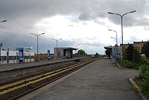
Kalbakken (station)
Oslo metro station
Distance: Approx. 1183 meters
Latitude and longitude: 59.95388889,10.86666667
Kalbakken is the station on Grorud Line of the Oslo Metro between Rødtvet and Ammerud. It is located in the Grorud borough. Kalbakken is part of the original stretch of the Grorud Line opened 16 October 1966.
Veitvet (station)
Oslo metro station
Distance: Approx. 1239 meters
Latitude and longitude: 59.94444444,10.84638889
Veitvet is a station on Grorud Line (Line 5) on the Oslo Metro. It is located at Veitvet between Linderud and Rødtvet, 8.4 kilometers (5.2 mi) from Stortinget. It was opened on 16 October 1966.

Rødtvet (station)
Oslo metro station
Distance: Approx. 1057 meters
Latitude and longitude: 59.95083333,10.85694444
Rødtvet is a station on Grorud Line (Lines 4 and 5) of the Oslo Metro. The station is located in north-central Groruddalen, between the stations of Veitvet and Kalbakken, 9.5 kilometers (5.9 mi) from Stortinget. The station was opened 10 October 1966 as part of the original stretch of the Grorud Line.

Rødtvet
Distance: Approx. 1134 meters
Latitude and longitude: 59.9516,10.8567
Rødtvet is a residential area in the district of Grorud in Oslo, located just southwest of Grorud proper. The area was urbanized from the mid 1960s, and connected to the city centre with metro line 5 from 1966. Rødtvet has the forest Lillomarka as a neighbor to the north, and the residential areas Bredtvet, Kalbakken, Flaen and Nordtvet as its closest neighbors to the south.
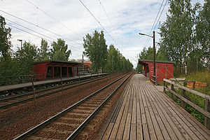
Nyland Station
Distance: Approx. 311 meters
Latitude and longitude: 59.9443,10.8737
Nyland Station (Norwegian: Nyland holdeplass) is a railway station on the Trunk Line located in the Grorud borough of Oslo, Norway. Situated 9.30 kilometers (5.78 mi) from Oslo Central Station, it consists of two wooden side platforms along a double-tracked line. Nyland is served by the L1 line of the Oslo Commuter Rail.

Trosterud
Distance: Approx. 1114 meters
Latitude and longitude: 59.93333333,10.86666667
Trosterud is a neighborhood in Alna borough in Oslo, Norway. The place is named after Trosterud farm. The farm is preserved and is located in Dr.

Bredtveit Prison
Norwegian prison
Distance: Approx. 811 meters
Latitude and longitude: 59.94888889,10.85916667
Bredtveit Prison (formally Bredtveit Prison Service, Custody and Supervision Unit, Norwegian: Bredtveit fengsel, forvarings- og sikringsanstalt) is a prison located in the neighborhood of Bredtvet in Oslo, Norway. During World War II it was a concentration camp.

Bredtvet
Distance: Approx. 721 meters
Latitude and longitude: 59.94805556,10.85972222
Bredtvet is a neighborhood in the borough of Bjerke in Oslo, Norway. The area is located on a ridge between the neighborhoods of Veitvet to the west and Kalbakken to the east. Its origin was as a farm of the same name.

Norwegian National Road 163
Distance: Approx. 384 meters
Latitude and longitude: 59.9416,10.8625
Riksvei 163 (Rv163) runs between Skogskrysset in Lørenskog and Økern in Oslo. The road is 11 km, of which 1.2 km are in Akershus and 9.8 km in Oslo. The road consists of Østre Aker vei (Oslo) and Lørenskogveien (Lørenskog).

Furuset kulturpark
Park in Oslo, Norway
Distance: Approx. 1170 meters
Latitude and longitude: 59.94280306,10.88946806
Furuset kulturpark is a park in the neighborhood of Furuset in Oslo, Norway. It opened in May 2009 at a cost of NOK 5.6 million. The 15.2 acre park is operated by the municipality and is used for recreational purposes, with a pedestrian and bicycle paths and a recreational area.

Veitvet
Neighborhood in Oslo, Norway
Distance: Approx. 1273 meters
Latitude and longitude: 59.95,10.85
Veitvet is a neighborhood in the Bjerke borough of Oslo, Norway. The area borders to Linderud, Tonsenhagen and Bredtvet. Veitvet senter is located in the neighborhood which was Norway's first shopping mall and was Scandinavia's largest when it opened in 1958.

Furuset Church (Oslo)
Church in Oslo, Norway
Distance: Approx. 1164 meters
Latitude and longitude: 59.94212889,10.88924306
Furuset Church is a church that was consecrated in 1980. The church is located in the neighborhood of Furuset in Oslo, Norway. In the same area was a church in the Middle Ages, from which keys of iron were found, are preserved and placed in the present church.
Weather in this IP's area
overcast clouds
10 Celsius
10 Celsius
9 Celsius
11 Celsius
1016 hPa
98 %
1016 hPa
1001 hPa
165 meters
1.15 m/s
3.47 m/s
122 degree
100 %
08:06:06
17:56:27