Country:
 Netherlands
Region:
City:
Latitude and Longitude:
Time Zone:
Postal Code:
IP information under different IP Channel
ip-api
Country
Region
City
ASN
Time Zone
ISP
Blacklist
Proxy
Latitude
Longitude
Postal
Route
IPinfo
Country
Region
City
ASN
Time Zone
ISP
Blacklist
Proxy
Latitude
Longitude
Postal
Route
MaxMind
Country
Region
City
ASN
Time Zone
ISP
Blacklist
Proxy
Latitude
Longitude
Postal
Route
Luminati
Country
NLRegion
ut
City
utrecht
ASN
Time Zone
Europe/Amsterdam
ISP
IP Volume inc
Latitude
Longitude
Postal
db-ip
Country
Region
City
ASN
Time Zone
ISP
Blacklist
Proxy
Latitude
Longitude
Postal
Route
ipdata
Country
Region
City
ASN
Time Zone
ISP
Blacklist
Proxy
Latitude
Longitude
Postal
Route
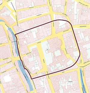
Popular places and events near this IP address
Utrecht
City and municipality in Utrecht, Netherlands
Distance: Approx. 383 meters
Latitude and longitude: 52.09083333,5.12166667
Utrecht ( YOO-trekt, Dutch: [ˈytrɛxt] ; Utrecht dialect: Ut(e)reg [ˈyt(ə)ʁɛχ]) is the fourth-largest city of the Netherlands, as well as the capital and the most populous city of the province of Utrecht. The municipality of Utrecht is located in the eastern part of the Randstad conurbation, in the very centre of mainland Netherlands, and includes Haarzuilens, Vleuten and De Meern. It has a population of 361,699 as of December 2021.

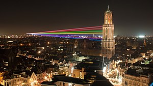
Dom Tower of Utrecht
Bell tower in Utrecht, Netherlands
Distance: Approx. 408 meters
Latitude and longitude: 52.09065,5.1214
The Dom Tower (Dutch: Domtoren 'Cathedral Tower') of Utrecht is the tallest church tower in the Netherlands, at 112.32 metres (368,5 feet) in height. It is considered the symbol of Utrecht. The tower was part of St.

St. Martin's Cathedral, Utrecht
Church dedicated to Saint Martin of Tours
Distance: Approx. 383 meters
Latitude and longitude: 52.09083333,5.12166667
St. Martin's Cathedral, Utrecht, or Dom Church (Dutch: Domkerk), is a Gothic church dedicated to Saint Martin of Tours, which was the cathedral of the Diocese of Utrecht during the Middle Ages. It is the country's only pre-Reformation cathedral, but has been a Protestant church since 1580.
University of Humanistic Studies
Distance: Approx. 97 meters
Latitude and longitude: 52.09169722,5.12563611
The University of Humanistic Studies (Dutch: Universiteit voor Humanistiek (UvH)) is a university in Utrecht, The Netherlands. It is the youngest university in the Netherlands and houses about 530 students. It is also the only university offering a degree programme in humanistic studies.

Museum Speelklok
Museum in Utrecht, Netherlands
Distance: Approx. 553 meters
Latitude and longitude: 52.09055556,5.11916667
Museum Speelklok (previously known as Museum van Speeldoos tot Pierement) is a museum in Utrecht, Netherlands, specializing in self-playing musical instruments. Since 1984, it has been housed in the centre of Utrecht in a former church called Buurkerk. Among the instruments on display are music boxes, musical clocks, pianolas, barrel organs (including the typically Dutch large street organs) and a turret clock with a carillon, most of which are still able to play for visitors.
St. Peter's Church, Utrecht
Distance: Approx. 185 meters
Latitude and longitude: 52.09138889,5.12444444
St. Peter's Church (Dutch: Pieterskerk) is a Reformed and former Roman Catholic church in the city of Utrecht in the Netherlands, dedicated to Peter the Apostle. It is one of the city's oldest churches.

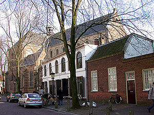
Buurkerk
Distance: Approx. 553 meters
Latitude and longitude: 52.09055556,5.11916667
The Buurkerk is a former church building in Utrecht (city), Netherlands on the Buurkerkhof. The building is the location of the Museum Speelklok, and the entrance is on the Steenweg. It is one of the medieval parish churches of Utrecht, along with the Jacobikerk, the Nicolaïkerk and the Geertekerk.
Traiectum (Utrecht)
Former Roman fort in The Netherlands
Distance: Approx. 391 meters
Latitude and longitude: 52.090692,5.121642
Traiectum was a Roman fort, on the frontier of the Roman Empire in Germania Inferior. The remains of the fort are in the center of Utrecht, Netherlands, which takes its name from the fort.

Begijnhof, Utrecht
Inner court in Utrecht, Netherlands
Distance: Approx. 530 meters
Latitude and longitude: 52.095775,5.12168889
The Begijnhof, Utrecht, was a beguinage (Dutch: Begijnhof) in the Dutch city of Utrecht.
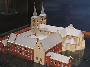
St. Paul's Abbey, Utrecht
Monastery in Utrecht, Netherlands
Distance: Approx. 419 meters
Latitude and longitude: 52.0892,5.1231
St. Paul's Abbey was a monastery in Utrecht in the Netherlands. In 1580 it was the second oldest monastery in the Netherlands, second only to Egmond Abbey in the north.
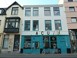
ACU (Utrecht)
Self-managed social centre in Utrecht
Distance: Approx. 458 meters
Latitude and longitude: 52.095,5.1219
ACU is a political-cultural venue in the city centre of Utrecht, in the Netherlands. The name ACU is derived from "Auto Centrale Utrecht" (Car Centre Utrecht) and is one of the many signs of its origin as an old squat. Nowadays it is still run by volunteers as an infoshop and social centre in order to keep it an independent and non-profit harbour within Utrecht's nightlife.
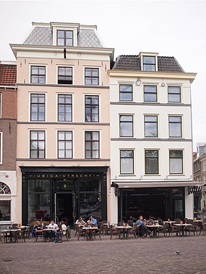
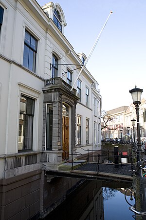
Ubica
Hotel and former squat in Utrecht
Distance: Approx. 480 meters
Latitude and longitude: 52.092494,5.119803
The Ubica buildings are two adjacent buildings standing at 24 and 26 Ganzenmarkt, in central Utrecht, the Netherlands. Number 24 is a rijksmonument. The first recorded mention of the buildings is from 1319.
Weather in this IP's area
overcast clouds
14 Celsius
14 Celsius
13 Celsius
15 Celsius
1018 hPa
91 %
1018 hPa
1017 hPa
10000 meters
0.45 m/s
2.24 m/s
180 degree
96 %
08:13:25
18:34:43