89.234.186.197 - IP Lookup: Free IP Address Lookup, Postal Code Lookup, IP Location Lookup, IP ASN, Public IP
Country:
Region:
City:
Location:
Time Zone:
Postal Code:
ISP:
ASN:
language:
User-Agent:
Proxy IP:
Blacklist:
IP information under different IP Channel
ip-api
Country
Region
City
ASN
Time Zone
ISP
Blacklist
Proxy
Latitude
Longitude
Postal
Route
db-ip
Country
Region
City
ASN
Time Zone
ISP
Blacklist
Proxy
Latitude
Longitude
Postal
Route
IPinfo
Country
Region
City
ASN
Time Zone
ISP
Blacklist
Proxy
Latitude
Longitude
Postal
Route
IP2Location
89.234.186.197Country
Region
bretagne
City
gael
Time Zone
Europe/Paris
ISP
Language
User-Agent
Latitude
Longitude
Postal
ipdata
Country
Region
City
ASN
Time Zone
ISP
Blacklist
Proxy
Latitude
Longitude
Postal
Route
Popular places and events near this IP address

Saint-Méen-le-Grand
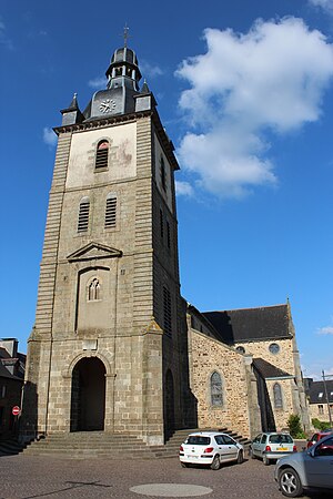
Commune in Brittany, France
Distance: Approx. 6895 meters
Latitude and longitude: 48.19,-2.1897
Saint-Méen-le-Grand (French pronunciation: [sɛ̃ mɛ̃ lə ɡʁɑ̃]; Breton: Sant-Meven; Gallo: Saent-Men) is a commune in the Ille-et-Vilaine department in Brittany in northwestern France. It is located west of Rennes between Montauban-de-Bretagne and Gaël. The town was the birthplace of the 3-time Tour de France winner Louison Bobet.
Canton of Saint-Méen-le-Grand
Former canton in Brittany, France
Distance: Approx. 6387 meters
Latitude and longitude: 48.15888889,-2.14666667
The Canton of Saint-Méen-le-Grand is a former canton of France, in the Ille-et-Vilaine département, located southwest of Rennes. It had 11,135 inhabitants (2012). It was disbanded following the French canton reorganisation which came into effect in March 2015.

Gaël
Commune in Brittany, France
Distance: Approx. 229 meters
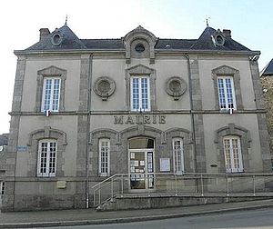
Latitude and longitude: 48.1331,-2.22
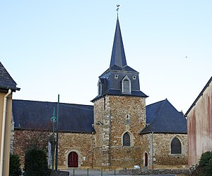
Gaël (Gallo: Gaèu, Breton: Gwazel) is a commune in the Ille-et-Vilaine department in Brittany in northwestern France. It lies southwest of Rennes between Saint-Méen-le-Grand and Mauron. In the 18th century, a fair was held twice a year in August and October.

Château de Comper
Castle in Brittany, France
Distance: Approx. 7829 meters
Latitude and longitude: 48.070136,-2.172879
The Château de Comper is a former castle located in Paimpont forest (formerly known as Brocéliande), three kilometers to the east of the village of Concoret in the department of Morbihan in the region of Brittany, France. It has been rebuilt as a château. The name Comper, like Quimper, probably comes from the Breton word kemper, which means confluence.

Concoret
Commune in Brittany, France
Distance: Approx. 7585 meters
Latitude and longitude: 48.065,-2.205
Concoret (Konkored in Breton) is a commune in the Morbihan department of Brittany in north-western France.
Mauron
Commune in Brittany, France
Distance: Approx. 7141 meters
Latitude and longitude: 48.0831,-2.2847
Mauron (French pronunciation: [moʁɔ̃]; Breton: Maoron) is a commune in the Morbihan department and Brittany region of north-western France. It lies close to the borders of both Côtes d'Armor and Ille-et-Vilaine. Mauron's location make it a crossroads on the routes connecting Dinan to Vannes and Quimper to Rennes.

Bléruais
Commune in Brittany, France
Distance: Approx. 7721 meters
Latitude and longitude: 48.1119,-2.1233
Bléruais (French pronunciation: [bleʁɥɛ]; Breton: Blerwaz; Gallo: Bleruaz) is a commune in the Ille-et-Vilaine department in Brittany in northwestern France.
Saint-Léry
Commune in Brittany, France
Distance: Approx. 5176 meters
Latitude and longitude: 48.0908,-2.2547
Saint-Léry (French pronunciation: [sɛ̃ leʁi]; Breton: Sant-Leri) is a commune in the Morbihan department of Brittany in north-western France. Inhabitants of Saint-Léry are called in French Saint-Léritins or Léritins.
Loscouët-sur-Meu
Commune in Brittany, France
Distance: Approx. 5348 meters
Latitude and longitude: 48.1786,-2.2408
Loscouët-sur-Meu (French pronunciation: [lɔskwɛt syʁ mø], literally Loscouët on Meu; Breton: Loskoed-ar-Mozon) is a commune in the Côtes-d'Armor department of Brittany in northwestern France.
Muel, Ille-et-Vilaine
Commune in Brittany, France
Distance: Approx. 4991 meters
Latitude and longitude: 48.1281,-2.1558
Muel (French pronunciation: [mɥɛl]; Breton: Moel; Gallo: Muèu) is a commune in the Ille-et-Vilaine department in Brittany in northwestern France.
Saint-Onen-la-Chapelle
Commune in Brittany, France
Distance: Approx. 6342 meters
Latitude and longitude: 48.1778,-2.1717
Saint-Onen-la-Chapelle (French pronunciation: [sɛ̃.t‿ɔnɛ̃ la ʃapɛl]; Breton: Santez-Onenn) is a commune in the Ille-et-Vilaine department in Brittany in northwestern France.
Abbey of St Méen
Distance: Approx. 6606 meters
Latitude and longitude: 48.18805556,-2.19305556
The Abbey of Saint-Méen otherwise the Abbey of Saint Jean de Gaël (French: Abbaye Saint-Jean de Gaël, later Abbaye de Saint-Méen) is a monastery in Saint-Méen-le-Grand in Brittany. It was founded in the 6th century by Saint Mewan (known in French as Méen), after whom it was eventually named. The original foundation had fallen into disuse by the end of the 8th century.
Weather in this IP's area
clear sky
4 Celsius
3 Celsius
4 Celsius
4 Celsius
1025 hPa
80 %
1025 hPa
1011 hPa
10000 meters
2.02 m/s
1.92 m/s
82 degree


