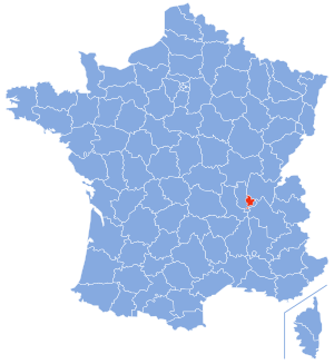
Country:
 France
Region:
City:
Latitude and Longitude:
Time Zone:
Postal Code:
IP information under different IP Channel
ip-api
Country
Region
City
ASN
Time Zone
ISP
Blacklist
Proxy
Latitude
Longitude
Postal
Route
IPinfo
Country
Region
City
ASN
Time Zone
ISP
Blacklist
Proxy
Latitude
Longitude
Postal
Route
MaxMind
Country
Region
City
ASN
Time Zone
ISP
Blacklist
Proxy
Latitude
Longitude
Postal
Route
Luminati
Country
FRASN
Time Zone
Europe/Paris
ISP
Association Grenode
Latitude
Longitude
Postal
db-ip
Country
Region
City
ASN
Time Zone
ISP
Blacklist
Proxy
Latitude
Longitude
Postal
Route
ipdata
Country
Region
City
ASN
Time Zone
ISP
Blacklist
Proxy
Latitude
Longitude
Postal
Route
Popular places and events near this IP address

Urban Community of Lyon
Former communauté urbaine in Auvergne-Rhône-Alpes, France
Distance: Approx. 525 meters
Latitude and longitude: 45.7575,4.854
The Urban Community of Lyon (French: Communauté urbaine de Lyon), also known as Grand Lyon (i.e. "Greater Lyon") or by its former acronym COURLY, is the former intercommunal structure gathering the city of Lyon (France) and some of its suburbs. It was created in January 1969.

Battle of Lugdunum
Battle between Septimius Severus and Clodius Albinus (197)
Distance: Approx. 483 meters
Latitude and longitude: 45.76,4.85
The Battle of Lugdunum, also called the Battle of Lyon, was fought on 19 February 197 at Lugdunum (modern Lyon, France), between the armies of the Roman emperor Septimius Severus and of the Roman usurper Clodius Albinus. Severus' victory finally established him as the sole emperor of the Roman Empire following the Year of the Five Emperors and immediate aftermath. This battle is said to be the largest, most hard-fought, and bloodiest of all clashes between Roman forces.

Lyon
Third-largest city in France
Distance: Approx. 739 meters
Latitude and longitude: 45.76,4.84
Lyon is the second largest city in France and its third -largest city within city limits. It is located at the confluence of the rivers Rhône and Saône, to the northwest of the French Alps, 391 km (243 mi) southeast of Paris, 278 km (173 mi) north of Marseille, 113 km (70 mi) southwest of Geneva, Switzerland, 58 km (36 mi) northeast of Saint-Étienne. The City of Lyon had a population of 522,250 at the Jan.

Tour Part-Dieu
Skyscraper in Lyon, France
Distance: Approx. 736 meters
Latitude and longitude: 45.76111111,4.85361111
The Tour Part-Dieu (formerly Tour du Crédit Lyonnais, or colloquially Le Crayon, or The Pencil) is a skyscraper in Lyon, France. The building is 164.9 metres (541 ft) tall, in La Part-Dieu district, with 42 floors. The building was completed in 1977.

Siege of Lyon
Distance: Approx. 558 meters
Latitude and longitude: 45.758,4.841
The siege of Lyon occurred on 9 August to 9 October 1793 when French Republican forces laid siege and captured the city of Lyon, which was the centre of a revolt against the French government during the War of the First Coalition.

3rd arrondissement of Lyon
Municipal arrondissement in Auvergne-Rhône-Alpes, France
Distance: Approx. 703 meters
Latitude and longitude: 45.75861111,4.85583333
The 3rd arrondissement of Lyon (French: 3e arrondissement de Lyon) is one of the nine arrondissements of the City of Lyon.
France 3 Auvergne-Rhône-Alpes
Television channel
Distance: Approx. 731 meters
Latitude and longitude: 45.75833333,4.85638889
France 3 Rhône-Alpes Auvergne is one of France 3's regional services broadcasting to people in the Auvergne-Rhône-Alpes region. It was founded in 1954 as RTF Télé-Lyon. The service is headquartered in Lyon, the capital of the region.
Metropolis of Lyon
Territorial collectivity in Auvergne-Rhône-Alpes, France
Distance: Approx. 517 meters
Latitude and longitude: 45.7575,4.85388889
The Metropolis of Lyon (French: Métropole de Lyon, pronounced [metʁɔpɔl də ljɔ̃] ), also known as Grand Lyon ([ɡʁɑ̃ ljɔ̃], "Greater Lyon"), is a French territorial collectivity in the east-central region of Auvergne-Rhône-Alpes. It is a directly elected metropolitan authority encompassing the city of Lyon and most of its suburbs. It has jurisdiction as both a department and a metropolis, taking the territory out of the purview of the department of Rhône.

Berges du Rhône
Distance: Approx. 777 meters
Latitude and longitude: 45.754,4.838
The Berges du Rhône (Banks of the Rhône) or Quais du Rhône (Quays of the Rhône) refer to a series of parks, quays, streets and walking paths along the Rhône river in Lyon, France. The construction for the modern Berges du Rhône took place between 2005 and 2007, resulting in the development of 10 hectares of land on the left and right banks of the Rhône from Parc de la Tête d'Or to Parc de Gerland.

Bourse du Travail (Lyon)
Distance: Approx. 370 meters
Latitude and longitude: 45.7593,4.8482
The Bourse du Travail is a 1,950-capacity theatre located in Lyon, France.

Auditorium Maurice-Ravel
Concert Hall in Lyon, France
Distance: Approx. 742 meters
Latitude and longitude: 45.76161111,4.85275278
The Maurice Ravel Auditorium is a concert hall located in Part-Dieu, the 3rd district of Lyon. It was originally built for the National Orchestra of Lyon and is their residence hall. It is also one of the first buildings in France to be built with Prestressed concrete.

Tour Silex 2
Skyscrapers in Lyon, France
Distance: Approx. 723 meters
Latitude and longitude: 45.75829694,4.85629556
The Tour Silex 2 (Silex 2 Tower in English, usually presented in the form Silex²) is an office skyscraper which rises 23 levels in the district of La Part-Dieu in the 3rd arrondissement of Lyon, France. The tower rises 129 meters high. It is currently under construction and will be delivered in 2021.
Weather in this IP's area
mist
14 Celsius
14 Celsius
13 Celsius
14 Celsius
1012 hPa
98 %
1012 hPa
991 hPa
5000 meters
1.03 m/s
75 %
08:01:21
18:49:43