89.23.125.166 - IP Lookup: Free IP Address Lookup, Postal Code Lookup, IP Location Lookup, IP ASN, Public IP
Country:
Region:
City:
Location:
Time Zone:
Postal Code:
IP information under different IP Channel
ip-api
Country
Region
City
ASN
Time Zone
ISP
Blacklist
Proxy
Latitude
Longitude
Postal
Route
Luminati
Country
ASN
Time Zone
Europe/Prague
ISP
CMIS s.r.o.
Latitude
Longitude
Postal
IPinfo
Country
Region
City
ASN
Time Zone
ISP
Blacklist
Proxy
Latitude
Longitude
Postal
Route
IP2Location
89.23.125.166Country
Region
stredocesky kraj
City
zdiby
Time Zone
Europe/Prague
ISP
Language
User-Agent
Latitude
Longitude
Postal
db-ip
Country
Region
City
ASN
Time Zone
ISP
Blacklist
Proxy
Latitude
Longitude
Postal
Route
ipdata
Country
Region
City
ASN
Time Zone
ISP
Blacklist
Proxy
Latitude
Longitude
Postal
Route
Popular places and events near this IP address

Kobylisy Shooting Range
Site of Nazi war crimes in Czechia
Distance: Approx. 4132 meters
Latitude and longitude: 50.13166667,14.46305556
Kobylisy Shooting Range (Czech: Kobyliská střelnice) is a former military shooting range located in Kobylisy, a northern suburb of Prague, Czech Republic. The shooting range was established in 1889–1891, on a site that was at the time far outside the city, as a training facility for the Austro-Hungarian (and, later, Czechoslovak) army. During the Nazi occupation it was used for mass executions as part of retaliatory measures against the Czech people after the assassination of Reinhard Heydrich in 1942.

Líbeznice
Municipality in Central Bohemian, Czech Republic
Distance: Approx. 4031 meters
Latitude and longitude: 50.19194444,14.49361111
Líbeznice is a municipality and village in Prague-East District in the Central Bohemian Region of the Czech Republic. It has about 3,200 inhabitants.

Bořanovice
Municipality in Central Bohemian, Czech Republic
Distance: Approx. 2285 meters
Latitude and longitude: 50.17833333,14.47888889
Bořanovice is a municipality and village in Prague-East District in the Central Bohemian Region of the Czech Republic. It has about 1,000 inhabitants.

Bašť
Municipality in the Czech Republic
Distance: Approx. 4412 meters
Latitude and longitude: 50.20527778,14.47222222
Bašť is a municipality and village in Prague-East District in the Central Bohemian Region of the Czech Republic. It has about 3,100 inhabitants.

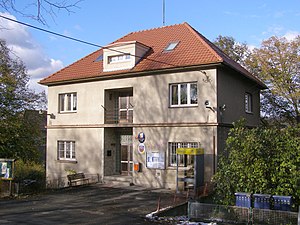
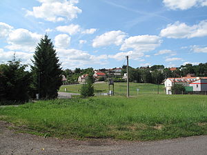
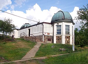
Zdiby
Municipality in Central Bohemian, Czech Republic
Distance: Approx. 15 meters
Latitude and longitude: 50.16805556,14.45138889
Zdiby is a municipality and village in Prague-East District in the Central Bohemian Region of the Czech Republic. It has about 4,000 inhabitants.

Sedlec (Prague-East District)
Municipality in Central Bohemian, Czech Republic
Distance: Approx. 2165 meters
Latitude and longitude: 50.18694444,14.45805556
Sedlec is a municipality and village in Prague-East District in the Central Bohemian Region of the Czech Republic. It has about 500 inhabitants.

Klecany
Town in Central Bohemian, Czech Republic
Distance: Approx. 2583 meters
Latitude and longitude: 50.175,14.41666667
Klecany is a town in Prague-East District in the Central Bohemian Region of the Czech Republic. It has about 3,900 inhabitants.

Dolní Chabry
Distance: Approx. 2006 meters
Latitude and longitude: 50.15,14.45
Dolní Chabry is a suburb of Prague in the Czech Republic. There are eight Menhirs located within this suburb, as well as a 12th-century Romanesque church.

Klíčany
Municipality in Central Bohemian, Czech Republic
Distance: Approx. 3992 meters
Latitude and longitude: 50.20222222,14.43444444
Klíčany is a municipality and village in Prague-East District in the Central Bohemian Region of the Czech Republic. It has about 600 inhabitants.

Březiněves
Neighborhood of Prague 8
Distance: Approx. 2422 meters
Latitude and longitude: 50.16583333,14.485
Březiněves is a municipal district (městská část) and cadastral area (katastrální území) in Prague. It is located in the northern part of the city. As of 2018, there were 1576 inhabitants living in Březiněves.

Ďáblice
Place in Czech Republic
Distance: Approx. 3295 meters
Latitude and longitude: 50.14861111,14.48611111
Ďáblice is a municipal district (městská část) and cadastral area (katastrální území) in Prague. It is located in the northern part of the city. As of 2021, there were 3,750 inhabitants living in Ďáblice.

Ďáblice Cemetery
Cemetery in Prague, Czech Republic
Distance: Approx. 4065 meters
Latitude and longitude: 50.13638889,14.47972222
Ďáblice cemetery (Czech: Ďáblický hřbitov) is a graveyard in Ďáblice municipal district, Prague. The entrance pavilions were designed by Vlastislav Hofman. The cemetery was opened in 1914 and over 20,000 registered graves are located here.
Weather in this IP's area
broken clouds
-0 Celsius
-6 Celsius
-1 Celsius
1 Celsius
1033 hPa
72 %
1033 hPa
1001 hPa
10000 meters
6.69 m/s
310 degree
75 %