89.22.208.21 - IP Lookup: Free IP Address Lookup, Postal Code Lookup, IP Location Lookup, IP ASN, Public IP
Country:
 Poland
Region:
City:
Location:
Time Zone:
Postal Code:
ISP:
ASN:
language:
User-Agent:
Proxy IP:
Blacklist:
IP information under different IP Channel
ip-api
Country
Region
City
ASN
Time Zone
ISP
Blacklist
Proxy
Latitude
Longitude
Postal
Route
db-ip
Country
Region
City
ASN
Time Zone
ISP
Blacklist
Proxy
Latitude
Longitude
Postal
Route
IPinfo
Country
Region
City
ASN
Time Zone
ISP
Blacklist
Proxy
Latitude
Longitude
Postal
Route
IP2Location
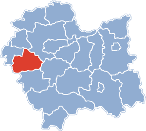
89.22.208.21Country
plRegion
malopolskie
City
jaroszowice
Time Zone
Europe/Warsaw
ISP
Language
User-Agent
Latitude
Longitude
Postal
ipdata
Country
Region
City
ASN
Time Zone
ISP
Blacklist
Proxy
Latitude
Longitude
Postal
Route
Popular places and events near this IP address

Wadowice
Place in Lesser Poland Voivodeship, Poland
Distance: Approx. 2693 meters
Latitude and longitude: 49.88333333,19.5
Wadowice (Polish: [vadɔˈvit͡sɛ] ; German: Frauenstadt – Wadowitz) is a town in southern Poland, 50 kilometres (31 miles) southwest of Kraków with 17,455 inhabitants (2022), situated on the Skawa river, confluence of Vistula, in the eastern part of Silesian Foothills (Pogórze Śląskie). Wadowice is known for being the birthplace of Karol Wojtyła, later Pope John Paul II and Godwin von Brumowski, Austria-Hungary’s best flying ace with 35 credited and an additional 8 possible wins in the air.
Wadowice County
County in Lesser Poland Voivodeship, Poland
Distance: Approx. 2693 meters
Latitude and longitude: 49.88333333,19.5
Wadowice County (Polish: powiat wadowicki) is a unit of territorial administration and local government (powiat) in Lesser Poland Voivodeship, southern Poland. It came into being on January 1, 1999, as a result of the Polish local government reforms passed in 1998. Its administrative seat is the town of Wadowice, the birthplace of Pope John Paul II, which lies 38 kilometres (24 mi) south-west of the regional capital Kraków.

Gmina Wadowice
Gmina in Lesser Poland Voivodeship, Poland
Distance: Approx. 2693 meters
Latitude and longitude: 49.88333333,19.5
Gmina Wadowice is an urban-rural gmina (administrative district) in Wadowice County, Lesser Poland Voivodeship, in southern Poland. Its seat is the town of Wadowice, which lies approximately 38 kilometres (24 mi) south-west of the regional capital Kraków. The gmina covers an area of 113 square kilometres (43.6 sq mi), and as of 2006 its total population is 37,481 (of which the population of Wadowice is 19,149, and the population of the rural part of the gmina is 18,332).

Barwałd Dolny
Village in Lesser Poland Voivodeship, Poland
Distance: Approx. 3406 meters
Latitude and longitude: 49.86666667,19.56666667
Barwałd Dolny (Polish pronunciation: [ˈbarvawd ˈdɔlnɨ]) is a village in the administrative district of Gmina Wadowice, within Wadowice County, Lesser Poland Voivodeship, in southern Poland. It lies approximately 6 kilometres (4 mi) east of Wadowice and 35 km (22 mi) south-west of the regional capital Kraków.
Gorzeń Dolny
Village in Lesser Poland Voivodeship, Poland
Distance: Approx. 1538 meters
Latitude and longitude: 49.86444444,19.49833333
Gorzeń Dolny [ˈɡɔʐɛɲ ˈdɔlnɨ] is a village in the administrative district of Gmina Wadowice, within Wadowice County, Lesser Poland Voivodeship, in southern Poland. It lies approximately 2 kilometres (1 mi) west of Wadowice and 39 km (24 mi) south-west of the regional capital Kraków. The village of Gorzeń was first mentioned in 1390 and was differentiated into two parts after the 16th century (since the 19th century known respectively as Gorzeń Dolny and Gorzeń Górny).

Gorzeń Górny
Village in Lesser Poland Voivodeship, Poland
Distance: Approx. 1689 meters
Latitude and longitude: 49.85583333,19.49861111
Gorzeń Górny [ˈɡɔʐɛɲ ˈɡurnɨ] is a village in the administrative district of Gmina Wadowice, within Wadowice County, Lesser Poland Voivodeship, in southern Poland. It lies approximately 3 kilometres (2 mi) south-west of Wadowice and 40 km (25 mi) south-west of the regional capital Kraków. The village of Gorzeń was first mentioned in 1390 and was differentiated into two parts after the 16th century.

Jaroszowice
Village in Lesser Poland Voivodeship, Poland
Distance: Approx. 1080 meters
Latitude and longitude: 49.86666667,19.53333333
Jaroszowice [jarɔʂɔˈvit͡sɛ] is a village in the administrative district of Gmina Wadowice, within Wadowice County, Lesser Poland Voivodeship in southern Poland. It is approximately 4 kilometres (2 mi) southeast of Wadowice and 37 km (23 mi) southwest of the regional capital Kraków.

Klecza Dolna
Village in Lesser Poland Voivodeship, Poland
Distance: Approx. 2252 meters
Latitude and longitude: 49.87083333,19.54833333
Klecza Dolna [ˈklɛt͡ʂa ˈdɔlna] is a village in the administrative district of Gmina Wadowice, within Wadowice County, Lesser Poland Voivodeship, in southern Poland. It lies approximately 4 kilometres (2 mi) east of Wadowice and 36 km (22 mi) south-west of the regional capital Kraków.

Klecza Górna
Village in Lesser Poland Voivodeship, Poland
Distance: Approx. 3406 meters
Latitude and longitude: 49.86666667,19.56666667
Klecza Górna [ˈklɛt͡ʂa ˈɡurna] is a village in the administrative district of Gmina Wadowice, within Wadowice County, Lesser Poland Voivodeship, in southern Poland. It lies approximately 6 kilometres (4 mi) east of Wadowice and 35 km (22 mi) south-west of the regional capital Kraków.
Ponikiew-Chobot
Village in Lesser Poland Voivodeship, Poland
Distance: Approx. 2609 meters
Latitude and longitude: 49.84,19.51055556
Ponikiew-Chobot [pɔˈnikʲɛf ˈxɔbɔt] is a village in the administrative district of Gmina Wadowice, within Wadowice County, Lesser Poland Voivodeship, in southern Poland.

Świnna Poręba
Village in Lesser Poland Voivodeship, Poland
Distance: Approx. 3273 meters
Latitude and longitude: 49.83333333,19.52194444
Świnna Poręba [ˈɕfinna pɔˈrɛmba] is a village in the administrative district of Gmina Mucharz, within Wadowice County, Lesser Poland Voivodeship, in southern Poland. It lies approximately 6 kilometres (4 mi) south of Wadowice and 40 km (25 mi) southwest of the regional capital Kraków.

Holy Father John Paul II Family Home, Wadowice
Distance: Approx. 2947 meters
Latitude and longitude: 49.8833,19.4938
The Holy Father John Paul II Family Home in Wadowice, Poland was the family home and birthplace of Karol Józef Wojtyła, who was elected Pope John Paul II in 1978, and canonised after his death. Its address is 7 Kościelna Street, Wadowice, in southern Poland. It is described on the Wadowice website as "The family home of Pope John Paul II - Papal Museum" and "Museum of John Paul II in Wadowice".
Weather in this IP's area
overcast clouds
-1 Celsius
-1 Celsius
-1 Celsius
-1 Celsius
1033 hPa
97 %
1033 hPa
983 hPa
10000 meters
0.45 m/s
0.89 m/s
71 degree
100 %