89.213.9.248 - IP Lookup: Free IP Address Lookup, Postal Code Lookup, IP Location Lookup, IP ASN, Public IP
Country:
Region:
City:
Location:
Time Zone:
Postal Code:
IP information under different IP Channel
ip-api
Country
Region
City
ASN
Time Zone
ISP
Blacklist
Proxy
Latitude
Longitude
Postal
Route
Luminati
Country
Region
eng
City
chesterfield
ASN
Time Zone
Europe/London
ISP
Gamma Telecom Holdings Ltd
Latitude
Longitude
Postal
IPinfo
Country
Region
City
ASN
Time Zone
ISP
Blacklist
Proxy
Latitude
Longitude
Postal
Route
IP2Location
89.213.9.248Country
Region
scotland
City
almondbank
Time Zone
Europe/London
ISP
Language
User-Agent
Latitude
Longitude
Postal
db-ip
Country
Region
City
ASN
Time Zone
ISP
Blacklist
Proxy
Latitude
Longitude
Postal
Route
ipdata
Country
Region
City
ASN
Time Zone
ISP
Blacklist
Proxy
Latitude
Longitude
Postal
Route
Popular places and events near this IP address

Methven Castle
Distance: Approx. 2316 meters
Latitude and longitude: 56.4168,-3.5549
Methven Castle is a privately owned 17th-century house situated east of Methven, in Perth and Kinross, Scotland.

McDiarmid Park
Football stadium in Perth, Scotland
Distance: Approx. 2624 meters
Latitude and longitude: 56.40972222,-3.47694444
McDiarmid Park is a stadium in Perth, Scotland, used mainly for association football. It has been the home ground of Scottish Premiership side St Johnstone since its opening in 1989. The stadium has an all-seated capacity of 10,696.

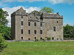
Huntingtower Castle
Castle in Perth and Kinross, Scotland
Distance: Approx. 1991 meters
Latitude and longitude: 56.4094,-3.4883
Huntingtower Castle, once known as Ruthven Castle or the Place of Ruthven, is located near the village of Huntingtower beside the A85 and near the A9, about 5 km NW of the centre of Perth, Perth and Kinross, in central Scotland, on the main road to Crieff. This castle is the subject for several local ghostlore stories.

Huntingtower and Ruthvenfield
Human settlement in Scotland
Distance: Approx. 1457 meters
Latitude and longitude: 56.407229,-3.502178
Huntingtower and Ruthvenfield is a village in Perthshire, Scotland, on the River Almond, 3 miles (5 kilometres) northwest of Perth. Bleaching, the chief industry, dated from 1774, when the bleaching-field was formed. By means of an old aqueduct, said to have been built by the Romans, it was provided with water from the River Almond, the properties of which rendered it especially suited for bleaching.

Almondbank
Human settlement in Scotland
Distance: Approx. 412 meters
Latitude and longitude: 56.421,-3.517
Almondbank is a village in Perth and Kinross, Scotland, about 4+1⁄2 miles (7 kilometres) northwest of Perth. With the building of Royal Naval Aircraft Workshops, Almondbank grew significantly during and after the Second World War.

Almondbank railway station
Disused railway station in Almondbank, Scotland
Distance: Approx. 977 meters
Latitude and longitude: 56.4087,-3.51416
Almondbank railway station served the village of Almondbank, in the Scottish county of Perth and Kinross.

Pitcairngreen
Human settlement in Scotland
Distance: Approx. 1013 meters
Latitude and longitude: 56.4264,-3.5178
Pitcairngreen (pronounced 'Pit-cairn Green') is a hamlet in the Scottish council area of Perth and Kinross which is more or less adjoined to the much larger village of Almondbank. It lies 4 miles (6 kilometres) northwest of Perth. As its name would suggest, two features of the settlement are a green and a cairn.
RAF Methven
Distance: Approx. 1296 meters
Latitude and longitude: 56.41055556,-3.53444444
Royal Air Force Methven, or more simply RAF Methven, was a World War 2 Royal Air Force Satellite Landing Ground (SLG) located 1.6 miles (2.6 km) south east of Methven, Perth and Kinross, Scotland and 4.1 miles (6.6 km) west of Perth, Perth and Kinross.
Bertha Park High School
Secondary school in Perth, Perth and Kinross, Scotland
Distance: Approx. 2071 meters
Latitude and longitude: 56.4225,-3.485
Bertha Park High School is a non-denominational state comprehensive secondary school in Perth, Scotland. Planning for the school began in 2013 when Perth and Kinross Council voted to accept Scottish Government funding for a new school in Perth. The school opened in 2019, and was the first new high school in Scotland since 2002.
Ruthven Road railway station
Disused railway station in Ruthvenfield, Perth and Kinross
Distance: Approx. 1652 meters
Latitude and longitude: 56.4141,-3.4911
Ruthven Road railway station served Ruthven House and the village of Ruthvenfield in Perthshire, Scotland, from 1859 to 1951 on the Perth, Almond Valley and Methven Railway.
Tibbermuir railway station
Disused railway station in Tibbermore, Perth and Kinross
Distance: Approx. 2166 meters
Latitude and longitude: 56.4035,-3.5421
Tibbermuir railway station served the village of Tibbermore, Perth and Kinross, Scotland, from 1859 to 1951 on the Perth, Almond Valley and Methven Railway.

Hillyland
Human settlement in Scotland
Distance: Approx. 2733 meters
Latitude and longitude: 56.403367,-3.4807714
Hillyland is a suburban area of Perth, Scotland, approximately 2.0 miles (3.2 km) west-northwest of the centre of Perth. It borders Tulloch, which is located to the north and northeast. Newhouse Road separates Hillyland from Letham to the east.
Weather in this IP's area
scattered clouds
0 Celsius
0 Celsius
-1 Celsius
1 Celsius
1034 hPa
64 %
1034 hPa
1014 hPa
10000 meters
1.16 m/s
1.36 m/s
285 degree
42 %