89.213.12.190 - IP Lookup: Free IP Address Lookup, Postal Code Lookup, IP Location Lookup, IP ASN, Public IP
Country:
Region:
City:
Location:
Time Zone:
Postal Code:
ISP:
ASN:
language:
User-Agent:
Proxy IP:
Blacklist:
IP information under different IP Channel
ip-api
Country
Region
City
ASN
Time Zone
ISP
Blacklist
Proxy
Latitude
Longitude
Postal
Route
db-ip
Country
Region
City
ASN
Time Zone
ISP
Blacklist
Proxy
Latitude
Longitude
Postal
Route
IPinfo
Country
Region
City
ASN
Time Zone
ISP
Blacklist
Proxy
Latitude
Longitude
Postal
Route
IP2Location
89.213.12.190Country
Region
england
City
blythebridge
Time Zone
Europe/London
ISP
Language
User-Agent
Latitude
Longitude
Postal
ipdata
Country
Region
City
ASN
Time Zone
ISP
Blacklist
Proxy
Latitude
Longitude
Postal
Route
Popular places and events near this IP address
Blythe Bridge
Village in Staffordshire, England
Distance: Approx. 499 meters
Latitude and longitude: 52.9704,-2.0709
Blythe Bridge () is a village in Staffordshire, England, south-east of Stoke-on-Trent.

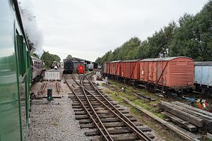
Foxfield Railway
Railway near Stoke-on-Trent, Staffordshire, England
Distance: Approx. 1012 meters
Latitude and longitude: 52.9757,-2.06454
The Foxfield Railway is a preserved standard gauge line located south east of Stoke-on-Trent. The line was built in 1893 to serve the colliery at Dilhorne on the Cheadle Coalfield. It joined the North Staffordshire Railway line near Blythe Bridge.
Forsbrook
Village in Staffordshire, England
Distance: Approx. 907 meters
Latitude and longitude: 52.97084,-2.05505
Forsbrook is a village in Staffordshire, around three miles southwest of Cheadle and situated on the edge of the Staffordshire Moorlands. It is an old village and is mentioned in the Domesday Book, with the rather unflattering description as waste ground. The village derives its name from the Old English Fotes-broc - a brook or ditch. .

Blythe Bridge railway station
Railway station in Staffordshire, England
Distance: Approx. 146 meters
Latitude and longitude: 52.968,-2.067
Blythe Bridge railway station in Blythe Bridge, Staffordshire, England, is served by trains on the Crewe to Derby Line; it is also a Community rail line known as the North Staffordshire line. The station is owned by Network Rail and managed by East Midlands Railway. The full range of tickets for travel are purchased from the guard on the train at no extra cost.

Caverswall
Human settlement in England
Distance: Approx. 1932 meters
Latitude and longitude: 52.98342,-2.07443
Caverswall is a village and parish in Staffordshire, England, to the south west of Staffordshire Moorlands. In the middle of the 19th century there were about 1500 inhabitants. In the 1880s an urbanised part of the parish called East Vale was transferred to Longton, which was then an expanding industrial town.

Boundary, Staffordshire
Human settlement in England
Distance: Approx. 2488 meters
Latitude and longitude: 52.97,-2.03
Boundary is a village in the civil parish of Forsbrook, in the Staffordshire Moorlands district, in the county of Staffordshire, England, near to the town of Cheadle. It is just outside of the city of Stoke-on-Trent.

Caverswall Castle
English mansion
Distance: Approx. 1864 meters
Latitude and longitude: 52.9825,-2.0759
Caverswall Castle is a privately owned early-17th-century English mansion built in a castellar style upon the foundations and within the walls of a 13th-century castle, in Caverswall, Staffordshire. It is a Grade I listed building. The castle is large, with a floor area of 2,030 square yards (1,700 m2).
Meir railway station
Former railway station in Staffordshire, England
Distance: Approx. 2421 meters
Latitude and longitude: 52.977,-2.0985
Meir railway station served the Meir area of Stoke-on-Trent, England. It was opened in 1894 by the North Staffordshire Railway on its line to Derby and was situated in a cutting to the east of Meir tunnel. The station closed in 1966 with hardly any evidence of its existence left today apart from the footprint of the buildings which are covered in vegetation.

Caverswall Road railway station
Distance: Approx. 992 meters
Latitude and longitude: 52.97555556,-2.065
Caverswall Road railway station is a heritage railway station on the Foxfield Railway in Staffordshire. It serves as the centre of the railway's operations. Since the Foxfield Railway is a former industrial railway, there were no passenger stations on the line originally.
Forsbrook Pendant
Piece of Anglo Saxon jewellery found in Forsbrook, Staffordshire, England
Distance: Approx. 1152 meters
Latitude and longitude: 52.972091,-2.052029
The Forsbrook Pendant is a piece of Anglo Saxon jewellery found in Forsbrook, Staffordshire, England and sold to the British Museum in 1879. It is a 7th-century setting of a 4th-century gold Roman coin in gold cellwork with garnet and blue glass inlays.
Blythe Bridge High School
Academy in Staffordshire, England
Distance: Approx. 405 meters
Latitude and longitude: 52.9682,-2.0612
Blythe Bridge High School is a coeducational secondary school and sixth form located in Blythe Bridge in the English county of Staffordshire. Previously a foundation school administered by Staffordshire County Council, in March 2023 Blythe Bridge High School converted to academy status. The school is now sponsored by the John Taylor Multi-Academy Trust.
RAF Meir
Distance: Approx. 1993 meters
Latitude and longitude: 52.97027778,-2.09583333
Royal Air Force Meir or more simply RAF Meir is a former Royal Air Force station located in Stoke-on-Trent, Staffordshire, England.
Weather in this IP's area
scattered clouds
1 Celsius
-3 Celsius
1 Celsius
2 Celsius
1003 hPa
67 %
1003 hPa
982 hPa
10000 meters
5 m/s
12.35 m/s
198 degree
39 %