Country:
Region:
City:
Latitude and Longitude:
Time Zone:
Postal Code:
IP information under different IP Channel
ip-api
Country
Region
City
ASN
Time Zone
ISP
Blacklist
Proxy
Latitude
Longitude
Postal
Route
Luminati
Country
Region
ha
City
haifa
ASN
Time Zone
Asia/Jerusalem
ISP
ITC NG ltd
Latitude
Longitude
Postal
IPinfo
Country
Region
City
ASN
Time Zone
ISP
Blacklist
Proxy
Latitude
Longitude
Postal
Route
db-ip
Country
Region
City
ASN
Time Zone
ISP
Blacklist
Proxy
Latitude
Longitude
Postal
Route
ipdata
Country
Region
City
ASN
Time Zone
ISP
Blacklist
Proxy
Latitude
Longitude
Postal
Route
Popular places and events near this IP address

Kiryat Yam
City in Israel
Distance: Approx. 1173 meters
Latitude and longitude: 32.83333333,35.06666667
Kiryat Yam (Hebrew: קִרְיַת יָם, lit. Sea Town) is a city in the Haifa Bay district of Israel, 12 km (7 mi) north of Haifa. One of a group of Haifa suburbs known as the Krayot, it is located on the Mediterranean coast, between Kiryat Haim and the Tzur Shalom industrial area, east of Kiryat Motzkin.

Kiryat Bialik
City in Israel
Distance: Approx. 1222 meters
Latitude and longitude: 32.83333333,35.08333333
Kiryat Bialik (Hebrew: קִרְייַת בְּיַאלִיק, also Qiryat Bialik) is a city in the Haifa District in Israel. The city was established on July 18, 1934, during the Fifth Aliyah. It is one of the five Krayot suburbs to the north of Haifa.

Kiryat Motzkin
City in Israel
Distance: Approx. 1222 meters
Latitude and longitude: 32.83333333,35.08333333
Kiryat Motzkin (Hebrew: קִרְיַת מוֹצְקִין) is a city in the Haifa District of Israel, 8 kilometres (5 miles) north of the city center of Haifa. According to the Israel Central Bureau of Statistics, in 2022 it had a population of 48,001. However, as of September 2024, the unofficial population count is 55,600, reflecting significant growth not yet captured in official statistics.
Rafael Advanced Defense Systems
Israeli defense company
Distance: Approx. 3458 meters
Latitude and longitude: 32.8684,35.0931
Rafael Advanced Defense Systems Ltd. (Hebrew: רפאל - מערכות לחימה מתקדמות בע"מ) is an Israeli defense technology company. It was founded as Israel's National R&D Defense Laboratory for the development of weapons and military technology within the Israeli Ministry of Defense; in 2002 it was incorporated as a limited company.

Krayot
Distance: Approx. 301 meters
Latitude and longitude: 32.84166668,35.0713889
The Krayot or Qerayot (Hebrew: הקריות, "townships") (plural of Kirya) are a cluster of four small cities and two neighbourhoods of Haifa founded in the 1930s on the outskirts of the city of Haifa, Israel, in the Haifa Bay area. The Krayot include Kiryat Yam (pop. 42,284), Kiryat Motzkin (pop.
Kiryat Motzkin railway station
Railway station in Israel
Distance: Approx. 1043 meters
Latitude and longitude: 32.833,35.0699
Kiryat Motzkin railway station (Hebrew: תחנת הרכבת קרית מוצקין, Takhanat HaRakevet Kiryat Motzkin) is an Israel Railways passenger station serving the city of Kiryat Motzkin and the surrounding Kerayot region.

Kiryat Haim railway station
Railway passenger station in Israel
Distance: Approx. 2097 meters
Latitude and longitude: 32.82481389,35.06419722
Kiryat Haim railway station (Hebrew: תחנת הרכבת קרית חיים, Tahanat HaRakevet Kiryat Haim) is an Israel Railways passenger station serving Haifa's borough of Kiryat Haim and its immediate surrounding region.

Thomas D'Alesandro Stadium
Distance: Approx. 2286 meters
Latitude and longitude: 32.82458333,35.06075
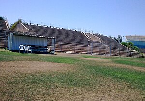
Thomas D'Alesandro Stadium, also known as Kiryat Haim Stadium, is a multi-purpose stadium in Kiryat Haim, Israel. It is used mostly for association football matches and is the home stadium of Hapoel Haifa's youth teams. It used to be home to the first teams of Hapoel as well as Maccabi Haifa, but was replaced by Kiryat Eliezer Stadium in 1955.

Kfar Bialik
Place in Haifa, Israel
Distance: Approx. 2570 meters
Latitude and longitude: 32.82111111,35.0875
Kfar Bialik (Hebrew: כְּפַר בְּיַאלִיק, lit. 'Bialik Village') is a moshav in northern Israel. Located near Kiryat Bialik, it falls under the jurisdiction of Zevulun Regional Council. In 2022 it had a population of 835.

Kiryat Shmuel, Haifa
Neighbourhood in Haifa, Israel
Distance: Approx. 1045 meters
Latitude and longitude: 32.83401944,35.06784167
Kiryat Shmuel (Hebrew: קרית שמואל) is a neighborhood at the perimeter of the city of Haifa in northern Israel. The neighborhood is bounded by Kiryat Haim in the south and in the west, by Kiryat Yam in the west, and by Kiryat Motzkin in the east. It is located about one kilometer from the coast, with a train station on its border with Kiryat Motzkin.

Kiryat Haim
Neighborhood of Haifa, Israel
Distance: Approx. 1173 meters
Latitude and longitude: 32.83333333,35.06666667
Kiryat Haim (Hebrew: קריית חיים pronounced [kiʁˈjat χaˈjim]) is a neighborhood of Haifa. It is considered part of the Krayot cluster in the northern part of metropolitan Haifa. In 2008, Kiryat Haim had a population of just under 27,000.
Krayot central bus station
Bus station in Haifa, Israel
Distance: Approx. 2443 meters
Latitude and longitude: 32.8597,35.0892
The Krayot central bus station (Hebrew: מרכזית הקריות: Merkazit HaKrayot) is a public transport terminal serving as a terminus for the Metronit bus rapid transit system, and as a station for local bus routes serving the Krayot suburbs of Haifa, Israel. Despite its name, the station is not located in the center of the Krayot but is located on the northern edge within the municipal boundaries of Kiryat Motzkin. Operations began in August 2013, coinciding with the commencement of the new Metronit system in the region.
Weather in this IP's area
clear sky
25 Celsius
25 Celsius
24 Celsius
26 Celsius
1018 hPa
48 %
1018 hPa
1017 hPa
10000 meters
6.69 m/s
110 degree
06:03:51
16:43:08

