89.208.4.144 - IP Lookup: Free IP Address Lookup, Postal Code Lookup, IP Location Lookup, IP ASN, Public IP
Country:
Region:
City:
Location:
Time Zone:
Postal Code:
IP information under different IP Channel
ip-api
Country
Region
City
ASN
Time Zone
ISP
Blacklist
Proxy
Latitude
Longitude
Postal
Route
Luminati
Country
Region
ta
City
telaviv
ASN
Time Zone
Asia/Jerusalem
ISP
ITC NG ltd
Latitude
Longitude
Postal
IPinfo
Country
Region
City
ASN
Time Zone
ISP
Blacklist
Proxy
Latitude
Longitude
Postal
Route
IP2Location
89.208.4.144Country
Region
hatsafon
City
jish
Time Zone
Asia/Jerusalem
ISP
Language
User-Agent
Latitude
Longitude
Postal
db-ip
Country
Region
City
ASN
Time Zone
ISP
Blacklist
Proxy
Latitude
Longitude
Postal
Route
ipdata
Country
Region
City
ASN
Time Zone
ISP
Blacklist
Proxy
Latitude
Longitude
Postal
Route
Popular places and events near this IP address

Safsaf
Depopulated Palestinian village in present-day Israel
Distance: Approx. 1455 meters
Latitude and longitude: 33.01166667,35.44555556
Safsaf (Arabic: صفصاف Ṣafṣāf, "weeping willow") was a Palestinian village 9 kilometres northwest of Safed, present-day Israel. Its villagers fled to Lebanon after the Safsaf massacre in October 1948, during the 1948 Arab–Israeli War.
Safsaf massacre
1948 killing of Palestinians by Israeli forces
Distance: Approx. 1521 meters
Latitude and longitude: 33.01111111,35.44611111
The Safsaf massacre took place on 29 October 1948, following the capture of the Palestinian Arab village of Safsaf in the Galilee by the Israel Defense Forces (IDF). The village was defended by the Arab Liberation Army's Second Yarmuk Battalion. Safsaf was the first village to fall in Operation Hiram, the aim of which, according to the IDF, was to "destroy the enemy in the central Galilee 'pocket,' to take control of the whole of the Galilee and to establish a defense line on the country's northern border." The village was attacked by two platoons of armored cars and a tank company from the 7th Brigade, and a fierce battle lasted from the evening until seven o'clock the next morning.
Or HaGanuz
Place in Northern, Israel
Distance: Approx. 2196 meters
Latitude and longitude: 33.005,35.44555556
Or HaGanuz (Hebrew: אוֹר הַגָּנוּז, lit. Hidden Light), sometimes Or Ganuz, is a community settlement in northern Israel. Located in the eastern Upper Galilee, about six kilometers northwest of the town of Safed, it falls under the jurisdiction of Merom HaGalil Regional Council.
Merom HaGalil Regional Council
Regional council in Israel
Distance: Approx. 2937 meters
Latitude and longitude: 33,35.43333333
The Merom HaGalil Regional Council (Hebrew: מועצה אזורית מרום הגליל, Mo'atza Azorit Merom HaGalil) is a regional council in the northern Galilee of northern Israel. The regional council was established in 1950. The head of the council is Shlomo Levi.
Jish
Local council in Israel
Distance: Approx. 177 meters
Latitude and longitude: 33.02611111,35.44527778
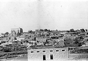
Jish (Arabic: الجش, al-Jiŝ), also known by its Hebrew name of Gush Halab (Hebrew: גּוּשׁ חָלָב, Gūŝ Ḥālāḇ), or by its classical name of Gischala, is a local council in Upper Galilee, located on the northeastern slopes of Mount Meron, 13 kilometres (8.1 mi) north of Safed, in Israel's Northern District. In 2022, it had a population of 3,216, which is predominantly Maronite Catholic and Melkite Greek Catholic Christians (63%), with a Sunni Muslim Arab minority (about 35.7%). Jish is the ancient Giscala or Gush Halav, first mentioned in the historical record by the Roman-Jewish historian Josephus, who described it as the home of John of Giscala and the last city in the Galilee to fall to the Romans during the First Jewish–Roman War (War 4:93).
Kerem Ben Zimra
Place in Northern, Israel
Distance: Approx. 2722 meters
Latitude and longitude: 33.03833333,35.46861111
Kerem Ben Zimra (Hebrew: כֶּרֶם בֶּן זִמְרָה) is a moshav in northern Israel. Near Safed in the Upper Galilee, it falls under the jurisdiction of Merom HaGalil Regional Council. In 2022, it had a population of 535.

Bar Yohai
Place in Northern, Israel
Distance: Approx. 3026 meters
Latitude and longitude: 32.99777778,35.44888889
Bar Yohai (Hebrew: בַּר יוֹחַאי) is a religious Jewish community settlement in northern Israel. Located near Mount Meron, it falls under the jurisdiction of Merom HaGalil Regional Council. as of 2022 its population was 1,092.
Kfar Hoshen
Moshav in northern Israel
Distance: Approx. 1417 meters
Latitude and longitude: 33.01222222,35.44138889
Kfar Hoshen (Hebrew: כפר חושן), also known as Safsufa (ספסופה), is a moshav in northern Israel. Located around four kilometres north of Meron, it falls under the jurisdiction of Merom HaGalil Regional Council. In 2022 it had a population of 808.
Tziv'on
Place in Northern, Israel
Distance: Approx. 2671 meters
Latitude and longitude: 33.02611111,35.41583333
Tziv'on (Hebrew: צִבְעוֹן, lit. 'Crayon') is a kibbutz in northern Israel. Located near Safed and the Lebanese border, it falls under the jurisdiction of Upper Galilee Regional Council. In 2022 it had a population of 380.

Qaddita
Village in Safad, Mandatory Palestine
Distance: Approx. 3134 meters
Latitude and longitude: 33.00472222,35.46805556
Qaddita (Arabic: قدّيتا, transliteration: Qaddîtâ) was a Palestinian Arab village of 240, located 4.5 kilometers (2.8 mi) northwest of Safad. It was captured and depopulated in the 1948 Arab-Israeli War, with some of its inhabitants expelled or fleeing to nearby 'Akbara where they live as internally displaced Palestinians and others to refugee camps in Lebanon or Syria.

Al-Ras al-Ahmar
Place in Safad, Mandatory Palestine
Distance: Approx. 2860 meters
Latitude and longitude: 33.03916667,35.46972222
Al-Ras al-Ahmar was a Palestinian Arab village in the Safad Subdistrict. It was depopulated during the 1948 Arab–Israeli War on October 30, 1948, by the Israeli 7th Armored Brigade during Operation Hiram. It was located 8.5 km north of Safad.

Kadita
Place in Northern, Israel
Distance: Approx. 2849 meters
Latitude and longitude: 33.005,35.46388889
Kadita (Hebrew: כדיתה or קדיתא) is an unrecognised Jewish community settlement in northern Israel. Located in the central Galilee, it falls under the jurisdiction of Merom HaGalil Regional Council. In 2022 it had a population of 187.
Weather in this IP's area
clear sky
9 Celsius
9 Celsius
9 Celsius
9 Celsius
1016 hPa
66 %
1016 hPa
925 hPa
10000 meters
1.13 m/s
1.53 m/s
85 degree


