89.188.0.136 - IP Lookup: Free IP Address Lookup, Postal Code Lookup, IP Location Lookup, IP ASN, Public IP
Country:
Region:
City:
Location:
Time Zone:
Postal Code:
IP information under different IP Channel
ip-api
Country
Region
City
ASN
Time Zone
ISP
Blacklist
Proxy
Latitude
Longitude
Postal
Route
Luminati
Country
Region
nh
City
amsterdam
ASN
Time Zone
Europe/Amsterdam
ISP
Duocast B.V.
Latitude
Longitude
Postal
IPinfo
Country
Region
City
ASN
Time Zone
ISP
Blacklist
Proxy
Latitude
Longitude
Postal
Route
IP2Location
89.188.0.136Country
Region
utrecht
City
houten
Time Zone
Europe/Amsterdam
ISP
Language
User-Agent
Latitude
Longitude
Postal
db-ip
Country
Region
City
ASN
Time Zone
ISP
Blacklist
Proxy
Latitude
Longitude
Postal
Route
ipdata
Country
Region
City
ASN
Time Zone
ISP
Blacklist
Proxy
Latitude
Longitude
Postal
Route
Popular places and events near this IP address
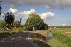
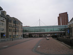
Houten
Municipality in Utrecht, Netherlands
Distance: Approx. 569 meters
Latitude and longitude: 52.03333333,5.16666667
Houten (Dutch pronunciation: [ˈɦʌutə(n)] ) is a municipality in the Netherlands, in the province of Utrecht.

Schalkwijk, Utrecht
Village in Utrecht, Netherlands
Distance: Approx. 4049 meters
Latitude and longitude: 51.99388889,5.18722222
Schalkwijk (Dutch pronunciation: [ˈsxɑl(ə)kˌʋɛik]) is a small village in the Dutch province of Utrecht. It consists of a small village centre on the railway line between Utrecht and 's-Hertogenbosch and a 5 km long ribbon of farms along the small channel Schalkwijksche Wetering. The statistical district of Schalkwijk had a population of about 1650 in 2004.

Oud-Wulven
Hamlet in Utrecht, Netherlands
Distance: Approx. 2009 meters
Latitude and longitude: 52.04444444,5.155
Oud-Wulven is a hamlet in the Dutch province of Utrecht. It is located just north of the village of Houten, and is part of that municipality.
Tull en 't Waal
Village in Utrecht, Netherlands
Distance: Approx. 3912 meters
Latitude and longitude: 52.00055556,5.13305556
Tull en 't Waal is a village in the Dutch province of Utrecht. Until 1962, it was a separate municipality, but now it is a part of the municipality of Houten. Originally, there were two villages: 't Waal, at the site of the present village; and Tull, more to the south.

Heemstede, Utrecht
Hamlet in Utrecht, Netherlands
Distance: Approx. 3188 meters
Latitude and longitude: 52.03777778,5.12416667
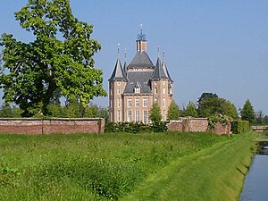
Heemstede is a hamlet in the central Netherlands. It is located 3 km west of Houten, Utrecht. The hamlet is known for Heemstede Castle (1645).

Schonauwen
Distance: Approx. 1663 meters
Latitude and longitude: 52.01666667,5.18333333
Schonauwen is a former castle in the Dutch province of Utrecht. It is located on the southern outskirts of the town of Houten, surrounded by new buildings. Until the end of the 18th century, Schonauwen was a separate heerlijkheid (fiefdom).

Bunnik railway station
Railway station in the Netherlands
Distance: Approx. 4301 meters
Latitude and longitude: 52.06305556,5.19555556
Bunnik is a railway station located in Bunnik, Netherlands. The station was opened in 1868 and is located on the Amsterdam–Arnhem railway. The station is operated by Nederlandse Spoorwegen.

Houten railway station
Railway station in the Netherlands
Distance: Approx. 684 meters
Latitude and longitude: 52.03444444,5.16777778
Houten is a railway station located in Houten, Netherlands. The station was opened on 1 November 1868 and is located on the Utrecht–Boxtel railway and the Houten - Houten Castellum tram line which closed on 14 December 2008. The services are operated by Nederlandse Spoorwegen.
Houten Castellum railway station
Railway station in the Netherlands
Distance: Approx. 1359 meters
Latitude and longitude: 52.01805556,5.17888889
Houten Castellum is a railway station located in Houten, Netherlands, which opened at 8 January 2001 and it is located on the Utrecht–Boxtel railway . Originally it was the southernmost point of the Houten - Houten Castellum tram line. This temporary service closed at 14 December 2008.

Fectio
Former Roman castellum, village in Netherlands
Distance: Approx. 3134 meters
Latitude and longitude: 52.05638889,5.165
Fectio, known as Vechten in Old Dutch, was a Roman castellum in the province Germania Inferior established in the year 4 or 5 AD. It was located at the place where the river Vecht (Fectio) branched off from the Rhine, leading to Lake Flevo, which was later to become the Zuiderzee. This was near the modern hamlet of Vechten in the municipality Bunnik, Utrecht, Netherlands.
Kasteel Heemstede
Restaurant in Houten, Netherlands
Distance: Approx. 2991 meters
Latitude and longitude: 52.033,5.1251
Kasteel Heemstede is a restaurant in Houten, Netherlands. It is a fine dining restaurant that was awarded one Michelin star for the periods 2003-2008 and 2011–present. The restaurant is located in the souterrain of the eponymous castle, although it was in fact an buitenplaats.
Plofsluis
Lock in the Netherlands
Distance: Approx. 3715 meters
Latitude and longitude: 52.0348,5.1149
The Plofsluis (lit. 'Explosion lock') or Keersluis bij Jutphaas (Control lock near Jutphaas) is a control lock in the Netherlands. It lies in the Amsterdam–Rhine Canal, between Nieuwegein and Houten, southeast of Fort Jutphaas. As part of the New Dutch Waterline, it was constructed to quickly dam the canal, so water from the flooded surroundings would not flow away through the canal.
Weather in this IP's area
moderate rain
2 Celsius
-1 Celsius
2 Celsius
3 Celsius
1000 hPa
92 %
1000 hPa
999 hPa
10000 meters
2.54 m/s
4.83 m/s
112 degree
100 %


