89.184.63.195 - IP Lookup: Free IP Address Lookup, Postal Code Lookup, IP Location Lookup, IP ASN, Public IP
Country:
Region:
City:
Location:
Time Zone:
Postal Code:
ISP:
ASN:
language:
User-Agent:
Proxy IP:
Blacklist:
IP information under different IP Channel
ip-api
Country
Region
City
ASN
Time Zone
ISP
Blacklist
Proxy
Latitude
Longitude
Postal
Route
db-ip
Country
Region
City
ASN
Time Zone
ISP
Blacklist
Proxy
Latitude
Longitude
Postal
Route
IPinfo
Country
Region
City
ASN
Time Zone
ISP
Blacklist
Proxy
Latitude
Longitude
Postal
Route
IP2Location
89.184.63.195Country
Region
roscommon
City
castlerea
Time Zone
Europe/Dublin
ISP
Language
User-Agent
Latitude
Longitude
Postal
ipdata
Country
Region
City
ASN
Time Zone
ISP
Blacklist
Proxy
Latitude
Longitude
Postal
Route
Popular places and events near this IP address

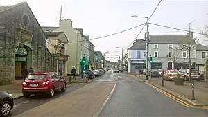
Castlerea
Town in County Roscommon, Ireland
Distance: Approx. 0 meters
Latitude and longitude: 53.7667,-8.5
Castlerea ( KASS-əl-REE; Irish: An Caisleán Riabhach, meaning 'brindled castle') is the third largest town in County Roscommon, Ireland. It is located in the west of the county and had a population of 1,992 at the 2016 census. Roughly translated from Irish, Castlerea is generally thought to mean 'brindled castle' (Caisleán Riabhach).

Ballymoe
Village in County Galway, Ireland
Distance: Approx. 7742 meters
Latitude and longitude: 53.7,-8.4667
Ballymoe (historically Bellamoe, from Irish: Béal Átha Mó, meaning 'ford-mouth of Mó') is a village in County Galway, Ireland. Ballymoe is situated on the western side of the River Suck that separates counties Galway and Roscommon. The N60 national secondary road meets the R360 regional road in the centre of the village.

Castlerea railway station
Railway station in Castlerea, Ireland
Distance: Approx. 1104 meters
Latitude and longitude: 53.76138889,-8.48583333
Castlerea railway station serves the town of Castlerea in County Roscommon, Ireland. The station opened on 15 November 1860. The station is on the Dublin to Westport Rail service.

Clonalis House
Historic manor house in Ireland
Distance: Approx. 0 meters
Latitude and longitude: 53.7667,-8.5
Clonalis House (Irish: Teach Chluain Mhalais) is an historic manor house in Castlerea, County Roscommon, Ireland, and the ancestral home of the O'Conor Don, who are direct descendants of Cathal Crobhdearg Ua Conchobair, King of Connacht, a younger brother of Ruaidrí Ua Conchobair, the last High King of Ireland. The current building was constructed in 1878 by Charles Owen O'Conor as a replacement for an earlier house on the same site which was frequently damaged by flooding. Built of mass concrete, its design by Frederick Pepys Cockerell is of a mixture of styles drawing on the traditions of Italianate and Queen Anne Style architecture.

Loughglinn
Village in Connacht, Ireland
Distance: Approx. 6461 meters
Latitude and longitude: 53.81666667,-8.55
Loughglinn or Loughglynn ( lokh-GLIN; Irish: Loch Glinne) is a village in County Roscommon, Ireland. It is named after the lake to the north of the village.

Cloonbonniffe
Village in County Roscommon, Ireland
Distance: Approx. 5672 meters
Latitude and longitude: 53.7815,-8.5825
Cloonbonniffe, officially Cloonbonniff (Irish: Cluain Banbh), is a small village and townland in County Roscommon, Ireland. The nearest town is Castlerea, six kilometres east. Cloonbonniff is home to the O'Connor Don National School and community centre, which is beside Cloonbonniffe Catholic Church.
Castlerea Prison
Prison in County Roscommon, Ireland
Distance: Approx. 1510 meters
Latitude and longitude: 53.754843,-8.488866
Castlerea Prison (Irish: Príosún an Chaisleáin Riabhach) is a closed category, medium security prison in Castlerea, County Roscommon, Ireland. It houses men over 17 years of age. As of 2022, it had a bed capacity of 340 and the daily average number of resident inmates was 320.

Castlerea Railway Museum
Railway museum in Castlerea, Ireland
Distance: Approx. 486 meters
Latitude and longitude: 53.7698,-8.4948
Castlerea Railway Museum, formerly known as Hells Kitchen Railway Museum, is a private railway museum on Main Street, Castlerea, County Roscommon in Ireland.

Emlagh High Cross
High crosses in County Roscommon, Ireland
Distance: Approx. 3729 meters
Latitude and longitude: 53.745381,-8.456296
Emlagh High Cross or Emlagh Cross is a high cross which is a National Monument in County Roscommon, Ireland.
Cloonshanville High Cross
High cross in County Roscommon, Ireland
Distance: Approx. 3729 meters
Latitude and longitude: 53.745381,-8.456296
Cloonshanville High Cross is a high cross which is a National Monument in County Roscommon, Ireland.
Bellanagare Bog
Ecological site in County Roscommon, Ireland
Distance: Approx. 8005 meters
Latitude and longitude: 53.8275,-8.435
The Bellanagare Bog (Irish: Portach Baile an Turlaigh) Special Area of Conservation (or SAC) is a Natura 2000 site based close to the village of Bellanagare and the town of Castlerea in County Roscommon, Ireland. The qualifying interests by which it is protected as an SAC are the presence of three habitat types: the presence of active raised bog (priority habitat), the presence of degraded raised bogs still capable of natural regeneration, and the presence of depressions on peat substrates of Rhynchosporion vegetation.
Cloonchambers Bog
Ecological site in County Roscommon, Ireland
Distance: Approx. 7939 meters
Latitude and longitude: 53.8273,-8.43633
The Cloonchambers (Irish: Portach Chluain Sheamhair) Special Area of Conservation or SAC is a Natura 2000 site based close to the town of Castlerea in County Roscommon, Ireland. The qualifying interests by which it is protected as an SAC are the presence of three habitat types: the presence of active raised bogs (priority habitat), the presence of degraded raised bogs still capable of natural regeneration, and the presence of depressions on peat substrates of Rhynchosporion vegetation.
Weather in this IP's area
clear sky
2 Celsius
0 Celsius
2 Celsius
2 Celsius
1005 hPa
94 %
1005 hPa
994 hPa
10000 meters
1.5 m/s
1.48 m/s
232 degree
10 %