89.174.170.182 - IP Lookup: Free IP Address Lookup, Postal Code Lookup, IP Location Lookup, IP ASN, Public IP
Country:
Region:
City:
Location:
Time Zone:
Postal Code:
ISP:
ASN:
language:
User-Agent:
Proxy IP:
Blacklist:
IP information under different IP Channel
ip-api
Country
Region
City
ASN
Time Zone
ISP
Blacklist
Proxy
Latitude
Longitude
Postal
Route
db-ip
Country
Region
City
ASN
Time Zone
ISP
Blacklist
Proxy
Latitude
Longitude
Postal
Route
IPinfo
Country
Region
City
ASN
Time Zone
ISP
Blacklist
Proxy
Latitude
Longitude
Postal
Route
IP2Location
89.174.170.182Country
Region
podkarpackie
City
nowa sarzyna
Time Zone
Europe/Warsaw
ISP
Language
User-Agent
Latitude
Longitude
Postal
ipdata
Country
Region
City
ASN
Time Zone
ISP
Blacklist
Proxy
Latitude
Longitude
Postal
Route
Popular places and events near this IP address

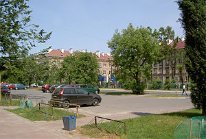
Nowa Sarzyna
Place in Subcarpathian Voivodeship, Poland
Distance: Approx. 1853 meters
Latitude and longitude: 50.32222222,22.31861111
Nowa Sarzyna (Polish: [ˈnɔva saˈʐɨna]; Ukrainian: Но́ва Сажи́на, romanized: Nóva Sazhýna) is a town in Poland, with 5,970 inhabitants as of 2017. The first buildings of Nowa Sarzyna were constructed in the late 1930s to house workers of a new chemical plant, built as part of Poland's Central Industrial Region. The town lies on land formerly belonging to the village Sarzyna.
Gmina Nowa Sarzyna
Gmina in Subcarpathian Voivodeship, Poland
Distance: Approx. 1853 meters
Latitude and longitude: 50.32222222,22.31861111
Gmina Nowa Sarzyna is an urban-rural gmina (administrative district) in Leżajsk County, Subcarpathian Voivodeship, in south-eastern Poland. Its seat is the town of Nowa Sarzyna, which lies approximately 11 kilometres (7 mi) north-west of Leżajsk and 40 km (25 mi) north-east of the regional capital Rzeszów. The gmina covers an area of 144.55 square kilometres (55.8 sq mi), and as of 2006 its total population is 21,296 (out of which the population of Nowa Sarzyna amounts to 6,308, and the population of the rural part of the gmina is 14,988).
Przychojec
Village in Subcarpathian Voivodeship, Poland
Distance: Approx. 4574 meters
Latitude and longitude: 50.3,22.4
Przychojec [pʂɨˈxɔjɛt͡s] is a village in the administrative district of Gmina Leżajsk, within Leżajsk County, Subcarpathian Voivodeship, in south-eastern Poland. It lies approximately 5 kilometres (3 mi) north-west of Leżajsk and 41 km (25 mi) north-east of the regional capital Rzeszów.

Jelna, Podkarpackie Voivodeship
Village in Subcarpathian Voivodeship, Poland
Distance: Approx. 2872 meters
Latitude and longitude: 50.29583333,22.35416667
Jelna [ˈjɛlna] is a village in the administrative district of Gmina Nowa Sarzyna, within Leżajsk County, Subcarpathian Voivodeship, in south-eastern Poland. It lies approximately 4 kilometres (2 mi) south-east of Nowa Sarzyna, 7 km (4 mi) north-west of Leżajsk, and 39 km (24 mi) north-east of the regional capital Rzeszów.
Jelna-Judaszówka
Village in Subcarpathian Voivodeship, Poland
Distance: Approx. 2737 meters
Latitude and longitude: 50.30416667,22.31638889
Jelna-Judaszówka [ˈjɛlna judaˈʂufka] is a village in the administrative district of Gmina Nowa Sarzyna, within Leżajsk County, Subcarpathian Voivodeship, in south-eastern Poland. It lies approximately 3 kilometres (2 mi) south of Nowa Sarzyna, 10 km (6 mi) north-west of Leżajsk, and 38 km (24 mi) north-east of the regional capital Rzeszów.
Łętownia-Gościniec
Village in Podkarpackie Voivodeship, Poland
Distance: Approx. 1352 meters
Latitude and longitude: 50.33138889,22.335
Łętownia-Gościniec (Polish pronunciation: [wɛnˈtɔvɲa ɡɔɕˈt͡ɕiɲɛt͡s]) is a village in the administrative district of Gmina Nowa Sarzyna, within Leżajsk County, Podkarpackie Voivodeship, in south-eastern Poland.
Łukowa, Podkarpackie Voivodeship
Village in Subcarpathian Voivodeship, Poland
Distance: Approx. 1990 meters
Latitude and longitude: 50.32611111,22.37138889
Łukowa [wuˈkɔva] is a village in the administrative district of Gmina Nowa Sarzyna, within Leżajsk County, Subcarpathian Voivodeship, in south-eastern Poland. It lies approximately 4 kilometres (2 mi) east of Nowa Sarzyna, 8 km (5 mi) north-west of Leżajsk, and 42 km (26 mi) north-east of the regional capital Rzeszów.
Ruda Łańcucka
Village in Subcarpathian Voivodeship, Poland
Distance: Approx. 220 meters
Latitude and longitude: 50.32194444,22.34722222
Ruda Łańcucka (Polish pronunciation: [ˈruda waj̃ˈt͡sut͡ska]) is a village in the administrative district of Gmina Nowa Sarzyna, within Leżajsk County, Subcarpathian Voivodeship, in south-eastern Poland. It lies approximately 3 kilometres (2 mi) east of Nowa Sarzyna, 9 km (6 mi) north-west of Leżajsk, and 41 km (25 mi) north-east of the regional capital Rzeszów.
Sarzyna
Village in Subcarpathian Voivodeship, Poland
Distance: Approx. 3262 meters
Latitude and longitude: 50.35,22.35
Sarzyna (Polish pronunciation: [saˈʐɨna]) is a village in the administrative district of Gmina Nowa Sarzyna, within Leżajsk County, Subcarpathian Voivodeship, in south-eastern Poland. It lies approximately 4 kilometres (2 mi) north-east of Nowa Sarzyna, 11 km (7 mi) north-west of Leżajsk, and 43 km (27 mi) north-east of the regional capital Rzeszów.
Tarnogóra, Podkarpackie Voivodeship
Village in Subcarpathian Voivodeship, Poland
Distance: Approx. 5297 meters
Latitude and longitude: 50.36472222,22.31555556
Tarnogóra [tarnɔˈɡura] is a village in the administrative district of Gmina Nowa Sarzyna, within Leżajsk County, Subcarpathian Voivodeship, in south-eastern Poland. It lies approximately 5 kilometres (3 mi) north of Nowa Sarzyna, 14 km (9 mi) north-west of Leżajsk, and 43 km (27 mi) north-east of the regional capital Rzeszów.
Koziarnia
Village in Subcarpathian Voivodeship, Poland
Distance: Approx. 5783 meters
Latitude and longitude: 50.37194444,22.32944444
Koziarnia [kɔˈʑarɲa] is a village in the administrative district of Gmina Krzeszów, within Nisko County, Subcarpathian Voivodeship, in south-eastern Poland. It lies approximately 4 kilometres (2 mi) south of Krzeszów, 23 km (14 mi) south-east of Nisko, and 45 km (28 mi) north-east of the regional capital Rzeszów.

Trzebośnica
River in Poland
Distance: Approx. 4007 meters
Latitude and longitude: 50.352601,22.371326
Trzebośnica is a left tributary of the San River in southeastern Poland. Its length is 35.3 kilometres. It flows into the San near Sarzyna.
Weather in this IP's area
clear sky
-0 Celsius
-3 Celsius
-0 Celsius
-0 Celsius
1027 hPa
85 %
1027 hPa
1003 hPa
10000 meters
2.19 m/s
3.89 m/s
189 degree
4 %