Country:
 Croatia
Region:
City:
Latitude and Longitude:
Time Zone:
Postal Code:
IP information under different IP Channel
ip-api
Country
Region
City
ASN
Time Zone
ISP
Blacklist
Proxy
Latitude
Longitude
Postal
Route
IPinfo
Country
Region
City
ASN
Time Zone
ISP
Blacklist
Proxy
Latitude
Longitude
Postal
Route
MaxMind
Country
Region
City
ASN
Time Zone
ISP
Blacklist
Proxy
Latitude
Longitude
Postal
Route
Luminati
Country
HRRegion
17
City
split
ASN
Time Zone
Europe/Zagreb
ISP
Telemach Hrvatska d.o.o.
Latitude
Longitude
Postal
db-ip
Country
Region
City
ASN
Time Zone
ISP
Blacklist
Proxy
Latitude
Longitude
Postal
Route
ipdata
Country
Region
City
ASN
Time Zone
ISP
Blacklist
Proxy
Latitude
Longitude
Postal
Route
Popular places and events near this IP address

Obrovac, Croatia
Town in Zadar, Croatia
Distance: Approx. 8198 meters
Latitude and longitude: 44.20027778,15.68138889
Obrovac (pronounced [ɔbrɔ̌ːʋats]; Italian: Obrovazzo) is a town located in northern Dalmatia, in the Zadar County of Croatia. The Obrovac municipality has a total population of 4,323 people. The town is located in the canyon of the river Zrmanja.
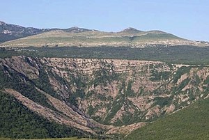
Zrmanja
River in Croatia
Distance: Approx. 8191 meters
Latitude and longitude: 44.2017,15.5883
Zrmanja (pronounced [zř̩maɲa], Italian: Zermagna) is a river in southern Lika and northern Dalmatia, Croatia. It is 69 km (43 mi) long and its basin covers an area of 907 km2 (350 sq mi). It was known to the ancient Romans as Tedanius.

Bukovica, Dalmatia
Distance: Approx. 9621 meters
Latitude and longitude: 44.1483051,15.75188061
Bukovica is a geographical region in Croatia. It lies in northern Dalmatia, with Lika to the north, Kninska Krajina to the east, and Ravni Kotari to the southwest.

Novigrad, Zadar County
Municipality in Zadar, Croatia
Distance: Approx. 8485 meters
Latitude and longitude: 44.18111111,15.54777778
Novigrad is a village and municipality in Croatia in the Zadar County. According to the 2011 census, there were 2,375 inhabitants, absolute majority of whom were Croats.
Kula Atlagića
Place in Zadar, Croatia
Distance: Approx. 9197 meters
Latitude and longitude: 44.059,15.589
Kula Atlagića (Serbian Cyrillic: Кула Атлагић) is a settlement in the Benkovac municipality, in the Zadar County in Croatia. It is located in the Ravni Kotari region of Dalmatia. The settlement is inhabited by ethnic Serbs.
Weather in this IP's area
broken clouds
17 Celsius
17 Celsius
17 Celsius
17 Celsius
1016 hPa
88 %
1016 hPa
1013 hPa
10000 meters
2.66 m/s
2.56 m/s
42 degree
83 %
06:42:34
18:59:09