Country:
Region:
City:
Latitude and Longitude:
Time Zone:
Postal Code:
IP information under different IP Channel
ip-api
Country
Region
City
ASN
Time Zone
ISP
Blacklist
Proxy
Latitude
Longitude
Postal
Route
Luminati
Country
Region
04
City
braganca
ASN
Time Zone
Europe/Lisbon
ISP
Nos Comunicacoes, S.A.
Latitude
Longitude
Postal
IPinfo
Country
Region
City
ASN
Time Zone
ISP
Blacklist
Proxy
Latitude
Longitude
Postal
Route
db-ip
Country
Region
City
ASN
Time Zone
ISP
Blacklist
Proxy
Latitude
Longitude
Postal
Route
ipdata
Country
Region
City
ASN
Time Zone
ISP
Blacklist
Proxy
Latitude
Longitude
Postal
Route
Popular places and events near this IP address

Bragança, Portugal
Municipality in Norte, Portugal
Distance: Approx. 240 meters
Latitude and longitude: 41.80666667,-6.75888889
Bragança (Portuguese: [bɾɐˈɣɐ̃sɐ] ; Mirandese: Bergáncia), also known in English as Braganza ( brə-GAN-zə, US also -GAHN-), is a city and municipality in north-eastern Portugal, capital of the district of Bragança, in the Terras de Trás-os-Montes subregion of Portugal. The population in 2011 was 35,341, in an area of 1173.57 km².
Castro de Avelãs
Civil parish in Norte, Portugal
Distance: Approx. 4077 meters
Latitude and longitude: 41.798,-6.806
Castro de Avelãs is a civil parish in the municipality of Bragança, Portugal. The population in 2011 was 460, in an area of 13.48 km2.
Samil, Portugal
Civil parish in Norte, Portugal
Distance: Approx. 3197 meters
Latitude and longitude: 41.776,-6.759
Samil is a civil parish in the municipality of Bragança, Portugal. The population in 2011 was 1,246, in an area of 10.25 km2.

Sé, Santa Maria e Meixedo
Civil parish in Norte, Portugal
Distance: Approx. 400 meters
Latitude and longitude: 41.807,-6.754
Sé, Santa Maria e Meixedo is a civil parish in the municipality of Bragança, Portugal. It was formed in 2013 by the merger of the former parishes Sé, Santa Maria and Meixedo. The population in 2011 was 22,016, in an area of 35.69 km2.
São Pedro de Sarracenos
Civil parish in Norte, Portugal
Distance: Approx. 4425 meters
Latitude and longitude: 41.765,-6.755
São Pedro de Sarracenos is a civil parish in the municipality of Bragança, Portugal. The population in 2011 was 366, in an area of 15.91 km2.

Sé (Bragança)
Civil parish in Norte, Portugal
Distance: Approx. 983 meters
Latitude and longitude: 41.811,-6.766
Sé is a former civil parish in the municipality of Bragança, Portugal. In 2013, the parish merged into the new parish Sé, Santa Maria e Meixedo. The population in 2011 was 17,913, in an area of 10.72 km2.

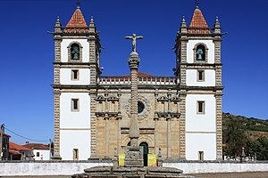
Roman Catholic Diocese of Bragança-Miranda
Roman Catholic diocese in Portugal
Distance: Approx. 387 meters
Latitude and longitude: 41.8056,-6.7622
The Diocese of Bragança–Miranda (Latin: Dioecesis Brigantiensis–Mirandensis), is a Latin Church diocese of the Catholic Church in the north-east of Portugal. It is a suffragan of the archdiocese of Braga. Its seats are the Cathedral of Braganza and the Co-Cathedral of Miranda do Douro.

Domus Municipalis
Municipal hall in Santa Maria, Portugal
Distance: Approx. 743 meters
Latitude and longitude: 41.80355833,-6.74887778
The Domus Municipalis (Latin: municipal house) is a Romanesque building in the northeastern municipality of Bragança in Portugal. The exact function of this building, even after research completed in the 20th century, is still largely unknown: it could have served as cistern, but there are doubts if this was its primary function.

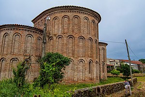
Igreja de Castro de Avelãs
Church in Bragança District, Portugal
Distance: Approx. 3936 meters
Latitude and longitude: 41.7989943,-6.8045117
The Igreja de Castro de Avelãs is a National monument of Portugal. It is located in Bragança Municipality, in the parish of Castro de Avelãs.

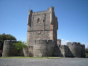
Castle of Bragança
Historic castle in Bragança, Portugal
Distance: Approx. 708 meters
Latitude and longitude: 41.8042,-6.7492
The Castle of Bragança (Portuguese: Castelo de Bragança) is a well-preserved medieval castle located in the historic center of the city of Bragança, district of Bragança, Portugal. The castle is very well-preserved. It has seen a turbulent history that saw occupation during the Moorish period to the devastation and reconstruction that accompanied the Christian reconquest of the Iberian Peninsula.

Old Cathedral of the Holy Name of Jesus, Bragança
Church in Bragança, Portugal
Distance: Approx. 414 meters
Latitude and longitude: 41.8057,-6.7625
The Old Cathedral of the Holy Name of Jesus (Portuguese: Antiga Catedral do Santo Nome de Jesus) also called Holy Name of Jesus Cathedral is the former headquarters of the diocese of Bragança-Miranda in northeastern Portugal. The temple was built in the sixteenth century to have the functions of a convent. In 1764, with the transfer of the seat of the diocese of Braganza Miranda do Douro, the building became the diocesan cathedral.

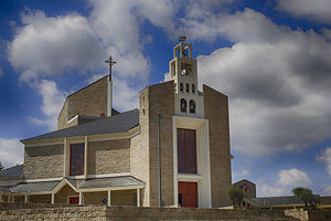
Our Lady Queen Cathedral, Bragança
Church in Bragança, Portugal
Distance: Approx. 414 meters
Latitude and longitude: 41.8057,-6.7625
The Our Lady Queen Cathedral (Portuguese: Catedral de Nossa Senhora Rainha; Sé Catedral de Bragança), also called New Cathedral of Bragança, is a religious building of the Catholic Church that serves as the seat of the diocese of Bragança-Miranda in northeastern Portugal. The temple was inaugurated on October 7, 2001 as the first Portuguese cathedral built in the 21st century. It was designed by architect Rosa Vassal in a total space of 10,000 square meters.
Weather in this IP's area
broken clouds
16 Celsius
15 Celsius
16 Celsius
16 Celsius
1017 hPa
61 %
1017 hPa
940 hPa
10000 meters
2.33 m/s
3.65 m/s
262 degree
73 %
07:20:35
17:04:16