Country:
 USA
USARegion:
City:
Latitude and Longitude:
Time Zone:
Postal Code:
IP information under different IP Channel
ip-api
Country
Region
City
ASN
Time Zone
ISP
Blacklist
Proxy
Latitude
Longitude
Postal
Route
IPinfo
Country
Region
City
ASN
Time Zone
ISP
Blacklist
Proxy
Latitude
Longitude
Postal
Route
MaxMind
Country
Region
City
ASN
Time Zone
ISP
Blacklist
Proxy
Latitude
Longitude
Postal
Route
Luminati
Country
USRegion
wy
City
cheyenne
ASN
Time Zone
America/Denver
ISP
iNES GROUP SRL
Latitude
Longitude
Postal
db-ip
Country
Region
City
ASN
Time Zone
ISP
Blacklist
Proxy
Latitude
Longitude
Postal
Route
ipdata
Country
Region
City
ASN
Time Zone
ISP
Blacklist
Proxy
Latitude
Longitude
Postal
Route
Popular places and events near this IP address

Roman Catholic Diocese of Cheyenne
Latin Catholic ecclesiastical jurisdiction in Wyoming, USA
Distance: Approx. 816 meters
Latitude and longitude: 41.14555556,-104.80194444
The Diocese of Cheyenne (Latin: Dioecesis Cheyennensis) is a Latin Church ecclesiastical territory, or diocese, of the Catholic Church in the US state of Wyoming. It is a suffragan diocese in the ecclesiastical province of the metropolitan Archdiocese of Denver. The cathedral and mother church for the Diocese of Cheyenne is St.
Cheyenne Regional Medical Center
Hospital in Cheyenne, Wyoming, United States
Distance: Approx. 588 meters
Latitude and longitude: 41.14055556,-104.81611111
Cheyenne Regional Medical Center (CRMC) is a hospital located in Cheyenne, Wyoming, USA. CRMC is divided into four campuses.

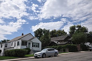
Lakeview Historic District (Cheyenne, Wyoming)
Historic district in Wyoming, United States
Distance: Approx. 380 meters
Latitude and longitude: 41.14194444,-104.81444444
The Lakeview Historic District is a residential historic district in Cheyenne, Wyoming. The neighborhood was one of Cheyenne's original neighborhoods when the city was platted in 1870; most of the homes in the district were built between 1880 and 1930. Most of the neighborhood's residents were working-class, and many of them worked for the Union Pacific Railroad.
Wyoming State Museum
Museum in Cheyenne, Wyoming
Distance: Approx. 764 meters
Latitude and longitude: 41.1395,-104.8177
The Wyoming State Museum is a state-run museum established in 1895 in Cheyenne, Wyoming. It is the official state repository for material concerning Wyoming history and cultural heritage. Permanent exhibit themes include coal, flora and fauna, fossils, Wyoming settlement, Native American culture and history, the National Park Service in Wyoming, and other Wyoming-related issues.

Rainsford Historic District
Historic district in Wyoming, United States
Distance: Approx. 707 meters
Latitude and longitude: 41.13916667,-104.80722222
The Rainsford Historic District in Cheyenne, Wyoming comprises a group of Victorian houses, many designed by architect George D. Rainsford. The neighborhood includes the residences of a number of cattle barons, giving rise to the name "Cattle Baron Row." The district is located immediately to the east of downtown Cheyenne and includes examples of Stick, Eastlake, Greek Revival, Romanesque Revival and Shingle style architecture, among other eclectic styles of the time. The neighborhood includes the former Wyoming Governor's Mansion and the William Sturgis House, both individually listed on the National Register of Historic Places.
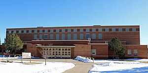
Storey Gymnasium
United States historic place
Distance: Approx. 546 meters
Latitude and longitude: 41.14527778,-104.81805556
Storey Gymnasium, also known as Cheyenne High School Gymnasium, was built in 1953 on the campus of Central High School in Cheyenne, Wyoming, United States. The brick gymnasium was designed by Cheyenne architect Frederic Hutchinson Porter to include additional functions associated with the school's ROTC program, with an armory, rifle range and drill halls in addition to classrooms, shops and music spaces. The contractor was Loren Hancock, who built it at a cost of $646,611.66.

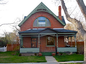
Crook House (Cheyenne, Wyoming)
United States historic place
Distance: Approx. 664 meters
Latitude and longitude: 41.13888889,-104.81388889
The Crook House in Cheyenne, Wyoming, also known as Gibbons House, is a Queen Anne-style house that was built in 1890. It was listed on the National Register of Historic Places in 1979. It is associated with Dr.
Capitol North Historic District
Historic district in Wyoming, United States
Distance: Approx. 334 meters
Latitude and longitude: 41.14222222,-104.80916667
The Capitol North Historic District in Cheyenne, Wyoming is a 20.4 acres (8.3 ha) historic district which was listed on the National Register of Historic Places in 1980. The district is roughly bounded by E. 29th, and E. 25th St., Warren and Pioneer Avenues. It included 112 contributing buildings, a contributing structure, and two contributing objects when first listed.

Cheyenne High School (Cheyenne, Wyoming)
United States historic place
Distance: Approx. 634 meters
Latitude and longitude: 41.14472222,-104.81916667
The Cheyenne High School at 2810 House Avenue in Cheyenne, Wyoming is a Late Gothic Revival-style building which was built in 1921. It has also been known as Central High School and as Laramie County School District No.1 Administration Building and was listed on the National Register of Historic Places in 2005. It is a three-story Collegiate Gothic style building which is 250 by 220 feet (76 m × 67 m) in plan.

Moreton Frewen House
United States historic place
Distance: Approx. 371 meters
Latitude and longitude: 41.14138889,-104.81277778
The Moreton Frewen House, at 506 E. 23rd Street in Cheyenne, Wyoming, also known as the Everett V. Hall House, was built in 1881. It was listed on the National Register of Historic Places in 1975. It is significant for its association with stockman Moreton Frewen, and also as a well-preserved historic house.

Mabel Fincher School
United States historic place
Distance: Approx. 440 meters
Latitude and longitude: 41.14277778,-104.80694444
The Mabel Fincher School, at 2201 Morrie Ave. in Cheyenne, Wyoming, is an Art Deco-style building which was built in 1940. It has also served as the Triumph High School.
Keefe Row
Historic houses in Wyoming, United States
Distance: Approx. 557 meters
Latitude and longitude: 41.13972222,-104.81305556
Keefe Row, at E. 22nd St. and Evans Ave. in Cheyenne, Wyoming, was built in 1892.
Weather in this IP's area
scattered clouds
12 Celsius
10 Celsius
11 Celsius
12 Celsius
1017 hPa
34 %
1017 hPa
817 hPa
10000 meters
2.57 m/s
340 degree
40 %
07:02:35
18:30:56