Country:
 USA
USARegion:
City:
Latitude and Longitude:
Time Zone:
Postal Code:
IP information under different IP Channel
ip-api
Country
Region
City
ASN
Time Zone
ISP
Blacklist
Proxy
Latitude
Longitude
Postal
Route
IPinfo
Country
Region
City
ASN
Time Zone
ISP
Blacklist
Proxy
Latitude
Longitude
Postal
Route
MaxMind
Country
Region
City
ASN
Time Zone
ISP
Blacklist
Proxy
Latitude
Longitude
Postal
Route
Luminati
Country
USRegion
ri
City
providence
ASN
Time Zone
America/New_York
ISP
iNES GROUP SRL
Latitude
Longitude
Postal
db-ip
Country
Region
City
ASN
Time Zone
ISP
Blacklist
Proxy
Latitude
Longitude
Postal
Route
ipdata
Country
Region
City
ASN
Time Zone
ISP
Blacklist
Proxy
Latitude
Longitude
Postal
Route
Popular places and events near this IP address

Rhode Island Supreme Court
Highest court in the U.S. state of Rhode Island
Distance: Approx. 131 meters
Latitude and longitude: 41.82527778,-71.40694444
The Rhode Island Supreme Court is the court of last resort in the U.S. State of Rhode Island. The Court consists of a Chief Justice and four Associate Justices, all selected by the Governor of Rhode Island from candidates vetted by the Judicial Nominating Commission. Each justice enjoys lifetime tenure and no mandatory retirement age, similar to Federal judges.

Waterplace Park
Distance: Approx. 85 meters
Latitude and longitude: 41.8237113,-71.4075563
Waterplace Park is an urban park situated along the Woonasquatucket River in downtown Providence, Rhode Island at the original site of the Great Salt Cove. Finished in 1994, Waterplace Park is connected to 3/4 mile of cobblestone-paved pedestrian walkways along the waterfront known as Riverwalk. Venice-styled Pedestrian bridges cross the river.

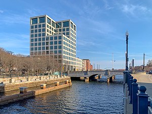
Textron Tower
International-style skyscraper in downtown Providence, Rhode Island
Distance: Approx. 113 meters
Latitude and longitude: 41.825,-71.4091
The Textron Tower, formerly the Old Stone Tower, is a modern skyscraper in downtown Providence, Rhode Island. It is the world headquarters of Textron. At 311 ft (95 m), the Textron Tower stands as the 5th-tallest building in the city and the state.

Providence County Courthouse
Building in Providence, Rhode Island
Distance: Approx. 152 meters
Latitude and longitude: 41.82548889,-71.4069
The Providence County Courthouse (also known as the Frank Licht Judicial Complex) is a Georgian Revival building in the College Hill neighborhood of Providence, Rhode Island. The building contains the state's court of last resort, the Rhode Island Supreme Court, and the local trial court, the Providence County Superior Court. At a height of 216 ft (66 m), the courthouse is the 11th-tallest building in the city.

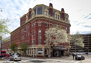
Turk's Head Building
Office in RI , United States
Distance: Approx. 155 meters
Latitude and longitude: 41.82456111,-71.40986111
The Turk's Head Building is a 16-story office high-rise in Providence, Rhode Island. When completed in 1913, the Turk's Head Building surpassed the 1901 Union Trust Company Building to become the tallest building in downtown (the Rhode Island State House is taller and was finished in 1904). The building retained that title until 1922, when the Providence Biltmore was completed.

Customhouse Historic District
Historic district in Rhode Island, United States
Distance: Approx. 145 meters
Latitude and longitude: 41.82416667,-71.40972222
The Customhouse Historic District is a historic district encompassing fifteen historic buildings in downtown Providence, Rhode Island. The district is bounded by Westminster, Exchange, Dyer, Pine, and Peck Streets, and includes eight buildings associated with the important functions of the business center Providence became in the mid-to-late 19th century. It was listed on the National Register of Historic Places in 1975, and is completely contained within the Downtown Providence Historic District, listed in 1984.
Hay and Owen Buildings
United States historic place
Distance: Approx. 153 meters
Latitude and longitude: 41.82333333,-71.40916667
The Hay and Owen Buildings are a pair of historic commercial buildings in Providence, Rhode Island, United States. The Owen Building (101 Dyer Street) was built in 1866 as two buildings, with a narrow alley running between them. They were designed by Alfred Stone for George and Smith Owen (G. & S. Owen), whose sons operated a wholesale yarn business on the premises.

Market House (Providence, Rhode Island)
United States historic place
Distance: Approx. 159 meters
Latitude and longitude: 41.82581,-71.40833
The Market House is a historic three-story brick market house in Market Square, in the College Hill, a neighborhood of Providence, Rhode Island, USA. The building was constructed between 1773 and 1775 and designed by prominent local architects, Joseph Brown and Declaration of Independence signer Stephen Hopkins. The bottom floor of the house was used as a market, and the upper level was used for holding meetings. Similar buildings existed in other American cities, such as Faneuil Hall in Boston and the Old Brick Market in Newport.

Institute for Computational and Experimental Research in Mathematics
Research institute at Brown University
Distance: Approx. 119 meters
Latitude and longitude: 41.824002,-71.406663
The Institute for Computational and Experimental Research in Mathematics (ICERM), founded in 2011, is an American research institute in mathematics at Brown University, funded since 2010 by a grant from the National Science Foundation.

Crawford Street Bridge (Providence, Rhode Island)
Former bridge in Providence, Rhode Island
Distance: Approx. 24 meters
Latitude and longitude: 41.8242,-71.4079
The Crawford Street Bridge was a concrete and steel bridge over the Providence River in downtown Providence, Rhode Island. It was originally built from 1873 to 1904 and then rebuilt starting in 1930. Composed of a set of interconnected bridges that span the river, it had a total area of over 3 acres (1.2 hectares) and covered nearly a quarter of a mile of the river.
Brown University School of Public Health
Distance: Approx. 130 meters
Latitude and longitude: 41.8237,-71.40675
The Brown University School of Public Health is the public health school of Brown University, a private research university in Rhode Island. It is located along the Providence River, down the hill and about a quarter mile from Brown's central campus on College Hill. The School of Public Health grew out of the Department of Community Health at Brown's Alpert Medical School and was officially founded in 2013 as an independent school.

Joseph Brown House (Providence, Rhode Island)
United States historic place
Distance: Approx. 93 meters
Latitude and longitude: 41.82474,-71.40697
The Joseph Brown House is a historic Georgian house located at 50 South Main Street Providence, Rhode Island. The building, designed by astronomer and amateur architect Joseph Brown, is the oldest extant house built by an American architect for his own use.
Weather in this IP's area
clear sky
15 Celsius
15 Celsius
14 Celsius
17 Celsius
1013 hPa
70 %
1013 hPa
1010 hPa
10000 meters
6.69 m/s
290 degree
06:19:13
19:07:26