Country:
 Romania
Region:
City:
Latitude and Longitude:
Time Zone:
Postal Code:
IP information under different IP Channel
ip-api
Country
Region
City
ASN
Time Zone
ISP
Blacklist
Proxy
Latitude
Longitude
Postal
Route
IPinfo
Country
Region
City
ASN
Time Zone
ISP
Blacklist
Proxy
Latitude
Longitude
Postal
Route
MaxMind
Country
Region
City
ASN
Time Zone
ISP
Blacklist
Proxy
Latitude
Longitude
Postal
Route
Luminati
Country
RORegion
sb
City
sibiu
ASN
Time Zone
Europe/Bucharest
ISP
Orange Romania S.A.
Latitude
Longitude
Postal
db-ip
Country
Region
City
ASN
Time Zone
ISP
Blacklist
Proxy
Latitude
Longitude
Postal
Route
ipdata
Country
Region
City
ASN
Time Zone
ISP
Blacklist
Proxy
Latitude
Longitude
Postal
Route
Popular places and events near this IP address
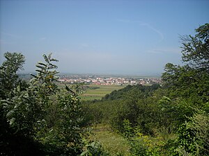
Hațeg
Town in Hunedoara, Romania
Distance: Approx. 1062 meters
Latitude and longitude: 45.6075,22.95
Hațeg (Romanian pronunciation: [ˈhat͡seg]; ‹See Tfd›German: Wallenthal; Hungarian: Hátszeg) is a town in Hunedoara County, Romania with a population of 8,793 as of 2021. Three villages are administered by the town: Nălațvad (Nalácvád), Silvașu de Jos (Alsószilvás), and Silvașu de Sus (Felsőszilvás). It is situated in the southwestern reaches of the historical region of Transylvania.

Râul Mare (Strei)
River in Hunedoara County, Romania
Distance: Approx. 4492 meters
Latitude and longitude: 45.5902,22.9899
The Râul Mare (upstream from its confluence with the Șes also: Lăpușnic) is a left tributary of the river Strei in Romania. It discharges into the Strei in Subcetate. Its source is in the Retezat Mountains.

Râul Galben
River in Hunedoara County, Romania
Distance: Approx. 3664 meters
Latitude and longitude: 45.5944,22.981
The Râul Galben is a left tributary of the Râul Mare in Romania. It discharges into the Râul Mare in Sântămăria-Orlea. Upstream of the confluence with the Răchitova, the river is also known as Densuș.
Pârâul de Câmp
River in Romania
Distance: Approx. 6509 meters
Latitude and longitude: 45.6037,22.8649
The Pârâul de Câmp is a right tributary of the Râul Galben in Romania. It flows into the Râul Galben near Fărcădin. Its length is 19 km (12 mi) and its basin size is 27 km2 (10 sq mi).
Silvaș
River in Hunedoara County, Romania
Distance: Approx. 5636 meters
Latitude and longitude: 45.6387,23.0116
The Silvaș (also: Silvuț) is a left tributary of the river Strei in Romania. It flows into the Strei near Plopi. Its length is 20 km (12 mi) and its basin size is 36 km2 (14 sq mi).

Sibișel (Strei)
River in Hunedoara County, Romania
Distance: Approx. 4010 meters
Latitude and longitude: 45.5915,22.9832
The Sibișel is a right tributary of the Râul Mare in Romania. It discharges into the Râul Mare in Sântămăria-Orlea. It starts at the confluence of headwaters Stânișoara and Pietrele in the Retezat Mountains.

General Berthelot
Commune in Hunedoara, Romania
Distance: Approx. 4911 meters
Latitude and longitude: 45.61666667,22.88333333
General Berthelot (Fărcădinul de Jos until 1923, Berthelot between 1923 and 1964, Unirea between 1965 and 2001; Hungarian: Alsófarkadin; ‹See Tfd›German: Unterwolfsdorf) is a commune in Hunedoara County, Transylvania, Romania. It is composed of five villages: Crăguiș (Kraguis), Fărcădin (Felsőfarkadin), General Berthelot, Livezi (Gauricsa), and Tuștea (Tustya). In 1923 and again in 2001, the commune was named after Henri Mathias Berthelot, a French general who was rewarded by King Ferdinand I of Romania for his role during World War I with properties in the village confiscated from the Nopcsa family.

Totești
Commune in Hunedoara, Romania
Distance: Approx. 7090 meters
Latitude and longitude: 45.571,22.883
Totești (Hungarian: Totesd) is a commune in Hunedoara County, Transylvania, Romania. It is composed of five villages: Cârnești, Copaci, Păclișa (Poklisa), Reea (Rea) and Totești.

Sântămăria-Orlea
Commune in Hunedoara, Romania
Distance: Approx. 3463 meters
Latitude and longitude: 45.5906,22.9706
Sântămăria-Orlea (Hungarian: Őraljaboldogfalva, ‹See Tfd›German: Liebfrauen) is a commune in Hunedoara County, Transylvania, Romania. It is composed of nine villages: Balomir (Balomir), Bărăștii Hațegului (Baresd), Bucium-Orlea (Bucsum), Ciopeia (Csopea), Săcel (Szacsal), Sânpetru (Szentpéterfalva), Sântămăria-Orlea, Subcetate (Hátszegváralja), and Vadu (Vád). The commune lies in a hilly area, north of the Retezat Mountains, on the banks of the river Strei and its tributary, Râul Mare, as well as the latter's tributaries, Râul Galben and Sibișel.

Hațeg Country Dinosaurs Geopark
Distance: Approx. 4887 meters
Latitude and longitude: 45.612,22.884
The Hațeg Country Dinosaurs Geopark has been established in 2004–05 in the general area of the prehistoric Hațeg Island, a large offshore island in the Tethys Sea which existed during the late Cretaceous period, probably from the Cenomanian to the Maastrichtian ages.
Sânpetru Formation
Distance: Approx. 4064 meters
Latitude and longitude: 45.6,22.9
The Sânpetru Formation is an early Maastrichtian geologic formation. Dinosaur remains are among the fossils that have been recovered from the formation. It is located in Romania, near Sânpetru village, part of Sântămăria-Orlea commune.

Țara Hațegului
Area of Romania
Distance: Approx. 4377 meters
Latitude and longitude: 45.58333333,22.91666667
Țara Hațegului ("Hațeg Land"; ‹See Tfd›German: Wallenthal, Hungarian: Hátszegvidék, Latin: terra Harszoc) is a historical and ethnographical area in Hunedoara County, Romania, in the south-western corner of Transylvania. It is centered in the town of Hațeg. Țara Hațegului is located in the Depression of Hațeg.
Weather in this IP's area
broken clouds
23 Celsius
22 Celsius
23 Celsius
23 Celsius
1009 hPa
41 %
1009 hPa
971 hPa
10000 meters
1.4 m/s
3.12 m/s
95 degree
75 %
07:29:06
19:05:01