Country:
Region:
City:
Latitude and Longitude:
Time Zone:
Postal Code:
IP information under different IP Channel
ip-api
Country
Region
City
ASN
Time Zone
ISP
Blacklist
Proxy
Latitude
Longitude
Postal
Route
Luminati
Country
Region
ab
City
santimbru
ASN
Time Zone
Europe/Bucharest
ISP
Orange Romania S.A.
Latitude
Longitude
Postal
IPinfo
Country
Region
City
ASN
Time Zone
ISP
Blacklist
Proxy
Latitude
Longitude
Postal
Route
db-ip
Country
Region
City
ASN
Time Zone
ISP
Blacklist
Proxy
Latitude
Longitude
Postal
Route
ipdata
Country
Region
City
ASN
Time Zone
ISP
Blacklist
Proxy
Latitude
Longitude
Postal
Route
Popular places and events near this IP address

Fogaras County
County of the Kingdom of Hungary
Distance: Approx. 191 meters
Latitude and longitude: 45.85,24.96666667
Fogaras was an administrative county (comitatus) of the Kingdom of Hungary. Its territory is now in central Romania (south-eastern Transylvania). The county's capital was Fogaras (present-day Făgăraș).

Făgăraș
Municipality in Brașov, Romania
Distance: Approx. 955 meters
Latitude and longitude: 45.84472222,24.97416667
Făgăraș (Romanian pronunciation: [fəɡəˈraʃ]; German: Fogarasch, Fugreschmarkt, Hungarian: Fogaras) is a city in central Romania, located in Brașov County. It lies on the Olt River and has a population of 26,284 as of 2021. It is situated in the historical region of Transylvania, and is the main city of a subregion, Țara Făgărașului.
Racovița (Făgăraș)
River in Brașov County, Romania
Distance: Approx. 1999 meters
Latitude and longitude: 45.8457,24.9427
The Racovița is a left tributary of the river Olt in Romania. It discharges into the Olt in the city of Făgăraș. Its length is 26 km (16 mi) and its basin size is 106 km2 (41 sq mi).
Săvăstreni
River in Brașov County, Romania
Distance: Approx. 3906 meters
Latitude and longitude: 45.8474,24.917
The Săvăstreni, also known as Recea, is a left tributary of the river Olt in Romania. It discharges into the Olt in Beclean. The upper reach of the river is known as the Dejani.
Mândra (Olt)
River in Brașov County, Romania
Distance: Approx. 5552 meters
Latitude and longitude: 45.8384,25.036
The Mândra (also: Iaz) is a left tributary of the river Olt in Romania. It flows into the Olt near the village Mândra. Its length is 23 km (14 mi) and its basin size is 29 km2 (11 sq mi).
Berivoi
River in Brașov County, Romania
Distance: Approx. 2082 meters
Latitude and longitude: 45.8337,24.9597
The Berivoi (also: Făgărășel) is a right tributary of the river Racovița in Romania. It discharges into the Racovița in the city Făgăraș. Its length is 29 km (18 mi) and its basin size is 80 km2 (31 sq mi).

Sebeș (Brașov)
River in Brașov County, Romania
Distance: Approx. 4438 meters
Latitude and longitude: 45.8385,25.021
The Sebeș (Hungarian: Sebes-patak) is a left tributary of the river Olt in Romania. It discharges into the Olt east of Făgăraș. The source of the Sebeș is in the Făgăraș Mountains.

Beclean, Brașov
Commune in Brașov, Romania
Distance: Approx. 3320 meters
Latitude and longitude: 45.8333,24.9333
Beclean (German: Badlinen; Hungarian: Betlen) is a commune in Brașov County, Transylvania, Romania. It is composed of five villages: Beclean, Boholț (Buchholz; Boholc), Calbor (Kaltbrunnen; Kálbor), Hurez (Huréz), and Luța (Luca).

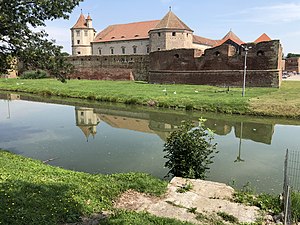
Făgăraș Citadel
Citadel in Brașov County, Romania
Distance: Approx. 894 meters
Latitude and longitude: 45.845245,24.97386
Făgăraș Citadel (Romanian: Cetatea Făgărașului pronunciation: [fəɡəˈraʃ], Hungarian: Fogarasi vár, German: Fogarascher Burg) is a historic monument in Făgăraș, Brașov County, Romania. The construction of the fortress started in 1310, on the site of a wooden fortification with earth ramparts from the 12th century. Archeological research shows that the old fortification was violently destroyed around the middle of the 13th century, presumably in connection with the Mongol invasion of 1241.

Făgăraș County
County in Romania
Distance: Approx. 1280 meters
Latitude and longitude: 45.8407,24.9718
Făgăraș County is one of the historic counties of Transylvania, Romania. The county seat was Făgăraș.

St. Nicholas Church, Făgăraș
Orthodox church in Făgăraș, Romania
Distance: Approx. 1574 meters
Latitude and longitude: 45.839943,24.978286
St. Nicholas Church (Romanian: Biserica Sfântul Nicolae) is a Romanian Orthodox church located at 16 Tudor Vladimirescu Street, Făgăraș, Romania. It is dedicated to Saint Nicholas.

Radu Negru National College
Distance: Approx. 1055 meters
Latitude and longitude: 45.8424,24.9696
Radu Negru National College (Romanian: Colegiul Național Radu Negru) is a high school located at 1 Școlii Street, Făgăraș, Romania.
Weather in this IP's area
broken clouds
11 Celsius
9 Celsius
11 Celsius
13 Celsius
999 hPa
50 %
999 hPa
950 hPa
10000 meters
1.38 m/s
4 m/s
184 degree
80 %
07:27:29
16:44:29