Country:
Region:
City:
Latitude and Longitude:
Time Zone:
Postal Code:
IP information under different IP Channel
ip-api
Country
Region
City
ASN
Time Zone
ISP
Blacklist
Proxy
Latitude
Longitude
Postal
Route
Luminati
Country
Region
vn
City
adjud
ASN
Time Zone
Europe/Bucharest
ISP
Orange Romania S.A.
Latitude
Longitude
Postal
IPinfo
Country
Region
City
ASN
Time Zone
ISP
Blacklist
Proxy
Latitude
Longitude
Postal
Route
db-ip
Country
Region
City
ASN
Time Zone
ISP
Blacklist
Proxy
Latitude
Longitude
Postal
Route
ipdata
Country
Region
City
ASN
Time Zone
ISP
Blacklist
Proxy
Latitude
Longitude
Postal
Route
Popular places and events near this IP address

Adjud
Municipality in Vrancea, Romania
Distance: Approx. 1209 meters
Latitude and longitude: 46.1,27.17972222
Adjud (Romanian pronunciation: [adˈʒud]; Hungarian: Egyedhalma) is a city in Vrancea County, Western Moldavia, Romania. It has a population of 15,178 inhabitants (as of 2021). It lies at a railway junction which has a classification yard and a passenger station.
Polocin
River in Vrancea, Romania
Distance: Approx. 5539 meters
Latitude and longitude: 46.1305,27.2173
The Polocin is a left tributary of the river Siret in Romania. It discharges into the Siret in Homocea. The basin size of the 24 km (15 mi) long Polocin is 106 km2 (41 sq mi).
Domoșița
River in Vrancea, Romania
Distance: Approx. 2291 meters
Latitude and longitude: 46.0772,27.1752
The Domoșița is a right tributary of the river Trotuș in Romania. It discharges into the Trotuș in Văleni, near Adjud. Its length is 20 km (12 mi) and its basin size is 61 km2 (24 sq mi).

Homocea
Commune in Vrancea, Romania
Distance: Approx. 6686 meters
Latitude and longitude: 46.13333333,27.23333333
Homocea is a commune located in Vrancea County, Romania. It is composed of three villages: Costișa, Homocea and Lespezi.

Ploscuțeni
Commune in Vrancea, Romania
Distance: Approx. 7992 meters
Latitude and longitude: 46.08333333,27.26666667
Ploscuțeni (Hungarian: Ploszkucény) is a commune located in Vrancea County, Romania. It is composed of two villages, Argea and Ploscuțeni. At the 2011 census, of the inhabitants for whom data were available, 99.9% were Romanians.

Păunești
Commune in Vrancea, Romania
Distance: Approx. 7958 meters
Latitude and longitude: 46.03333333,27.11666667
Păunești is a commune located in Vrancea County, Romania. It is composed of two villages, Păunești and Viișoara.

Ruginești
Commune in Vrancea, Romania
Distance: Approx. 4119 meters
Latitude and longitude: 46.06666667,27.13333333
Ruginești is a commune located in Vrancea County, Romania. It is composed of four villages: Anghelești, Copăcești, Ruginești and Văleni.

Urechești, Bacău
Commune in Bacău, Romania
Distance: Approx. 7828 meters
Latitude and longitude: 46.1288,27.0748
Urechești is a commune in Bacău County, Western Moldavia, Romania. It is composed of five villages: Cornățel, Lunca Dochiei, Satu Nou, Slobozia and Urechești.

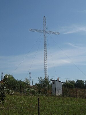
Trinitas Cross
Cross-shaped antenna in Romania
Distance: Approx. 9215 meters
Latitude and longitude: 46.01666667,27.13333333
The Trinitas Cross is a cross-shaped antenna with a height of 40 metres (131 ft) located on a hill near the Păun village in Bârnova, Iași County. It is taller than the Heroes' Cross on Caraiman Peak, which has a height of 28 metres (92 ft), and is considered the tallest cross in Romania. Due to its height and because it is lit at night, the cross is visible from almost any point of Iași and tens of kilometers away, even in places to the left of the Prut River in Moldova.

Domnești Princely Church
Orthodox church in Vrancea County, Romania
Distance: Approx. 8552 meters
Latitude and longitude: 46.02678837,27.21143958
The Domnești Princely Church (Romanian: Biserica Domnească din Domnești) is a Romanian Orthodox church located in Domnești-Târg village, Pufești Commune, Vrancea County, Romania. It is dedicated to the Dormition of the Mother of God. The church was begun in 1661, during the reign of Eustratie Dabija, Prince of Moldavia, and completed in 1667 by George Ducas.
Weather in this IP's area
few clouds
14 Celsius
12 Celsius
14 Celsius
14 Celsius
1000 hPa
40 %
1000 hPa
989 hPa
10000 meters
6.8 m/s
8.71 m/s
174 degree
22 %
07:19:26
16:34:57