Country:
 Romania
Region:
City:
Latitude and Longitude:
Time Zone:
Postal Code:
IP information under different IP Channel
ip-api
Country
Region
City
ASN
Time Zone
ISP
Blacklist
Proxy
Latitude
Longitude
Postal
Route
IPinfo
Country
Region
City
ASN
Time Zone
ISP
Blacklist
Proxy
Latitude
Longitude
Postal
Route
MaxMind
Country
Region
City
ASN
Time Zone
ISP
Blacklist
Proxy
Latitude
Longitude
Postal
Route
Luminati
Country
RORegion
vn
City
adjud
ASN
Time Zone
Europe/Bucharest
ISP
Orange Romania S.A.
Latitude
Longitude
Postal
db-ip
Country
Region
City
ASN
Time Zone
ISP
Blacklist
Proxy
Latitude
Longitude
Postal
Route
ipdata
Country
Region
City
ASN
Time Zone
ISP
Blacklist
Proxy
Latitude
Longitude
Postal
Route
Popular places and events near this IP address
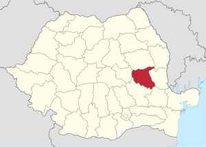
Vrancea County
County of Romania
Distance: Approx. 6882 meters
Latitude and longitude: 45.79,26.97
Vrancea (Romanian pronunciation: [ˈvrant͡ʃe̯a]) is a county (județ) in Romania, with its seat at Focșani. It is mostly in the historical region of Moldavia but the southern part, below the Milcov River, is in Muntenia.

Odobești
Town in Vrancea, Romania
Distance: Approx. 1232 meters
Latitude and longitude: 45.76666667,27.06666667
Odobești (Romanian pronunciation: [odoˈbeʃtʲ]) is a town in Vrancea County, Western Moldavia, Romania. The town administers one village, Unirea. The town is located in the central part of the county, on the banks of the Milcov River, 10 km (6.2 mi) northwest of the county seat, Focșani.

Mera, Vrancea
Commune in Vrancea, Romania
Distance: Approx. 9140 meters
Latitude and longitude: 45.76666667,26.93333333
Mera is a commune in Romania. It is located in Vrancea County. It is composed of five villages: Livada, Mera, Milcovel, Roșioara, and Vulcăneasa.
Dălhăuți
River in Vrancea County, Romania
Distance: Approx. 9708 meters
Latitude and longitude: 45.695,27.1257
The Dălhăuți is a right tributary of the river Milcov in Romania. It flows into the Milcov near Câmpineanca. Its length is 12 km (7.5 mi) and its basin size is 14 km2 (5.4 sq mi).

Bolotești
Commune in Vrancea, Romania
Distance: Approx. 7714 meters
Latitude and longitude: 45.83333333,27.06666667
Bolotești is a commune located in Vrancea County, Romania. It is composed of six villages: Bolotești, Găgești, Ivăncești, Pietroasa, Putna and Vităneștii de sub Măgură.
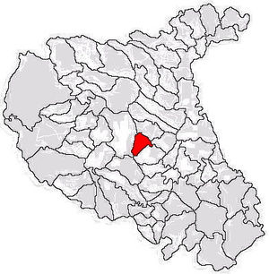
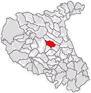
Broșteni, Vrancea
Commune in Vrancea, Romania
Distance: Approx. 2153 meters
Latitude and longitude: 45.75,27.03333333
Broșteni is a commune located in Vrancea County, Muntenia, Romania. It is composed of three villages: Arva, Broșteni and Pitulușa.

Câmpineanca
Commune in Vrancea, Romania
Distance: Approx. 9650 meters
Latitude and longitude: 45.7,27.13333333
Câmpineanca is a commune located in Vrancea County, Romania. It is composed of three villages: Câmpineanca, Pietroasa and Vâlcele.
Cârligele
Commune in Vrancea, Romania
Distance: Approx. 9846 meters
Latitude and longitude: 45.68333333,27.1
Cârligele is a commune located in Vrancea County, Muntenia, Romania. It is composed of four villages: Blidari, Bonțești, Cârligele, and Dălhăuți. The commune is located in the south-central part of Vrancea County, 12 km (7.5 mi) west of the county seat, Focșani.
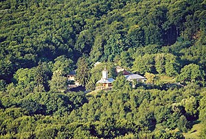
Jariștea
Commune in Vrancea, Romania
Distance: Approx. 2385 meters
Latitude and longitude: 45.78333333,27.06666667
Jariștea is a commune located in Vrancea County, Romania. It is composed of four villages: Jariștea, Pădureni, Scânteia and Vărsătura. The Buluc Monastery is in the commune.

Vârteșcoiu
Commune in Vrancea, Romania
Distance: Approx. 4319 meters
Latitude and longitude: 45.73333333,27.08333333
Vârteșcoiu is a commune located in Vrancea County, Muntenia, Romania. It is composed of six villages: Beciu, Faraoanele, Olteni, Pietroasa, Râmniceanca, and Vârteșcoiu. The commune is located in the central part of the county, on the right bank of the Milcov River.
1940 Vrancea earthquake
1940 earthquake in eastern Romania
Distance: Approx. 9337 meters
Latitude and longitude: 45.753,26.932
The 1940 Vrancea earthquake, also known as the 1940 Bucharest earthquake, (Romanian: Cutremurul din 1940) occurred on Sunday, 10 November 1940, in Romania, at 03:39 (local time), when the majority of the population was at home. The 1940 earthquake registered a magnitude of 7.7 on the moment magnitude scale, being the strongest earthquake recorded in the 20th century in Romania. Its epicenter lay in the Vrancea zone at a depth of about 133 km.
Weather in this IP's area
few clouds
20 Celsius
19 Celsius
20 Celsius
20 Celsius
1012 hPa
42 %
1012 hPa
986 hPa
10000 meters
3.96 m/s
4.88 m/s
158 degree
24 %
07:12:44
18:48:33