Country:
Region:
City:
Latitude and Longitude:
Time Zone:
Postal Code:
IP information under different IP Channel
ip-api
Country
Region
City
ASN
Time Zone
ISP
Blacklist
Proxy
Latitude
Longitude
Postal
Route
Luminati
Country
Region
ph
City
ploiesti
ASN
Time Zone
Europe/Bucharest
ISP
Orange Romania S.A.
Latitude
Longitude
Postal
IPinfo
Country
Region
City
ASN
Time Zone
ISP
Blacklist
Proxy
Latitude
Longitude
Postal
Route
db-ip
Country
Region
City
ASN
Time Zone
ISP
Blacklist
Proxy
Latitude
Longitude
Postal
Route
ipdata
Country
Region
City
ASN
Time Zone
ISP
Blacklist
Proxy
Latitude
Longitude
Postal
Route
Popular places and events near this IP address

Pantelimon metro station
Bucharest metro station
Distance: Approx. 7466 meters
Latitude and longitude: 44.44091,26.19185
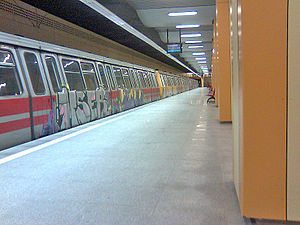
Pantelimon (also known informally as Antilopa) is a metro station on Line M1 of the Bucharest Metro. Situated in Pantelimon neighbourhood, adjacent to the town of Pantelimon, it is the terminus of Line M1 and was opened in May 1991 as a one-station extension from Republica. The station was built only to serve the Pantelimon Subway Depot and the workers of the defunct Antilopa factory, which is located in the close vicinity.

Pantelimon, Ilfov
Town in Ilfov, Romania
Distance: Approx. 7361 meters
Latitude and longitude: 44.45,26.2
Pantelimon (Romanian pronunciation: [panteliˈmon]) is a town in Ilfov County, Muntenia, Romania. The town — bordered to the west by the Romanian capital, Bucharest — has an area of 69 km2 (27 sq mi). Its name is derived from the Greek saint Panteleimon.

Brănești, Ilfov
Commune in Ilfov, Romania
Distance: Approx. 5880 meters
Latitude and longitude: 44.45,26.33333333
Brănești is a commune in the far east of Ilfov County, Muntenia, Romania. Its name is derived from Bran, a Romanian name, and the suffix -ești. It is composed of four villages: Brănești, Islaz, Pasărea, and Vadu Anei.

Glina, Ilfov
Commune in Ilfov, Romania
Distance: Approx. 4154 meters
Latitude and longitude: 44.38333333,26.25
Glina is a commune in the south-east of Ilfov County, Muntenia, Romania. Its name is derived from Slavic Glina, meaning "clay". It is composed of three villages: Cățelu, Glina, and Manolache.

Cernica
Commune in Ilfov, Romania
Distance: Approx. 456 meters
Latitude and longitude: 44.41666667,26.28333333
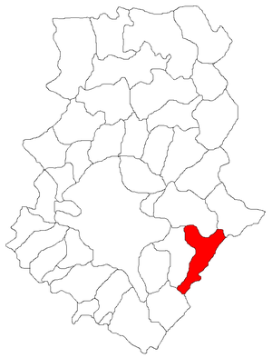
Cernica is a commune in the southeast part of Ilfov County, Muntenia, Romania, with a population of 11,871 as of 2021. It is composed of five villages: Bălăceanca, Căldăraru, Cernica, Poșta, and Tânganu. The commune is situated in the Wallachian Plain, on the banks of the Dâmbovița River and its left tributary, the Colentina River.

Colentina (river)
River in Ilfov, Romania
Distance: Approx. 1915 meters
Latitude and longitude: 44.39888889,26.28777778
The Colentina is a left tributary of the river Dâmbovița in Romania. It discharges into the Dâmbovița near Bălăceanca. It passes through the city of Bucharest and the villages and towns Călugăreni, Bălănești, Ghimpați, Ciocănești, Crevedia, Buftea, Mogoșoaia, Pantelimon and Cernica.
Șindrilița
River in Ilfov County, Romania
Distance: Approx. 7083 meters
Latitude and longitude: 44.4743,26.3095
The Șindrilița is a left tributary of the river Pasărea in Romania. It flows into the Pasărea in the village Pasărea. Its length is 12 km (7.5 mi) and its basin size is 59 km2 (23 sq mi).

Anghel Saligny metro station
Bucharest metro station
Distance: Approx. 5646 meters
Latitude and longitude: 44.40563,26.20844
Anghel Saligny, known for a short time as Linia de Centură ("Ring Road"), is a metro station in southeastern Bucharest on Line M3. It is the final stop of the Preciziei – Anghel Saligny M3 extension. It was opened on 20 November 2008 as part of the extension from Nicolae Grigorescu, which initially operated as a shuttle.

Nicolae Teclu metro station
Bucharest metro station
Distance: Approx. 6694 meters
Latitude and longitude: 44.4075,26.19472222
Nicolae Teclu, known for a short time as Policolor is a metro station in southeastern Bucharest on Line M3. It is on the Nicolae Grigorescu – Anghel Saligny M3 branch and was opened on 20 November 2008 as part of the extension from Nicolae Grigorescu to Linia de Centură (now Anghel Saligny). Initially, a shuttle started operating between Nicolae Grigorescu and Linia de centura.
Stadionul Cătălin Hîldan
Romanian stadium
Distance: Approx. 7005 meters
Latitude and longitude: 44.46418,26.33276
Cătălin Hîldan Stadium is a multi-use stadium in Brănești, Ilfov County, Romania. It was the home ground of CS Brănești, a professional football club founded in 1968 and dissolved in 2012. It holds 2,500 people, all on seats.

International School of Bucharest
Private international school in Bucharest, Romania
Distance: Approx. 5317 meters
Latitude and longitude: 44.430943,26.21541
International School of Bucharest (ISB) is a private international school founded in 1996 that offers a British style of education for students from the age of 2.5 to 19, located at 1R Șoseaua Gării Cățelu in Bucharest, Romania's capital city. It caters to over 700 students from 40 countries.
Lake Pantelimon
Reservoir in Sector, Bucharest
Distance: Approx. 5000 meters
Latitude and longitude: 44.43554,26.222585
Lake Pantelimon is an anthropic lake located in the northern part of the city of Bucharest, developed on the Colentina River, in the area where it flows through the urban area of the city, situated between Lake Cernica upstream and Lake Dobroești downstream.
Weather in this IP's area
clear sky
13 Celsius
11 Celsius
12 Celsius
13 Celsius
1003 hPa
60 %
1003 hPa
997 hPa
10000 meters
3.09 m/s
250 degree
07:17:57
16:43:31