89.111.226.235 - IP Lookup: Free IP Address Lookup, Postal Code Lookup, IP Location Lookup, IP ASN, Public IP
Country:
Region:
City:
Location:
Time Zone:
Postal Code:
ISP:
ASN:
language:
User-Agent:
Proxy IP:
Blacklist:
IP information under different IP Channel
ip-api
Country
Region
City
ASN
Time Zone
ISP
Blacklist
Proxy
Latitude
Longitude
Postal
Route
db-ip
Country
Region
City
ASN
Time Zone
ISP
Blacklist
Proxy
Latitude
Longitude
Postal
Route
IPinfo
Country
Region
City
ASN
Time Zone
ISP
Blacklist
Proxy
Latitude
Longitude
Postal
Route
IP2Location
89.111.226.235Country
Region
republika srpska
City
pale
Time Zone
Europe/Sarajevo
ISP
Language
User-Agent
Latitude
Longitude
Postal
ipdata
Country
Region
City
ASN
Time Zone
ISP
Blacklist
Proxy
Latitude
Longitude
Postal
Route
Popular places and events near this IP address

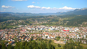
Pale, Bosnia and Herzegovina
Town and municipality in Republika Srpska
Distance: Approx. 483 meters
Latitude and longitude: 43.81194444,18.57111111
Pale (Serbian Cyrillic: Пале) is a municipality of the city of Istočno Sarajevo, Republika Srpska, Bosnia and Herzegovina. It is situated southeast of the capital city of Sarajevo. As of 2013, it had a population of 22,282 inhabitants, while the town of Pale has a population of 13,883 inhabitants.

SAO Romanija
Self-proclaimed ethnic Serb autonomous region in the Socialist Republic of Bosnia and Herzegovina
Distance: Approx. 483 meters
Latitude and longitude: 43.81194444,18.57111111
The SAO of Romanija (Serbian Cyrillic: САО Романија, Serbian: SAO Romanija) was a self-proclaimed ethnic Serb autonomous region within SR Bosnia and Herzegovina in the prelude to the Bosnian War. It was named after the Romanija mountain. It included parts of three municipalities with a population of 37,000.
Donja Ljubogošta
Village in Republika Srpska, Bosnia and Herzegovina
Distance: Approx. 4083 meters
Latitude and longitude: 43.85,18.55
Donja Ljubogošta (Serbian: Доња Љубогошта) is a village in the municipality of Pale, Bosnia and Herzegovina.
Gornja Ljubogošta
Village in Republika Srpska, Bosnia and Herzegovina
Distance: Approx. 3611 meters
Latitude and longitude: 43.84805556,18.56166667
Gornja Ljubogošta (Serbian Cyrillic: Горња Љубогошта) is a village in the municipality of Pale, Bosnia and Herzegovina.
Gornje Pale
Village in Republika Srpska, Bosnia and Herzegovina
Distance: Approx. 2031 meters
Latitude and longitude: 43.79944444,18.57972222
Gornje Pale (Serbian: Горње Пале) is a village in the municipality of Pale, Bosnia and Herzegovina.
Gornji Pribanj
Village in Republika Srpska, Bosnia and Herzegovina
Distance: Approx. 4649 meters
Latitude and longitude: 43.83333333,18.51666667
Gornji Pribanj (Serbian: Горњи Прибањ) is a village in the municipality of Pale, Bosnia and Herzegovina.
Jelovci
Village in Republika Srpska, Bosnia and Herzegovina
Distance: Approx. 4312 meters
Latitude and longitude: 43.8475,18.60083333
Jelovci is a village in the municipality of Pale, Bosnia and Herzegovina.
Rakovac (Pale)
Village in Republika Srpska, Bosnia and Herzegovina
Distance: Approx. 2089 meters
Latitude and longitude: 43.83194444,18.58333333
Rakovac (Serbian: Раковац) is a village in the municipality of Pale, Bosnia and Herzegovina.
Vlahovići (Pale)
Village in Republika Srpska, Bosnia and Herzegovina
Distance: Approx. 4420 meters
Latitude and longitude: 43.78333333,18.53833333
Vlahovići (Serbian Cyrillic: Влаховићи) is a village in the municipality of Pale, Bosnia and Herzegovina.
Radonjići
Village in Republika Srpska, Bosnia and Herzegovina
Distance: Approx. 2533 meters
Latitude and longitude: 43.80527778,18.54166667
Radonjići (Serbian Cyrillic: Радоњићи) is a village in the municipality of Pale, Bosnia and Herzegovina.
Toplik
Village in Republika Srpska, Bosnia and Herzegovina
Distance: Approx. 3780 meters
Latitude and longitude: 43.85,18.56666667
Toplik (Serbian: Топлик) is a village in Bosnia and Herzegovina. According to the 1991 census, the village is located in the municipality of Istočno Novo Sarajevo.

Faculty of Philosophy, University of East Sarajevo
Constituent faculty of University of East Sarajevo in Pale
Distance: Approx. 4495 meters
Latitude and longitude: 43.8564831,18.56947848
The Faculty of Philosophy of the University of East Sarajevo (Serbian Cyrillic: Филозофски факултет Универзитета у Источном Сарајеву) abbreviated as FFUIS is a constituent faculty of the University of East Sarajevo located in Pale, a university town twenty kilometers away from Sarajevo in Republika Srpska, Bosnia and Herzegovina. The Faculty is the largest organizational unit of the University of East Sarajevo. It is one of only five faculties of philosophy in the country.
Weather in this IP's area
overcast clouds
1 Celsius
-0 Celsius
1 Celsius
1 Celsius
1026 hPa
86 %
1026 hPa
896 hPa
10000 meters
1.47 m/s
1.38 m/s
154 degree
100 %