Country:
 Austria
Region:
City:
Latitude and Longitude:
Time Zone:
Postal Code:
IP information under different IP Channel
ip-api
Country
Region
City
ASN
Time Zone
ISP
Blacklist
Proxy
Latitude
Longitude
Postal
Route
IPinfo
Country
Region
City
ASN
Time Zone
ISP
Blacklist
Proxy
Latitude
Longitude
Postal
Route
MaxMind
Country
Region
City
ASN
Time Zone
ISP
Blacklist
Proxy
Latitude
Longitude
Postal
Route
Luminati
Country
ATASN
Time Zone
Europe/Vienna
ISP
mur.at - Verein zur Foerderung von Netzwerkkunst
Latitude
Longitude
Postal
db-ip
Country
Region
City
ASN
Time Zone
ISP
Blacklist
Proxy
Latitude
Longitude
Postal
Route
ipdata
Country
Region
City
ASN
Time Zone
ISP
Blacklist
Proxy
Latitude
Longitude
Postal
Route
Popular places and events near this IP address
Tyrnau
Former municipality in Styria, Austria
Distance: Approx. 7533 meters
Latitude and longitude: 47.31194444,15.415
Tyrnau (German pronunciation: [ˈtʏʁnaʊ̯] ) is a former municipality in the district of Graz-Umgebung in the Austrian state of Styria. Since the 2015 Styria municipal structural reform, it is part of the municipality Fladnitz an der Teichalm, in the Weiz District.

Mürz
River in Styria, Austria
Distance: Approx. 7692 meters
Latitude and longitude: 47.4099,15.2752
The Mürz (German pronunciation: [mʏʁt͡s] ) is a river in Styria, Austria, with a length of 84 km (52 mi). Its drainage basin is 1,505 km2 (581 sq mi). The Mürz begins at the confluence of the Stille Mürz and Kalte Mürz near Kaltenbach, Neuberg and the border to Lower Austria.

Breitenau am Hochlantsch
Municipality in Styria, Austria
Distance: Approx. 7681 meters
Latitude and longitude: 47.38333333,15.43333333
Breitenau am Hochlantsch is a municipality in the district of Bruck-Mürzzuschlag in Styria, Austria.

Frauenberg, Styria
Former municipality in Styria, Austria
Distance: Approx. 8611 meters
Latitude and longitude: 47.43333333,15.35
Frauenberg is a former municipality in the district of Bruck-Mürzzuschlag in Styria, Austria. Since the 2015 Styria municipal structural reform, it is part of the municipality Sankt Marein im Mürztal.

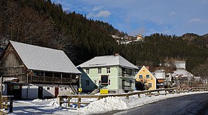
Pernegg an der Mur
Municipality in Styria, Austria
Distance: Approx. 1395 meters
Latitude and longitude: 47.36666667,15.35
Pernegg an der Mur is a municipality in the district of Bruck-Mürzzuschlag in Styria, Austria. It is home to the famous Drachenhöhle cave and Bärenschützklamm gorge. The operatic soprano Ingrid Kaiserfeld was born in the municipality.

Röthelstein
Former municipality in Styria, Austria
Distance: Approx. 5719 meters
Latitude and longitude: 47.30861111,15.36777778
Röthelstein is a former municipality in the district of Graz-Umgebung in the Austrian state of Styria. Since the 2015 Styria municipal structural reform, it is part of the municipality Frohnleiten.

Drachenhöhle
Cave and archaeological site in Austria
Distance: Approx. 4532 meters
Latitude and longitude: 47.32583333,15.37944444
Drachenhöhle or Drachenhöhle Mixnitz (literally Dragon's Cave of Mixnitz) is a 542 m (1,778 ft) long cave with a 20 m (66 ft) wide and 12 m (39 ft) high entrance near Mixnitz, Styria, Austria, south-east of Bruck an der Mur located at an elevation of 950 m (3,120 ft) above sea level. Cave bear of the species (Ursus ingressus) and other bone fossils that people found during the Middle Ages were deemed to be the bones of dragons, a belief that culminated in the saga of the "Dragon slayer of Mixnitz". The cave is one of the largest caves in the Alps where bears occupied an area that stretched over a length of way over 500 m (1,600 ft), by an average width of up to 40 m (130 ft) and a height of 10 to 15 m (33 to 49 ft).

Rennfeld
Distance: Approx. 5275 meters
Latitude and longitude: 47.4,15.36666667
Rennfeld (1,629 m) is a mountain in the Fischbach Alps, part of the Prealps east of the Mur. It is the westernmost peak of the range. Rennfeld is the highest of the three hausbergs of the city of Bruck an der Mur and towers over a kilometre above the Mur Valley to the west.
Graz Highlands
Distance: Approx. 6418 meters
Latitude and longitude: 47.36277778,15.42416667
The Graz Highlands or Graz Mountains (German: Grazer Bergland) are a low mountain range north of the Styrian state capital of Graz in Austria. It is part of the Central Alps and forms the start of the Prealps East of the Mur. From a geological perspective, regions on the west bank of the Mur, which are clearly separate from the building of the Styrian Prealps, belong to the Graz Highlands.

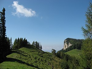
Hochlantsch
Distance: Approx. 6418 meters
Latitude and longitude: 47.36277778,15.42416667
The Hochlantsch (1,720 m (AA)) is the highest mountain in the Graz Highlands, a subgroup of the Prealps East of the Mur according to the Alpine Club classification of the Eastern Alps. To the north the mountain drops steeply into the Lantschmauern. The Hochlantsch is a popular destination for those living in the Graz area due to its good views and easy access.

Heiligen-Geist-Kapelle, Bruck
Chapel in Bruck an der Mur, Styria, Austria
Distance: Approx. 6902 meters
Latitude and longitude: 47.4053,15.2835
The Heiligen-Geist-Kapelle in Bruck an der Mur, Styria, Austria, is a chapel named for the Holy Spirit. It was built in late-Gothic style, originally dedicated to the Trinity, which explains its unusual triangular floorplan, with three similar walls, all with a portal. The building fell into disrepair in the 18th century and was used for several purposes such as a postmaster's stable, an inn and for housing, which changed the interior.

Bärenschützklamm
Distance: Approx. 4454 meters
Latitude and longitude: 47.34194444,15.39472222
The Bärenschützklamm ("Bärenschütz Gorge") is a narrow valley in the Graz Highlands in the Austrian Central Alps. It was carved out of limestone by the Mixnitzbach ("Mixnitz Creek") and is a popular tourist destination. After a deadly rockfall in July 2020 it was closed until September 2024.
Weather in this IP's area
overcast clouds
10 Celsius
10 Celsius
9 Celsius
11 Celsius
1026 hPa
97 %
1026 hPa
972 hPa
10000 meters
0.37 m/s
0.73 m/s
197 degree
100 %
07:23:01
18:03:46