88.97.141.213 - IP Lookup: Free IP Address Lookup, Postal Code Lookup, IP Location Lookup, IP ASN, Public IP
Country:
Region:
City:
Location:
Time Zone:
Postal Code:
ISP:
ASN:
language:
User-Agent:
Proxy IP:
Blacklist:
IP information under different IP Channel
ip-api
Country
Region
City
ASN
Time Zone
ISP
Blacklist
Proxy
Latitude
Longitude
Postal
Route
db-ip
Country
Region
City
ASN
Time Zone
ISP
Blacklist
Proxy
Latitude
Longitude
Postal
Route
IPinfo
Country
Region
City
ASN
Time Zone
ISP
Blacklist
Proxy
Latitude
Longitude
Postal
Route
IP2Location
88.97.141.213Country
Region
england
City
catton
Time Zone
Europe/London
ISP
Language
User-Agent
Latitude
Longitude
Postal
ipdata
Country
Region
City
ASN
Time Zone
ISP
Blacklist
Proxy
Latitude
Longitude
Postal
Route
Popular places and events near this IP address

Sinderhope
Human settlement in England
Distance: Approx. 4916 meters
Latitude and longitude: 54.858,-2.243
Sinderhope is a hamlet situated on the east Allen Valley in south-west Northumberland. The population is spread over farms in an area approximately 25 square miles (65 km2). The population is around 80.

Allendale, Northumberland
Village in Northumberland, England
Distance: Approx. 764 meters
Latitude and longitude: 54.896,-2.257
Allendale, often marked on maps as Allendale Town, is a village and civil parish in south west Northumberland, England. It is located within the North Pennines Area of Outstanding Natural Beauty. At the 2001 census, the parish had a population of 2,120, decreasing to 2,021 at the 2011 Census.

Bearsbridge
Village in Northumberland, in England
Distance: Approx. 4693 meters
Latitude and longitude: 54.912,-2.337
Bearsbridge is a village in Northumberland, in England. It is situated to the west of Hexham, on the A686.
Catton, Northumberland
Village in Northumberland, England
Distance: Approx. 1403 meters
Latitude and longitude: 54.9118,-2.2744
Catton is a village in Northumberland, England. It is about 7 miles (11 km) to the southwest of Hexham and is located on the outskirts of Allendale. It is featured as a key location in Stewart Pringle's 2024 play The Bounds, which premiered at Live Theatre, Newcastle before transferring to the Royal Court, London.
Acton, Northumberland
Human settlement in England
Distance: Approx. 4701 meters
Latitude and longitude: 54.858,-2.259
Acton is a small hamlet in Northumberland, north-east England, about 3 miles (5 km) south of Allendale Town. Acton is usually Anglo-Saxon Old English for "farmstead at the oak tree(s)"; here, though, it is "Acca's farmstead". Acca is an Anglo-Saxon settler's forename.

Ninebanks
Human settlement in England
Distance: Approx. 5224 meters
Latitude and longitude: 54.8757,-2.3365
Ninebanks is a small village in south west Northumberland, England in the North Pennines Area of Outstanding Natural Beauty 8 miles (13 km) north-east of Alston by road. It is noted for the early sixteenth century Ninebanks Tower, sometimes described as a pele tower, but possibly built as a watchtower. It is made of sandstone and has four floors, the lowest of which is now below the level of the road.

Allendale railway station
Disused railway station in Northumberland, England
Distance: Approx. 897 meters
Latitude and longitude: 54.908,-2.265
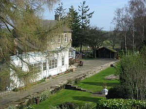
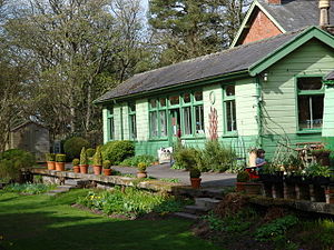
Allendale railway station was the terminus of the single track branch of the Hexham and Allendale Railway, in north east England. The line connected villages in the area to the railway network via a junction at Hexham.

Staward Halt railway station
Disused railway station in Northumberland, England
Distance: Approx. 4203 meters
Latitude and longitude: 54.9312,-2.3037
Staward Halt is a closed stone built railway station situated on a single track branch railway line in Northumberland, England, that ran from Allendale through to Hexham.

Langley-on-Tyne railway station
Disused railway station in Northumberland, England
Distance: Approx. 5078 meters
Latitude and longitude: 54.9456,-2.269
Langley-on-Tyne is a closed stone built railway station situated on a single track branch railway line in Northumberland, England, that runs from Allendale through the Border Counties Junction to Hexham.

Allen Confluence Gravels
Distance: Approx. 3852 meters
Latitude and longitude: 54.92284,-2.31191
The Allen Confluence Gravels is the name given to a Site of Special Scientific Interest (SSSI) in Northumberland, England.

Allendale Co-operative Society
Consumer co-operative in Allendale, Northumberland, England
Distance: Approx. 847 meters
Latitude and longitude: 54.8975,-2.2542
Allendale Co-operative Society is a small consumer co-operative in the village of Allendale, Northumberland, England. Founded in 1874 as the Allendale Industrial and Provident Society, the co-operative is one of the few remaining British co-operative retail societies still operating from a single village store. The co-operative is incorporated as a registered society, and as a consumer co-operative the society is owned and democratically controlled by its members who are its customers.

Museum of Classic Sci-Fi
Museum in Allendale, England
Distance: Approx. 772 meters
Latitude and longitude: 54.89688889,-2.25591667
The Museum of Classic Sci-Fi is in Allendale, Northumberland in England. The museum opened in 2018 and houses a collection of more than 200 props, costumes and artworks from a number of "classic", mid to late-20th century science fiction franchises. The Guardian has described the establishment as "one of Britain’s most eccentric small museums".
Weather in this IP's area
broken clouds
4 Celsius
0 Celsius
4 Celsius
4 Celsius
1037 hPa
79 %
1037 hPa
997 hPa
10000 meters
5.47 m/s
9.07 m/s
264 degree
69 %