88.87.253.235 - IP Lookup: Free IP Address Lookup, Postal Code Lookup, IP Location Lookup, IP ASN, Public IP
Country:
Region:
City:
Location:
Time Zone:
Postal Code:
ISP:
ASN:
language:
User-Agent:
Proxy IP:
Blacklist:
IP information under different IP Channel
ip-api
Country
Region
City
ASN
Time Zone
ISP
Blacklist
Proxy
Latitude
Longitude
Postal
Route
db-ip
Country
Region
City
ASN
Time Zone
ISP
Blacklist
Proxy
Latitude
Longitude
Postal
Route
IPinfo
Country
Region
City
ASN
Time Zone
ISP
Blacklist
Proxy
Latitude
Longitude
Postal
Route
IP2Location
88.87.253.235Country
Region
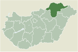
borsod-abauj-zemplen
City
sajokaza
Time Zone
Europe/Budapest
ISP
Language
User-Agent
Latitude
Longitude
Postal
ipdata
Country
Region
City
ASN
Time Zone
ISP
Blacklist
Proxy
Latitude
Longitude
Postal
Route
Popular places and events near this IP address
Vadna
Village in Northern Hungary, Hungary
Distance: Approx. 2539 meters
Latitude and longitude: 48.27299,20.55273
Vadna is a village in Borsod-Abaúj-Zemplén county, Hungary.

Kurityán
Place in Borsod-Abaúj-Zemplén, Hungary
Distance: Approx. 4474 meters
Latitude and longitude: 48.3131,20.62384
Kurityán is a village in Borsod-Abaúj-Zemplén county, Hungary.
Szuhakálló
Village in Northern Hungary, Hungary
Distance: Approx. 5437 meters
Latitude and longitude: 48.28297,20.6567
Szuhakálló is a village in Borsod-Abaúj-Zemplén county, Hungary.
Felsőnyárád
Village in Northern Hungary, Hungary
Distance: Approx. 5170 meters
Latitude and longitude: 48.328619,20.598569
Felsőnyárád is a village in Borsod-Abaúj-Zemplén County in northeastern Hungary. As of 2008, the village had a population of 1058.
Jákfalva
Village in Northern Hungary, Hungary
Distance: Approx. 5570 meters
Latitude and longitude: 48.33333333,20.58333333
Jákfalva is a village in Borsod-Abaúj-Zemplén County in northeastern Hungary.

Sajógalgóc
Village in Northern Hungary, Hungary
Distance: Approx. 4141 meters
Latitude and longitude: 48.3,20.53333333
Sajógalgóc is a village in Borsod-Abaúj-Zemplén County in northeastern Hungary.
Sajóivánka
Village in Northern Hungary, Hungary
Distance: Approx. 1852 meters
Latitude and longitude: 48.26666667,20.58333333
Sajóivánka is a village in the Kazincbarcika District of Borsod-Abaúj-Zemplén County in northeastern Hungary.

Sajókaza
Village in Northern Hungary, Hungary
Distance: Approx. 40 meters
Latitude and longitude: 48.28335,20.582761
Sajókaza is a village in Borsod-Abaúj-Zemplén County in northeastern Hungary.
Kolorcity Aréna
Sports stadium in Kazincbarcika, Hungary
Distance: Approx. 4821 meters
Latitude and longitude: 48.24388889,20.61027778
Kolorcity Aréna is a sports stadium in Kazincbarcika, Hungary. The stadium is home to the famous association football side Kazincbarcikai SC. The stadium has a capacity of 1,020.
Kazincbarcika Subregion
Distance: Approx. 3714 meters
Latitude and longitude: 48.31666667,20.58333333
Kazincbarcika Subregion Borsod-Abaúj-Zemplén third largest of the subregions of Hungary, with an area of 499.3 square kilometres and population of 60,332 in 2009.

Irinyi János Reformed Secondary School
Hungarian school
Distance: Approx. 4747 meters
Latitude and longitude: 48.24684,20.616516
Irinyi János Reformed Secondary School is one of the secondary educational institutions in Kazincbarcika, Borsod-Abaúj-Zemplén county, Hungary.

Kazincbarcika District
Districts of Hungary in Borsod-Abaúj-Zemplén
Distance: Approx. 3718 meters
Latitude and longitude: 48.3167,20.5833
Kazincbarcika (Hungarian: Kazincbarcikai járás) is a district in north-western part of Borsod-Abaúj-Zemplén County. Kazincbarcika is also the name of the town where the district seat is found. The district is located in the Northern Hungary Statistical Region.
Weather in this IP's area
overcast clouds
3 Celsius
3 Celsius
3 Celsius
4 Celsius
1018 hPa
89 %
1018 hPa
989 hPa
10000 meters
1.16 m/s
1.5 m/s
83 degree
100 %
